East Flores Regency
East Flores Regency (Indonesian: Kabupaten Flores Timur) is a regency in East Nusa Tenggara province of Indonesia. Established in 1958,[2] the regency has its seat (capital) in Larantuka on Flores Island. It covers a land area of 1,812.85 km2, and it had a population of 232,605 as of the 2010 census,[3] 246,742 at the 2015 Census[4] and 276,896 at the 2020 Census.[1] It encompasses the eastern tip of the island of Flores, together with all of the smaller islands of Adonara and Solor, both part of the Solor Archipelago, and much smaller offshore islands. In 1999 the island of Lembata (formerly called Lomblen) at the eastern end of the Archipelago was separated out to create its own Regency.
East Flores Regency
Kabupaten Flores Timur | |
|---|---|
 Coat of arms | |
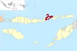 Location within East Nusa Tenggara | |
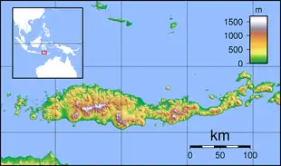  East Flores Regency 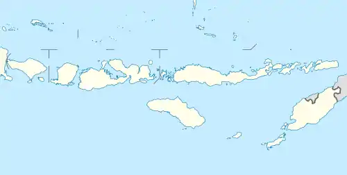 East Flores Regency East Flores Regency (Lesser Sunda Islands)  East Flores Regency East Flores Regency (Indonesia) | |
| Coordinates: 8.2422°S 122.9682°E | |
| Country |  Indonesia Indonesia |
| Province |  East Nusa Tenggara East Nusa Tenggara |
| Capital | Larantuka |
| Government | |
| • Regent | Antonius Gege Hadjon |
| • Vice Regent | Agustinus Payong Boli |
| Area | |
| • Total | 699.95 sq mi (1,812.85 km2) |
| Population (2020 Census) | |
| • Total | 276,896 |
| • Density | 400/sq mi (150/km2) |
| [1] | |
| Time zone | UTC+8 (ICST) |
| Area code | (+62) 383 |
| Website | florestimurkab |
Administration
The regency is divided into nineteen districts (kecamatan), tabulated below with their areas and their populations at the 2010 Census[3] and the 2020 Census.[1] The table also includes the number of villages (rural desa and urban kelurahan) in each district, and its post code.
| Name | Area in km2 | Population Census 2010 | Population Census 2020 | Number of villages | Post codes |
|---|---|---|---|---|---|
| Wulanggitang | 225.85 | 13,143 | 14,780 | 11 | 86256 |
| Titehena | 154.84 | 11,145 | 12,974 | 14 | 86255 |
| Ile Bura | 118.32 | 6,165 | 7,517 | 7 | 86254 |
| Tanjung Bunga | 257.57 | 11,880 | 14,184 | 16 | 86251 |
| Lewo Lema | 92.84 | 7,951 | 9,694 | 7 | 86252 |
| Larantuka (town) | 48.91 | 37,348 | 40,828 | 20 | 86212 -86219 |
| Ile Mandiri | 72.76 | 9,145 | 11,506 | 8 | 86211 |
| Demon Pagong | 85.40 | 4,283 | 4,916 | 7 | 86219 |
| Totals on Flores Island | 1,056.49 | 101,060 | 116,398 | 90 | |
| Solor Barat (West Solor) | 128.20 | 9,321 | 11,180 | 15 | 86272 |
| Solor Selatan (South Solor) | 31.58 | 4,841 | 6,874 | 7 | 86273 |
| Solor Timur (East Solor) | 66.56 | 12,879 | 15,975 | 17 | 86271 |
| Totals on Solor Island | 226.34 | 27,041 | 34,029 | 39 | |
| Adonara Barat (West Adonara) | 79.71 | 11,743 | 13,529 | 18 | 86263 |
| Wotan Ulu Mado | 86.31 | 7,871 | 9,968 | 12 | 86260 |
| Adonara Tengah (Central Adonara) | 42.73 | 10,686 | 13,312 | 13 | 86264 |
| Adonara Timur (East Adonara) | 91.06 | 26,161 | 30,299 | 21 | 86261 |
| Ile Boleng | 49.30 | 13,958 | 17,416 | 21 | 86253 |
| Witihama | 79.43 | 14,140 | 17,460 | 16 | 86266 |
| Kelubagolit | 44.41 | 10,210 | 12,650 | 12 | 86265 |
| Adonara (a) | 56.80 | 9,745 | 11,835 | 8 | 86262 |
| Totals on Adonara Island | 529.75 | 104,514 | 126,469 | 121 |
Note: (a) Adonara District covers only the northern part of Adonara Island ("Adonara Utara").
References
- Badan Pusat Statistik, Jakarta, 2021.
- Government of Indonesia (9 August 1958), Establishment of the Second-level Administrative Regions under the First-level Administrative Region of Bali, West Nusa Tenggara and East Nusa Tenggara (in Indonesian), Indonesia Ministry of Law and Justice, UU No. 69/1958
- Biro Pusat Statistik, Jakarta, 2011.
- Badan Pusat Statistik, Jakarta, 2018.
External links
Regencies and cities of East Nusa Tenggara | ||
|---|---|---|
Capital: Kupang | ||
| Regencies |  | |
| Cities | ||
Authority control  | |
|---|---|
| General | |
| National libraries | |