European route E22
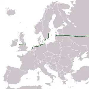
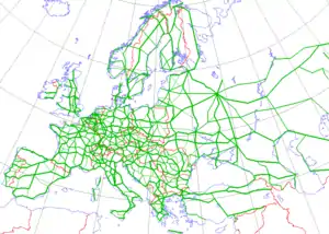
European route E22 is one of the longest European routes. It has a length of about 5,320 km (3,310 mi). Many of the E-roads have been extended into Asia since the year 2000; the E22 was extended on 24 June 2002.
 | ||||
|---|---|---|---|---|
 | ||||
| Route information | ||||
| Length | 5,320 km (3,310 mi) | |||
| Major junctions | ||||
| West end | Holyhead, United Kingdom | |||
| ||||
| East end | Ishim, Russia | |||
| Location | ||||
| Countries |  United Kingdom United Kingdom Netherlands Netherlands Germany Germany Sweden Sweden Latvia Latvia Russia Russia | |||
| Major cities | Manchester Leeds Amsterdam Bremen Hamburg Malmö Rīga Moscow Nizhny Novgorod Kazan Perm Yekaterinburg | |||
| Highway system | ||||
International E-road network
| ||||

Route
|
A55 → A494 → M56 → M6 → M62 → M60 → M62 → M18 → M180 → A180 → A160 |
|
A10 → A8 → A7 → N7 → A7 → N7 → A7 |
|
A 280 → A 31 → A 28 → A 1 → A 20 → B 96 |
|
E6/E22 → E6/E20/E22 → E22 |
|
A10 → A8/A10 → A7/A8/A10 → A6 → A4 → P5 → P80 → A6 → A12 |
|
M9 → МКАD → M7 → P242 → EKAD → P351 → P402 |
United Kingdom
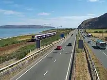
Port of Holyhead  (53.3094°N 4.6289°W)
 : Holyhead - A494
- Ewloe Interchange (53.18752°N 3.06427°W)
 : A55 - Ellesmere Port
- Dunkirk Roundabout (53.24527°N 2.93714°W)
 : Ellesmere Port - Warrington
- Lymm Interchange (53.3525°N 2.5029°W)
 : Warrington
(Concurrency with E 5)
E 5)
- Croft Interchange (53.426°N 2.5561°W)
(Start of concurrency with E 20)
E 20)
- Croft Interchange (53.426°N 2.5561°W)
 : Warrington - Manchester
- Eccles Interchange (53.48761°N 2.37666°W)
 : Manchester Outer Ring Road
- Simister Island (53.54978°N 2.26054°W)
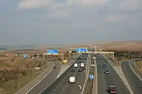
- : Manchester - Goole
(
 E 15/
E 15/.svg.png.webp) : Pontefract 53.711174°N 1.290832°W)
: Pontefract 53.711174°N 1.290832°W)
- Langham Interchange (53.6844°N 0.9693°W)
(End of concurrency with E 20)
- Langham Interchange (53.6844°N 0.9693°W)
 : Goole - M180
- North Ings Interchange (53.5915°N 0.9872°W)
 : Whole length
- Barnetby Top (53.58556°N 0.41392°W)
 : M180 - A160
- Brocklesby Interchange (53.61415°N 0.28289°W)
 : A180 - Immingham (Whole length)
Netherlands
- Knooppunt De Nieuwe Meer (52.33867°N 4.84153°E)
(  E 19/
E 19/ /
/ )
)
- Knooppunt De Nieuwe Meer (52.33867°N 4.84153°E)
- : Ring Amsterdam
- Coenplein (52.4231°N 4.876°E)
(  E 35/)
- Coenplein (52.4231°N 4.876°E)
 : Amsterdam - Zaandam
- Knooppunt Zaandam (52.4556°N 4.8415°E)
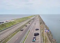
 : Zaandam - Sneek
 : Sneek
- : Sneek - Groningen
- Gronigen-West (53.1966°N 6.5403°E)
- : Groningen
(  E 232/
 53.20325°N 6.56469°E)
- Westerbroek (53.20416°N 6.63233°E)
- : Groningen - German border
Germany
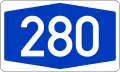 A 280: Dutch border - A 31 (Whole length)
- Dreieck Bunde (53.1628°N 7.2831°E)
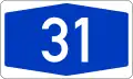 A 31: A 280 - Leer
- Dreieck Leer (53.267°N 7.497°E)
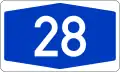 A 28: Leer - Bremen
- Dreieck Stuhr (53.00533°N 8.70239°E)
(  E 37/
E 37/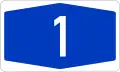 A 1)
A 1)
- Dreieck Stuhr (53.00533°N 8.70239°E)
- A 1: Bremen - Lübeck
(  E 234/
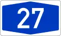 A 27: Bremen 53.0421°N 8.9833°E)
(  E 45/
E 45/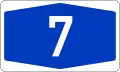 A 7: Hamburg 53.3771°N 10.0155°E)
(  E 26/
E 26/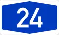 A 24: Hamburg 53.5616°N 10.1667°E)
- Kreuz Lübeck (53.8501°N 10.5937°E)
(  E 47/ A 1)
- Kreuz Lübeck (53.8501°N 10.5937°E)
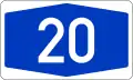 A 20: Lübeck - Grimmen
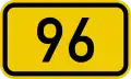 B 96: Grimmen - Sassnitz
(Concurrency with E 251)
Elbe Crossing
There are currently plans to reroute the E22 between Lübeck and Westerstede, to go north of Hamburg and Bremen over the A20, when this new motorway is built after 2020. The E22 would then use the planned tunnel under the Elbe at Drochtersen/Glückstadt.
Sweden
Trelleborg (55°22′N 13°10′E)
(Start of concurrency with .svg.png.webp) E 6)
E 6)
.svg.png.webp) E 22: Trelleborg - Malmö
E 22: Trelleborg - Malmö
- Trafikplats Petersborg (55.5474°N 13.0023°E)
- E 22: Malmö
(Concurrency with.svg.png.webp) E 20)
E 20)
( .svg.png.webp) E 65: 55.5602°N 13.0782°E)
E 65: 55.5602°N 13.0782°E)
- Trafikplats Kronetorp (55.6411°N 13.1047°E)
(End of concurrency with E 6)
- Trafikplats Kronetorp (55.6411°N 13.1047°E)
- E 22: Malmö - Norrköping
- Trafikplats Norrköping Södra (58.5805°N 16.1122°E)
( .svg.png.webp) E 4)
E 4)
- Trafikplats Norrköping Södra (58.5805°N 16.1122°E)
In Sweden, E-Roads do not have national numbers. There is currently no ferry across the Baltic Sea between Norrköping and Ventspils. The best ferry alternative is from Nynäshamn to Ventspils. The line is run by Scandlines.
Latvia
Ventspils (57°23′26″N 21°34′24″E)
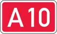 A 10: Ventspils - Rīga
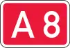 A 8/ A 10: Rīga
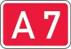 A 7/ A 8/ A 10: Rīga
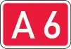 A 6: Rīga - Salaspils
(Start of concurrency with E 67 and
  E 77: Salaspils 56.8586°N 24.3121°E)
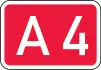 A 4: Salaspils
- (56.90080°N 24.40652°E)
(End of concurrency with E 67 and E 77)
- (56.90080°N 24.40652°E)
 P 5: Salaspils - Tīnūži
 P 80: Tīnūži - Koknese
- A 6: Koknese - Jēkabpils
 A 12: Jēkabpils - Russian border
Russia
Burachki (56.356°N 28.19383°E)
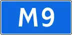 M 9: Latvian border - Moscow (Whole length)
(  E 95/
E 95/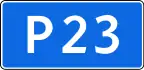 R 23: Pustoshka 56.3152°N 29.392°E)
- (55.78968°N 37.37281°E)
(Start of concurrency with E 105)
- (55.78968°N 37.37281°E)
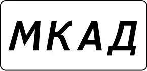 MKAD: Moscow Ring Road
(End of concurrency with E 105: 55.8816°N 37.4451°E)
(Start of concurrency with E 115: 55.8823°N 37.7259°E)
- (55.77692°N 37.84271°E)
(End of concurrency with E 115)
- (55.77692°N 37.84271°E)
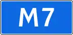 M 7: Moscow - Yelabuga
- M 7: Yelabuga - Perm
 R 242: Perm - Yekaterinburg
- EKAD: Yekaterinburg Ring Road
 R 351: Yekaterinburg - Tyumen
 R 402: Tyumen - Ishim
- (56.1522°N 69.4773°E)
(  E 30/
E 30/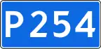 R 254)
- (56.1522°N 69.4773°E)
Ishim (56°07′N 69°30′E)
Between Kazan and Igra, the road takes a detour over Yelabuga, because the shortest route between Kazan and Igra uses a ferry over the Vyatka River (56.592°N 50.709°E), and the road is a bad gravel road around that area. Google Maps shows the E 22 to use the ferry, but that is wrong; the UN convention lists Yelabuga along a paved road without any ferry. Both routes are visible in Google Streetview. A much used shortcut is Izhevsk - Votkinsk - Perm.
Between Perm and Ishim, the E 22 follows the Trans-Siberian Railway.

External links
- UN Economic Commission for Europe: Overall Map of E-road Network (2007)
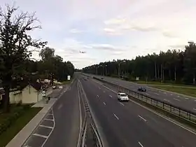
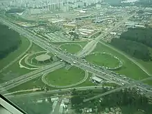
- E22 route near Jūrmala, Latvia
Transport in Greater Manchester | |||||||
|---|---|---|---|---|---|---|---|
| Air |  | ||||||
| Bus |
| ||||||
| Road | |||||||
| Tram | |||||||
| Cycle | |||||||
| Rail |
| ||||||
| TIF bid | |||||||
| |||||||
