Fuhai County
Fuhai County (Chinese: 福海县) as the official romanized name, also transliterated from Uyghur as Burultokay County (Uighur: بۇرۇلتوقاي ناھىيىسى; Chinese: 布伦托海县), is a county in the Xinjiang Uyghur Autonomous Region and is under the administration of the Altay Prefecture.[2] It has an area of 33,319.38 km2 (12,864.68 sq mi) with a population of 65,600.[2][1] The county's postcode is 836400.[1]
Fuhai County
福海县 بۇرۇلتوقاي ناھىيىسى بۋرىلتوعاي اۋدانى | |
|---|---|
.jpg.webp) | |
.png.webp) Location of Fuhai County (red) within Altay Prefecture (yellow) and Xinjiang | |
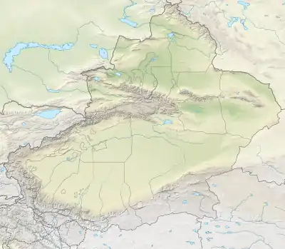  Fuhai Location of the seat in Xinjiang | |
| Coordinates (Fuhai County government): 47°06′43″N 87°29′12″E | |
| Country | People's Republic of China |
| Autonomous region | Xinjiang |
| Prefecture | Altay |
| County Seat | Fuhai (Town) |
| Area | |
| • Total | 33,319.38 km2 (12,864.68 sq mi) |
| Population | |
| • Total | 65,600 |
| • Density | 2.0/km2 (5.1/sq mi) |
| Time zone | UTC+8 (China Standard) |
| Postal code | 836400 |
| Fuhai County | |||||||||||
|---|---|---|---|---|---|---|---|---|---|---|---|
| Chinese name | |||||||||||
| Simplified Chinese | 福海县 | ||||||||||
| Traditional Chinese | 福海縣 | ||||||||||
| |||||||||||
| Alternative Chinese name | |||||||||||
| Simplified Chinese | 布伦托海县 | ||||||||||
| Traditional Chinese | 布倫託海縣 | ||||||||||
| |||||||||||
| Uyghur name | |||||||||||
| Uyghur | بۇرۇلتوقاي ناھىيىسى | ||||||||||
| |||||||||||
| Kazakh name | |||||||||||
| Kazakh | بۋرىلتوعاي اۋدانى
Kazakh Cyrillic: Бурылтоғай ауданы Kazakh Latin alphabet: Býryltoǵaı aýdany | ||||||||||
History
In 1921, the area was incorporated as Burultokay County, adapting the Kazakh endonym "Burultokay", meaning "colorful jungle".[2] The county was renamed as Fuhai County in 1942.[2]
Geography

The Altay Mountains run through Fuhai County, and the county's two main rivers which flow through the area the Ulungur River and the Ertix River (Irtysh).[2][1] Ulungur Lake is located in Fuhai County.[3]
Fuhai County is bordered by Mongolia to its northeast, Fuyun County to its east, Fukang City to its south, and by Jimunai County, Tacheng Prefecture, and Hoboksar Mongol Autonomous County all to its west.[2]
The county's elevation ranges from 386 to 3,332 m (1,266 to 10,932 ft) in height, with an average elevation of approximately 500 m (1,640 ft).[2]
Climate
The county has an average annual temperature of 4.7 °C (40.5 °F), with an extreme high temperature of 40.0 °C (104 °F), and an extreme low temperature of −42.7 °C (−45 °F).[2] The county, on average, goes 224 days of the year above 0 °C, 156 days without frost, has 2,908 annual hours of sunshine, and an annual precipitation of 131 millimeters.[2]
Administrative divisions
Fuhai County is directed divided into three towns, three townships, one township-level farm, one prison, and a number of areas administered by the Xinjiang Production and Construction Corps.[4]
Towns
Fuhai County's three towns (镇 / بازارلىق / قالاشىع) are Fuhai (福海镇 / بۇرۇلتوقاي بازىرى / بۋرىلتوعاي قالاشىعى), Kalamagai (喀拉玛盖镇 / قارامغاي بازىرى), and Jetaral (解特阿热勒镇 جېتئارال بازىرى).[4]
Townships
Fuhai County three townships (乡 / يېزا / اۋىل) are Kokagax Township (阔克阿尕什乡 /كۆكئاغاش يېزىسى / كوكاعاش اۋىلى), Qigandijie Township (齐干吉迭乡 / چىغان جىگدە يېزىسى) , and Arda Township (阿尔达乡 / ئاردا يېزىسى / اردا اۋىلى ).[4]
Prefecture Farm 1
Altay Prefecture Farm 1, a special township-level unit, is located in Fuhai County.[4]
Fuhai Prison
Fuhai Prison (福海监狱; 福海監獄) is a township-level prison located in Fuhai County.[4]
Xinjiang Production and Construction Corps
The Xinjiang Production and Construction Corps operates its 182nd Regiment, 183rd Regiment, 187th Regiment, and its 188th Regiment within Fuhai County.[4]
Demographics
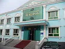
Fuhai County is an ethnically diverse county home to 32 different ethnic groups.[2] Ethnic Kazakhs and Han Chinese peoples both comprise large pluralities of the county's population, accounting for 48.25% and 45.65% of the county's population, respectively.[2] Fuhai County also has sizable Hui and Uyghur populations.[2]
| Ethnic group | 2016 (est.)[5] | 2018[6] | 2020 (est.)[2] | |||
|---|---|---|---|---|---|---|
| Kazakh | 30,000 | 45.7% | 31,319 | 42.19% | 31,363 | 48.25% |
| Han Chinese | 31,800 | 48.4% | 38,801 | 52.27% | 29,672 | 45.65% |
| Hui | 2,692 | 3.63% | ||||
| Uyghur | 502 | 0.68% | ||||
| Mongols | 211 | 0.28% | ||||
| Tatars | 53 | 0.07% | ||||
| Manchu | 37 | 0.05% | ||||
| Russians | 36 | 0.05% | ||||
| Xibe | 10 | 0.01% | ||||
| Daur | 3 | < 0.01% | ||||
| Kyrgyz | 2 | < 0.01% | ||||
| Others | 3,800 | 5.9% | 571 | 0.77% | 3,965 | 6.10% |
| Total | 65,600 | 100.0% | 74,237 | 100.00% | 65,000 | 100.00% |
Economy
Fuhai County has 1.2 million acres of cultivated land and 23 million acres of grassland, and is the home of the Altay Sheep.[2] In 2013, the county was named the camel milk capital of China.[2] Aquaculture is also present in the county, particularly in Ulungur Lake.[3]
The county is home to a number of natural resources, including oil, natural gas, iron ore, spodumene.[2] The county's proven natural gas reserves total 105.3 billion cubic meters, and the county's oil reserves are more than 11 million tons.[2] Geologic surveys exploring the county's copper, lead, zinc, gold, beryllium, lithium, niobium, tantalum, rubidium, cesium, and muscovite have been conducted.[3] Clay has also been mined in Fuhai County since the 1980s.[3]
Hongshanzui Port, a land border crossing with Mongolia, is located within Fuhai County.[3] The county government has announced efforts to improve the crossing's poor infrastructure in order to expand commerce through the crossing.[3]
Transportation
China National Highway 216 and China National Highway 218 both run through the county.[1] Xinjiang Provincial Highway 318 and Xinjiang Provincial Highway 324 also run through the county.[2]
The Kuytun–Beitun railway passes through Fuhai County.[2]
Culture
Kazakh culture is prevalent in Fuhai County due to its large Kazakh population, particularly Kazakh dastans, Kazakh embroidery, Kazakh yurts, and a number of horse-related traditions unique to Kazakh culture.[7]
Starting in 1988, the county government began undertaking research regarding dastans in the hope of preserving them.[7] In 1992, the county government archived four volumes of dastans, totaling 340,000 words.[7]
References
- 福海县概况地图. xzqh.org (in Chinese). 2014-11-07. Archived from the original on 2020-06-03. Retrieved 2020-06-03.
- 福海概况 (in Chinese). Fuhai County People's Government. 2021-01-28. Archived from the original on 2021-06-08. Retrieved 2021-06-08.
- 优势资源 (in Chinese). Fuhai County People's Government. Archived from the original on 2020-06-03. Retrieved 2020-06-03.
- 2019年统计用区划代码. stats.gov.cn (in Chinese). 2019. Archived from the original on 2020-06-03. Retrieved 2020-06-03.
- 福海概况 [Fuhai Overview] (in Chinese). Fuhai County People's Government. 2017-07-18. Archived from the original on 2020-06-03. Retrieved 2021-06-08.
- 3-7 各地、州、市、县(市)分民族人口数 [3-7 Population by Nationality by Prefecture, Prefecture, City and County (City)] (in Chinese). Statistical Bureau of Xinjiang Uygur Autonomous Region. 2020-06-10. Archived from the original on 2020-11-01. Retrieved 2021-06-08.
- 民族风情 (in Chinese). Fuhai County People's Government. 2013-07-23. Archived from the original on 2020-06-03. Retrieved 2020-06-03.
Authority control  | |
|---|---|
| General | |
| National libraries | |