Garioch
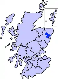
Garioch (Scots: The Geerie,[1] /ˈɡɪəri/ GEER-ee, Scottish Gaelic: Gaibheach[2]) is one of six committee areas in Aberdeenshire, Scotland. It has a population of 46,254 (2006 estimate), which gives it the largest population of Aberdeenshire's six committee areas.[3] 'The Rough Howe' from the Scots Gaelic Garbh – rough; iochd – howe. The Garioch consists primarily of the district drained by the River Ury and its tributaries the Shevock and the Gadie Burn.[4]
History
Garioch is first recorded as a provincial lordship granted to David, Earl of Huntingdon by King William the Lion in a charter dated between 1178 and 1182.[5] This grant was the first example north of the Mounth of the pattern already established south of the Forth by the 1160s of granting large territorial lordships to members of the incoming Anglo-Norman elite, and was thus intended as an aggressive assertion of royal power.[6] Garioch was strategically important to securing control by the Kings of Alba over the entire north, lying between the earldoms of Mar and Buchan,[5] and controlling the main routes from the Mounth north to the still-restive Province of Moray.[7] Earl David was the King's brother and had first-hand experience of suppressing rebellions in the north, having accompanied William with a "great army" on a military expedition to Ross in 1179.[8]
The lordship of Garioch granted to Earl David consisted of the eleven parishes of Kennethmont, Rathmuriel, Leslie, Insch, Premnay, Culsalmond, Oyne, Durno, Inverurie, Bourtie and Fintray.[9] This was a newly-created territorial unit, and its original charter of c. 1179 used the name "Garioch" to refer only to the hilly country to the west of Oyne, with the estates included in the lordship to the east of Oyne specified individually.[10] One of Earl David's first acts was to establish the precise boundaries of his acquisition through a perambulation and by 1195 "Garioch" was being used to describe the entire territory of the lordship.[10]
Geography
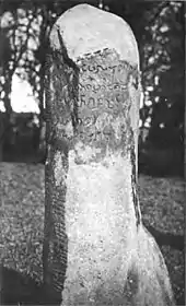
Centred on Inverurie, a traditional rural market town whose foundation dates back to the 9th century with the establishment of Christianity at Polnar, "The Kirk of Rocharl" – now St Andrew's Parish Church, Inverurie, "The Auld Kirk of Inverurie", the Garioch has also experienced rapid population growth due to its proximity to the city of Aberdeen. Significant growth in population, services and employment is anticipated in the A96 corridor and in Westhill. The area is largely agricultural, but is strongly affected by Aberdeen's economy and the oil and gas sector.
References
- The Online Scots Dictionary
- Mac an Tàilleir, Iain (2003). "Scottish Gaelic place names F-J" (PDF). Scottish Parliament. Retrieved 13 June 2016.
- "Small Area Population Estimates and Forecasts". Aberdeenshire Council. Retrieved 13 August 2010.
- Milne, John. 1912. Celtic Place-Names in Aberdeenshire: With a vocabulary of Gaelic words not in dictionaries; the meanings and etymology of the Gaelic names of places in Aberdeenshire
- Stringer 1985, p. 30.
- Stringer 1985, pp. 31–32.
- Stringer 1985, p. 34.
- Stringer 1985, p. 32.
- Stringer 1985, p. 65.
- Stringer 1985, p. 66.
Bibliography
- Stringer, K. J. (1985). Earl David of Huntingdon, 1152-1219: a study in Anglo-Scottish history. Edinburgh: Edinburgh University Press. ISBN 085224486X.
Settlements and places of interest in Garioch, Aberdeenshire | ||
|---|---|---|
| Primary settlements | | |
| Other settlements | ||
| Places of interest | ||
Areas and primary settlements in Aberdeenshire (see also: Aberdeen City) | ||
|---|---|---|
| in Banff and Buchan |  | |
| in Buchan | ||
| in Formartine | ||
| in Garioch | ||
| in Kincardine and Mearns | ||
| in Marr | ||