Glencoe, Louisiana
Glencoe is a census-designated place (CDP) in St. Mary Parish, Louisiana, United States. The population was 126 at the 2010 census.[1] It is part of the Morgan City Micropolitan Statistical Area.
Glencoe, Louisiana | |
|---|---|
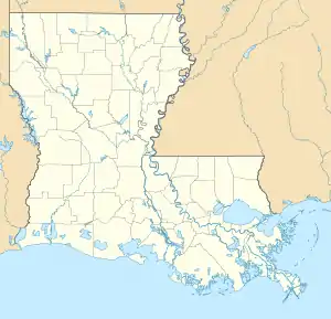  Glencoe, Louisiana Location of Glencoe in Louisiana | |
| Coordinates: 29°48′20″N 91°40′04″W | |
| Country | United States |
| State | Louisiana |
| Parish | St. Mary |
| Area | |
| • Total | 0.7 sq mi (1.7 km2) |
| Elevation | 9 ft (3 m) |
| Population (2010) | |
| • Total | 112 |
| • Density | 170/sq mi (66/km2) |
| Time zone | UTC-6 (CST) |
| • Summer (DST) | UTC-5 (CDT) |
| Area code(s) | 337 |
Geography
Glencoe is located at 29°48′20″N 91°40′4″W (29.80576, -91.66789).
Louisiana Highway 83 passes throughout the entire community and heads 9 miles (14 km) east to the town of Baldwin. Louisiana Highway 318, which intersects with LA-83, heads 7 miles (11 km) northeast to intersect with Louisiana Highway 182 at the unincorporated community of Sorrel.
According to the United States Census Bureau, the CDP has a total area of 0.66 square miles (1.7 km2), all land.[1]
References
- "Geographic Identifiers: 2010 Demographic Profile Data (G001): Glencoe CDP, Louisiana". U.S. Census Bureau, American Factfinder. Archived from the original on February 12, 2020. Retrieved March 29, 2013.
Municipalities and communities of St. Mary Parish, Louisiana, United States | ||
|---|---|---|
| Cities | 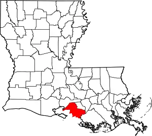 | |
| Towns | ||
| CDPs | ||
| Other communities | ||
| Indian reservation | ||
| Footnotes | ‡This populated place also has portions in an adjacent parish or parishes | |
| ||
Population 112
This article is issued from Wikipedia. The text is licensed under Creative Commons - Attribution - Sharealike. Additional terms may apply for the media files.