Hégenheim
Hégenheim (French pronunciation: [eɡənaim]; German: Hegenheim; Alsatian: Hagena) is a commune in the Haut-Rhin department in Alsace in north-eastern France. It is adjacent to the Swiss town of Allschwil, and is part of the Basel urban area.
Hégenheim | |
|---|---|
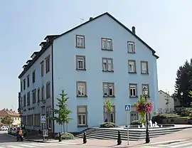 The town hall in Hégenheim | |
.svg.png.webp) Coat of arms | |
Location of Hégenheim 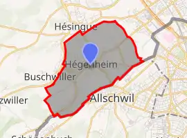
| |
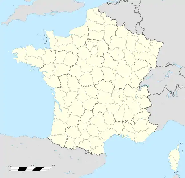  Hégenheim 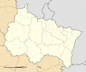 Hégenheim | |
| Coordinates: 47°33′41″N 7°31′37″E | |
| Country | France |
| Region | Grand Est |
| Department | Haut-Rhin |
| Arrondissement | Mulhouse |
| Canton | Saint-Louis |
| Government | |
| • Mayor (2020–2026) | Thomas Zeller[1] |
| Area 1 | 6.7 km2 (2.6 sq mi) |
| Population | 3,395 |
| • Density | 510/km2 (1,300/sq mi) |
| Time zone | UTC+01:00 (CET) |
| • Summer (DST) | UTC+02:00 (CEST) |
| INSEE/Postal code | 68126 /68220 |
| Elevation | 254–347 m (833–1,138 ft) (avg. 275 m or 902 ft) |
| 1 French Land Register data, which excludes lakes, ponds, glaciers > 1 km2 (0.386 sq mi or 247 acres) and river estuaries. | |
Geography
Hégenheim is a small town located in the northeastern quarter of France and in the southeastern part of the Haut-Rhin department.
Hégenheim is part of the french suburb of Basel and is adjacent to the swiss town of Allschwil.
Climate
Hégenheim features a moderately continental climate but nevertheless under maritime influence do to its significant exposure to prevailing winds and low-pressure areas from western France.
The town faces the Belfort Gap and thus is not protected by any mountain range which generates (on average) a higher amount of annual precipitation than in the rest of Alsace.
On the other hand, this precipitation falls mainly at the end of spring and in the summer when the dew point is high and thunderstorms numerous.
The village's weather station has the particularity of being a little higher up, in a place regularly exposed to wind and near many trees. These factors keep average maximum temperatures cool in all seasons despite the low altitude of the weather station.
Winters are cold and drier with weakly positive average maximum temperatures, around 4 °C to 6 °C. Snow falls each winter in a weak to moderate manner although long episodes of heavy snow have already been recorded, sometimes out of the winter season.
| Climate data for Hégenheim, elevation: 279 m (915 ft), modeled 1999-2019 averages | |||||||||||||
|---|---|---|---|---|---|---|---|---|---|---|---|---|---|
| Month | Jan | Feb | Mar | Apr | May | Jun | Jul | Aug | Sep | Oct | Nov | Dec | Year |
| Average high °C (°F) | 5.0 (41.0) |
6.3 (43.3) |
10.8 (51.4) |
14.9 (58.8) |
18.5 (65.3) |
22.5 (72.5) |
24.3 (75.7) |
24.1 (75.4) |
20.0 (68.0) |
15.5 (59.9) |
9.3 (48.7) |
5.6 (42.1) |
14.7 (58.5) |
| Daily mean °C (°F) | 1.4 (34.5) |
1.9 (35.4) |
5.8 (42.4) |
9.9 (49.8) |
13.9 (57.0) |
17.9 (64.2) |
19.7 (67.5) |
19.4 (66.9) |
15.3 (59.5) |
10.8 (51.4) |
5.4 (41.7) |
2.1 (35.8) |
10.3 (50.5) |
| Average low °C (°F) | −1.7 (28.9) |
−1.9 (28.6) |
1.1 (34.0) |
4.5 (40.1) |
8.8 (47.8) |
12.7 (54.9) |
14.6 (58.3) |
14.6 (58.3) |
10.7 (51.3) |
6.6 (43.9) |
2.0 (35.6) |
−0.9 (30.4) |
5.9 (42.7) |
| Average precipitation mm (inches) | 86 (3.4) |
77 (3.0) |
88 (3.5) |
98 (3.9) |
135 (5.3) |
124 (4.9) |
127 (5.0) |
128 (5.0) |
101 (4.0) |
101 (4.0) |
103 (4.1) |
106 (4.2) |
1,274 (50.3) |
| Average rainy days | 10 | 9 | 10 | 11 | 13 | 12 | 12 | 11 | 10 | 10 | 10 | 11 | 129 |
| Average relative humidity (%) | 82 | 79 | 75 | 71 | 73 | 70 | 67 | 69 | 75 | 81 | 85 | 84 | 76 |
| Mean monthly sunshine hours | 118.06 | 135.6 | 204.6 | 252.0 | 279.0 | 315.0 | 332.57 | 297.6 | 216.0 | 164.3 | 120.0 | 117.8 | 2,549.87 |
| Mean daily sunshine hours | 3.9 | 4.8 | 6.6 | 8.4 | 9.0 | 10.5 | 10.7 | 9.6 | 7.2 | 5.3 | 4.0 | 3.8 | 7.0 |
| Source: climate-data.org | |||||||||||||
meteorological records in the town since 2016
Since 2016, meteorological records have been carried out daily in the town and the climatic table is updated every month.
| Climate data for west-Hégenheim, elevation: 309 m (1,014 ft), 2016-2021 estimated averages | |||||||||||||
|---|---|---|---|---|---|---|---|---|---|---|---|---|---|
| Month | Jan | Feb | Mar | Apr | May | Jun | Jul | Aug | Sep | Oct | Nov | Dec | Year |
| Record high °C (°F) | 14.5 (58.1) |
18.5 (65.3) |
24.7 (76.5) |
27.7 (81.9) |
30.5 (86.9) |
35.6 (96.1) |
36.8 (98.2) |
33.9 (93.0) |
30.4 (86.7) |
24.0 (75.2) |
22.3 (72.1) |
15.2 (59.4) |
36.8 (98.2) |
| Average high °C (°F) | 4.7 (40.5) |
8.3 (46.9) |
11.5 (52.7) |
16.3 (61.3) |
18.8 (65.8) |
24.2 (75.6) |
26.0 (78.8) |
25.3 (77.5) |
21.6 (70.9) |
15.2 (59.4) |
8.6 (47.5) |
5.8 (42.4) |
15.5 (59.9) |
| Daily mean °C (°F) | 2.3 (36.1) |
4.6 (40.3) |
6.9 (44.4) |
10.6 (51.1) |
13.8 (56.8) |
19.1 (66.4) |
20.5 (68.9) |
20.1 (68.2) |
16.4 (61.5) |
11.1 (52.0) |
5.7 (42.3) |
3.3 (37.9) |
11.2 (52.2) |
| Average low °C (°F) | −0.2 (31.6) |
0.9 (33.6) |
2.3 (36.1) |
4.9 (40.8) |
8.9 (48.0) |
14.0 (57.2) |
15.0 (59.0) |
14.9 (58.8) |
11.2 (52.2) |
7.1 (44.8) |
2.9 (37.2) |
0.8 (33.4) |
6.9 (44.4) |
| Record low °C (°F) | −13.0 (8.6) |
−12.7 (9.1) |
−9.1 (15.6) |
−4.0 (24.8) |
−1.0 (30.2) |
5.7 (42.3) |
9.9 (49.8) |
6.7 (44.1) |
1.7 (35.1) |
−3.0 (26.6) |
−4.3 (24.3) |
−6.0 (21.2) |
−13.0 (8.6) |
| Average precipitation mm (inches) | 79.2 (3.12) |
56.0 (2.20) |
48.1 (1.89) |
62.8 (2.47) |
129.5 (5.10) |
109.2 (4.30) |
84.8 (3.34) |
101.2 (3.98) |
46.9 (1.85) |
72.5 (2.85) |
55.1 (2.17) |
66.4 (2.61) |
911.7 (35.88) |
| Average snowfall cm (inches) | 10.5 (4.1) |
4.2 (1.7) |
3.8 (1.5) |
0.8 (0.3) |
0.2 (0.1) |
0.0 (0.0) |
0.0 (0.0) |
0.0 (0.0) |
0.0 (0.0) |
0.0 (0.0) |
0.5 (0.2) |
2.6 (1.0) |
22.6 (8.9) |
| Average rainy days (≥ 1 mm) | 11.8 | 10.0 | 9.7 | 6.8 | 13.3 | 12.3 | 10.3 | 9.7 | 7.8 | 13.0 | 10.2 | 12.6 | 127.6 |
| Average snowy days (≥ 1 cm) | 6.0 | 2.5 | 1.5 | 0.8 | trace | 0.0 | 0.0 | 0.0 | 0.0 | trace | 0.3 | 1.4 | 12.5 |
| Average relative humidity (%) | — | — | — | — | — | 75.5 | 85.3 | 84.5 | 85.3 | 90.2 | 95.1 | — | — |
| Source: Météo & Nature | |||||||||||||
References
- "Répertoire national des élus: les maires". data.gouv.fr, Plateforme ouverte des données publiques françaises (in French). 2 December 2020.
- "Populations légales 2018". The National Institute of Statistics and Economic Studies. 28 December 2020.
External links
 |
Wikimedia Commons has media related to Hégenheim. |
- Official site
- Travel Index guide (in French)

Authority control  | |
|---|---|
| General | |
| National libraries | |
| Other | |