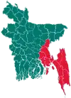
Hatiya Upazila
Hatiya (Bengali: হাতিয়া) is an upazila (sub-district) of Noakhali District in Bangladesh's Chittagong Division.[1] It encompasses several islands of Bangladesh, most notably Hatiya Island, Bhasan Char, Nijhum Dwip and Jahazir Char.[2]
Hatiya
হাতিয়া | |
|---|---|
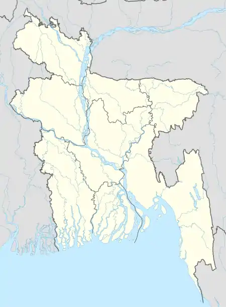  Hatiya Location in Bangladesh | |
| Coordinates: 22°22′N 91°7.5′E | |
| Country |  Bangladesh Bangladesh |
| Division | Chittagong Division |
| District | Noakhali District |
| Government | |
| • MP (Noakhali-6) | Ayesha Ferdaus |
| • Upazila Chairman | Mahbub Murshid Liton |
| Area | |
| • Total | 2,100 km2 (800 sq mi) |
| Population (2011 census) | |
| • Total | 452,463 |
| • Density | 216/km2 (560/sq mi) |
| Time zone | UTC+6 (BST) |
| Postal code | 3890 |
| Website | hatia |
History
The Hatiya thana was established with Hatiya Island as its largest and principal island. In 1983, Hatiya Thana was upgraded to an upazila (sub-district) as part of the President of Bangladesh Hussain Muhammad Ershad's decentralisation programme.
Geography
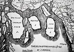
Hatiya Upazila is located at 22.3667°N 91.1250°E. It has 47,970 household units and a total area of 2,100 square kilometres. It is bounded by the Subarnachar Upazila to its north, Ramgati Upazila to its northwest, the Bay of Bengal to the east and south, and Manpura Upazila to its west.
Demographics
At the 2011 Bangladesh census, Hatiya had a population of 442,463. Males constituted 51% of the population and females constituted 49%. The population over age 18 was 125,512. Hatiya had an average literacy rate of 69% (7+ years), against the national average of 72.76%.[3]
Economy
The upazila consists of 52 markets and bazaars. They include Oskhali, Afazia, Tamruddi, Chowmuhani, Sagaria, Jahajmara, Sonadia chowrasta, Char Chenga, Maijdee Bazar and Nalchira Bazar. Most people are employed in agriculture and fishing, and a few professions are government or non-governmental jobs. All banks are run by the government including Krishi Bank, Sonali Bank Limited, and Janata Bank Limited.
The main exports include rice, coconut, betel nut, banana, betel leaf, chili, Hilsa, and other types of fish.
Administration
Hatiya Upazila is divided into one Municipality, the Hatiya Municipality, and 11 Union parishads:[4]
- Burir Char
- Chandnandi
- Char Ishwar
- Char King
- Harni
- Jahajmara
- Nijhum Dwip
- Nolchira
- Sonadiya
- Sukhchar
- Tomoroddi
The union parishads are subdivided into 44 mauzas and 62 villages.[4] Hatiya Upazila is represented as the Noakhali-6 constituency in the Jatiya Sangsad.
Chairmen
| Name | Notes |
|---|---|
| Ziaul Haq Taluq Miah | |
| Professor Muhammad Waliullah | |
| Muhammad Mahbub Murshid Liton | Present |
Healthcare
There is one Upazila Health Complex and 10 family planning centres. Notable NGOs operating in this area are Grameeen bank, Dwip Unnoyan Songstha, Brac, Proshika, Heed Bangladesh, CARE, and Caritas.
Education
Institutions of higher education include Hatiya Dwip Government College and three non-governmental colleges. Some of the schools include:
- Hatiya Darul Uloom Kamil Madrasa
- Sukhchar Azharul Uloom Fazil Madrasa
- Hatiya Rahmania Fazil Madrasa
- Char Renga Islamia Fazil Madrasa
- Char Kailas Hadia Fazil Madrasa
- Tamruddin Ahmadia Fazil Madrasa
- Jahazmara Sirajul Uloom Alia Madrasa
- Chowmuhani Tabarakia Alim Madrasa
- Burir Char Ahmadia Alim Madrasa
- Char King Muhammadia Dakhil Madrasa
- Sonadia Abdul Bari Dakhil Madrasa
- Jahazmara Women's Dakhil Madrasa
- Haji Fazil Ahmad Dakhil Madrasa
- Khaserhat Majidia Dakhil Madrasa
- Nalchira Sayyid Ahmad Dakhil Madrasa
- Burirchar Shaheed Ali Ahmed Memorial High School
- A.M High School
- Oskhali K.S.S. High School
Facilities
Hatiya Upazila has orphanage facilities across its territory. These include Hatiya Island Orphanage, Darul Aitam Oskhali and the Jahazmara Orphanage.[5]
Notable people
- Amirul Islam Kamal, politician
- Mohammad Ali, former Member of Parliament
- Mohammad Fazlul Azim, industralist and business magnate
- Muhammad Waliullah, professor
See also
References
- Chowdhury, Muhammad Tawhid Hussain Chowdhury (2012). "Hatiya Upazila". In Islam, Sirajul; Miah, Sajahan; Khanam, Mahfuza; Ahmed, Sabbir (eds.). Banglapedia: the National Encyclopedia of Bangladesh (Online ed.). Dhaka, Bangladesh: Banglapedia Trust, Asiatic Society of Bangladesh. ISBN 984-32-0576-6. OCLC 52727562. Retrieved 10 December 2021.
- "3 army men killed in Noakhali road accident". Dhaka Tribune. 8 February 2019. Retrieved 9 February 2019.
- "Population Census Wing, BBS". Archived from the original on 27 March 2005. Retrieved 10 November 2006.
- "District Statistics 2011: Noakhali" (PDF). Bangladesh Bureau of Statistics. Archived from the original (PDF) on 13 November 2014. Retrieved 14 July 2014.
- "এতিমখানা". Hatiya Upojela (in Bengali).