Ida Township, Michigan
Ida Township is a civil township of Monroe County in the U.S. state of Michigan. The population was 4,964 at the 2010 census. The township was organized in 1837 and named after local civic leader Ida M. Taylor.[3]
Ida Township, Michigan | |
|---|---|
.jpg.webp) Ida Township Municipal Office & Library | |
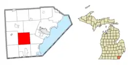 Location within Monroe County | |
  Ida Township Location within the state of Michigan  Ida Township Location within the United States | |
| Coordinates: 41°51′56″N 83°35′19″W | |
| Country | United States |
| State | Michigan |
| County | Monroe |
| Organized | 1837 |
| Government | |
| • Supervisor | Paul Metz |
| • Clerk | Tera Shaffer |
| Area | |
| • Total | 36.92 sq mi (95.62 km2) |
| • Land | 36.75 sq mi (95.18 km2) |
| • Water | 0.17 sq mi (0.44 km2) |
| Elevation | 640 ft (195 m) |
| Population (2010) | |
| • Total | 4,964 |
| • Density | 135.1/sq mi (52.2/km2) |
| Time zone | UTC-5 (Eastern (EST)) |
| • Summer (DST) | UTC-4 (EDT) |
| ZIP code(s) | |
| Area code(s) | 734 |
| FIPS code | 26-40260[1] |
| GNIS feature ID | 1626508[2] |
| Website | Official website |
Communities
- Federman was a community located at 41°54′21″N 83°37′28″W. The community contained its own railway station.[4] The station served as an intersection that linked the Ann Arbor Railroad and New York Central lines.[5] Federman had its own post office briefly from June 22, 1899 to August 31, 1906.[6][7]
- Ida is an unincorporated community on the northern boundary of the township at 41°54′39″N 83°34′25″W.[8] A post office opened named Ida on July 11, 1844 but was discontinued on July 29, 1852. It was reestablished soon after on June 11, 1853, and the community was platted in 1868.[9] The current post office is located at 2888 Lewis Avenue.[10] The Ida post office uses the 48140 ZIP Code, which serves most of Ida Township, as well as smaller portions of Raisinville Township to the northeast and La Salle Township to the east.[11][12] The community of Ida was listed as a new census-designated place for the 2020 census.[13]
- Ida Center is an unincorporated community located near the center of the township along the intersection of Ida Center Road and Lewis Avenue at 41°51′58″N 83°34′17″W.[14]
- Lulu is an unincorporated community centered at Douglas Road and Lulu Road slightly northwest of the center of the township at 41°52′47″N 83°36′39″W.[15] It was first settled in 1853. Lulu contained its own post office from 1880 to 1941.[16] The community also contained its own railway station built in 1880.[17] The station no longer exists, but the railway line continues to run through the community.[18][19] The community also contains the Lulu Cemetery with the earliest grave dating back to 1855.[20][21]
- Yargerville is an unincorporated community centered at the intersection of East Morocco / Wood Road and Minx Road along the eastern boundary of the township with La Salle Township at 41°50′18″N 83°31′55″W.[22] Yargerville contained its own post office from 1890–1906.[23][24]
Geography
According to the United States Census Bureau, the township has a total area of 36.92 square miles (95.62 km2), of which 36.75 square miles (95.18 km2) is land and 0.17 square miles (0.44 km2) (0.46%) is water.[25]
Demographics
As of the census[1] of 2000, there were 4,949 people, 1,622 households, and 1,373 families residing in the township. The population density was 134.7 per square mile (52.0/km2). There were 1,655 housing units at an average density of 45.0 per square mile (17.4/km2). The racial makeup of the township was 98.48% White, 0.14% African American, 0.16% Native American, 0.20% Asian, 0.51% from other races, and 0.51% from two or more races. Hispanic or Latino of any race were 1.25% of the population.
There were 1,622 households, out of which 41.7% had children under the age of 18 living with them, 75.2% were married couples living together, 5.6% had a female householder with no husband present, and 15.3% were non-families. 12.4% of all households were made up of individuals, and 5.4% had someone living alone who was 65 years of age or older. The average household size was 3.03 and the average family size was 3.32.
In the township the population was spread out, with 29.5% under the age of 18, 8.1% from 18 to 24, 29.0% from 25 to 44, 25.2% from 45 to 64, and 8.3% who were 65 years of age or older. The median age was 36 years. For every 100 females, there were 105.2 males. For every 100 females age 18 and over, there were 102.8 males.
The median income for a household in the township was $57,106, and the median income for a family was $60,990. Males had a median income of $46,130 versus $28,456 for females. The per capita income for the township was $21,074. About 1.9% of families and 2.6% of the population were below the poverty line, including 1.7% of those under age 18 and 4.4% of those age 65 or over.
Education
The majority of the township is served by Ida Public Schools, which has all three schools within one campus near the center of the community of Ida along Lewis Avenue. The district also serves a small area of several neighboring townships. A small portion of the western portion of Ida Township is served by Summerfield Schools in Summerfield Township to the west.[26]
Previously St. Anthony School of the Roman Catholic Archdiocese of Detroit was in Temperance. Its service area included Ida Township.[27]
Images

Community of Ida in 2010 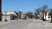
Community of Ida in 2020 
U.S. Post Office in Ida .jpg.webp)
Community of Lulu in 2021 .jpg.webp)
Lulu Cemetery
References
- "U.S. Census website". United States Census Bureau. Retrieved 2008-01-31.
- U.S. Geological Survey Geographic Names Information System: Ida Township, Michigan
- Romig, Walter (1986) [1973]. Michigan Place Names. Detroit, Michigan: Wayne State University Press. ISBN 0-8143-1838-X.
- U.S. Geological Survey Geographic Names Information System: Federman Station
- MichiganRailroads.com (2021). "Interlocking: Federman, MI". Retrieved May 13, 2021.
- U.S. Geological Survey Geographic Names Information System: Federman Post Office (historical)
- Romig, p. 193
- U.S. Geological Survey Geographic Names Information System: Ida, Michigan
- Romig, p. 281
- U.S. Geological Survey Geographic Names Information System: Ida Post Office
- UnitedStatesZipCodes.org (2021). "ZIP Code 48140: Ida". Retrieved March 7, 2021.
- Google (March 11, 2021). "48140 ZIP Code map" (Map). Google Maps. Google. Retrieved March 11, 2021.
- U.S. Census Bureau (2021). "State of Michigan Census Designated Places". Retrieved May 17, 2021.
- U.S. Geological Survey Geographic Names Information System: Ida Center
- U.S. Geological Survey Geographic Names Information System: Lulu, Michigan
- U.S. Geological Survey Geographic Names Information System: Lulu Post Office (historical)
- Romig, p. 337
- U.S. Geological Survey Geographic Names Information System: Lulu Station
- Robinson, John (9 March 2021). "Lulu: a Quaint Little 1853 Village in Monroe County". Retrieved March 12, 2021.
- U.S. Geological Survey Geographic Names Information System: Lulu Cemetery
- Find a Grave (2021). "Lulu Cemetery". Retrieved March 10, 2021.
- U.S. Geological Survey Geographic Names Information System: Yargerville
- U.S. Geological Survey Geographic Names Information System: Yargerville Post Office (historical)
- Romig, p. 616
- "Michigan: 2010 Population and Housing Unit Counts 2010 Census of Population and Housing" (PDF). 2010 United States Census. United States Census Bureau. September 2012. p. 34 Michigan. Retrieved July 22, 2020.
- Michigan Geographic Framework (15 November 2013). "Monroe County School Districts" (PDF). Retrieved March 12, 2021.
- "St. Anthony Temperance". Roman Catholic Archdiocese of Detroit. 2006-05-25. Archived from the original on 2006-05-25. Retrieved 2020-05-02.
Sources
- Romig, Walter (October 1, 1986) [1973]. Michigan Place Names: The History of the Founding and the Naming of More Than Five Thousand Past and Present Michigan Communities. Great Lakes Books Series (Paperback). Detroit, Michigan: Wayne State University Press. pp. 193, 281, 337, 616. ISBN 978-0-8143-1838-6.
Municipalities and communities of Monroe County, Michigan, United States | ||
|---|---|---|
| Cities |  Map of Michigan highlighting Monroe County | |
| Villages | ||
| Charter townships | ||
| Civil townships | ||
| CDPs | ||
| Other unincorporated communities |
| |
| Ghost towns | ||
| Footnotes | ‡This populated place also has portions in an adjacent county or counties | |
| ||