James Ruse Drive
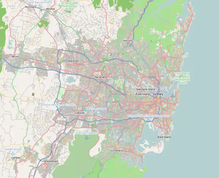
The James Ruse Drive is a 6.7-kilometre-long (4.2 mi)[1] urban freeway (North of Hassall St/River Rd W) and highway (South of Hassall St) located to the east and north of Parramatta, in western Sydney, New South Wales, Australia.
James Ruse Drive | |
|---|---|
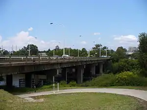 | |
James Ruse Drive Bridge over the Parramatta River | |
  SE end NW end | |
| Coordinates |
|
| General information | |
| Type | Freeway |
| Length | 6.7 km (4.2 mi)[1] |
| Opened | 1977 |
| Route number(s) |
|
| Former route number | see Former route allocations |
| Major junctions | |
| SE end |  Parramatta Road Parramatta RoadClyde, Sydney |
| |
| NW end |   Briens Road Briens RoadNorthmead, Sydney |
| Location(s) | |
| Major suburbs / towns | Clyde, Rosehill, Parramatta, North Parramatta, Northmead |
| Highway system | |
The road's southeastern terminus is located at the T-intersection with the Great Western Highway / Parramatta Road in Granville; with the road's northwestern terminus at the junction of the Cumberland Highway and Windsor Road in Northmead. The road passes through six large interchanges, with the Parramatta Road, the M4 Western Motorway, Victoria Road, Kissing Point Road, Pennant Hills Road, and Windsor Road.
History
The road was named in honour of James Ruse, a convict who was given land in the Parramatta district, which he successfully developed into the colony's first sustainable farm. The original Experiment Farm Cottage still exists on Ruse Street, Parramatta. Known initially as the Parramatta Bypass, the project was opened in stages: the opening of the first section northwards between Kissing Point Road (in Parramatta) and Pennant Hills Road (in North Parramatta) was opened in 1977; the second section between Pennant Hills Road and Windsor Road (in Northmead) in 1979; and the third and last section between Windsor Road to eventually link connect James Ruse Drive via an upgraded Briens Road to the intersection of Old Windsor Road and Hart Drive (now Cumberland Highway, in Constitution Hill) in 1981.
It has been allocated several route numbers, as follows: State route 53 (entire length from 1977-1988),[2] State Route 77 (Cumberland Highway 1988-1993), State route 55 (south of Cumberland Highway from 1988-2004), Metroad 7 (replaced SR77 from 1993-2005),[3] State route 40 (north of Victoria Road 2008/9-2013) and A40 (replaces SR40 2013- ).[4]
Former route allocations
Clyde - Parramatta:
 State Route 53 (1977-1988)[2]
 State Route 55 (1988-2004)
- unallocated (2007-present)
Parramatta - North Parramatta:
- State Route 53 (1977-1988)
- State Route 55 (1988-2004)
- unallocated (2004-2007)
 State Route 40 (2007-2013)
- A40 (2013-present)
North Parramatta - Northmead:
- State Route 53 (1979-1988)
 State Route 77 (1988-1993)
 Metroad 7 (1993-2005)[3]
- unallocated (2005-2007)
- State Route 40 (2007-2013)
- A28 (2013-present)
- A40 (2013-present)
Exits and interchanges
| Route Diagram | |||||||||||||||||||||||||||||||||||||||||||||||||||||||||||||||||||||||||||||||||||||||||||||||||||||||||||||||||||||||||||||||||||||||||||||||||||||||||||||||||||||||||||||||||||||||||||||||||||||||||||||||||||||||||||||
|---|---|---|---|---|---|---|---|---|---|---|---|---|---|---|---|---|---|---|---|---|---|---|---|---|---|---|---|---|---|---|---|---|---|---|---|---|---|---|---|---|---|---|---|---|---|---|---|---|---|---|---|---|---|---|---|---|---|---|---|---|---|---|---|---|---|---|---|---|---|---|---|---|---|---|---|---|---|---|---|---|---|---|---|---|---|---|---|---|---|---|---|---|---|---|---|---|---|---|---|---|---|---|---|---|---|---|---|---|---|---|---|---|---|---|---|---|---|---|---|---|---|---|---|---|---|---|---|---|---|---|---|---|---|---|---|---|---|---|---|---|---|---|---|---|---|---|---|---|---|---|---|---|---|---|---|---|---|---|---|---|---|---|---|---|---|---|---|---|---|---|---|---|---|---|---|---|---|---|---|---|---|---|---|---|---|---|---|---|---|---|---|---|---|---|---|---|---|---|---|---|---|---|---|---|---|---|---|---|---|---|---|---|---|---|---|---|---|---|---|---|---|
| |||||||||||||||||||||||||||||||||||||||||||||||||||||||||||||||||||||||||||||||||||||||||||||||||||||||||||||||||||||||||||||||||||||||||||||||||||||||||||||||||||||||||||||||||||||||||||||||||||||||||||||||||||||||||||||


| LGA | Location | km[1] | mi | Destinations[1] | Notes[1] | ||
|---|---|---|---|---|---|---|---|
| Parramatta | Clyde | 0 | 0.0 | Parramatta Road (Great Western Highway) (A44) – Granville, Merrylands, Auburn, Strathfield | Controlled T-intersection; southeastern highway terminus | ||
| 0.3 | 0.19 |   M4 Western Motorway (M4 east) – Homebush, Strathfield, Sydney CBD, Sydney airport M4 Western Motorway (M4 west) – Parramatta, Eastern Creek, Penrith M4 Western Motorway (M4 east) – Homebush, Strathfield, Sydney CBD, Sydney airport M4 Western Motorway (M4 west) – Parramatta, Eastern Creek, Penrith | Partial trumpet and partial diamond interchange; Northbound exit east only; northbound entrance east and west; southbound exit east and west; southbound entrance east only | ||||
| Rosehill | 1.6 | 0.99 | Grand Avenue (east) – Camellia, Rosehill Gardens Racecourse Hassall Street (west) – Harris Park, Parramatta | Controlled intersection | |||
| Parramatta River | 2.1 | 1.3 | James Ruse Drive Bridge | ||||
| Parramatta | Parramatta | 2.7 | 1.7 | Victoria Road (A40 east) – Ryde, Gladesville, Drummoyne, Sydney CBD Victoria Road (west) – North Parramatta, Parramatta | Partial diamond interchange with partial cloverleaf Route A40 continues north along James Ruse Drive, east along Victoria Road | ||
| 3.3 | 2.1 | Kissing Point Road (north-east) – Dundas Pennant Street (south-west) – North Parramatta | Diamond interchange | ||||
| Oatlands | 4.8 | 3.0 | Pennant Hills Road (Cumberland Highway) (A28 north-east) – Carlingford, Pennant Hills, Wahroonga Pennant Hills Road (south-west) – North Parramatta | Diamond interchange; southeastern concurrency terminus with route A28 Route A28 continues north along James Ruse Drive, east along Pennant Hills Road | |||
| Northmead | 6.4 | 4.0 | Windsor Road – Baulkham Hills, Castle Hill, Parramatta | Diamond interchange | |||
| 6.7 | 4.2 |  Briens Road (Cumberland Highway) (A28/A40) – Wentworthville, Bella Vista, Windsor, Westmead and Children's hospitals Briens Road (Cumberland Highway) (A28/A40) – Wentworthville, Bella Vista, Windsor, Westmead and Children's hospitals | Road continues west as Briens Road (Cumberland Highway) | ||||
1.000 mi = 1.609 km; 1.000 km = 0.621 mi
| |||||||
References
- "2 James Ruse Dr, Clyde NSW 2142 to Cumberland Hwy, Northmead NSW 2152". Google Maps. 2017. Retrieved 11 January 2017.
- Former NSW State Route 53, Ozroads, Retrieved on 9 June 2013.
- Metroad 7, Ozroads, Retrieved on 9 June 2013.
- James Ruse Drive, Ozroads. Retrieved on 14 May 2013.
External links
- "Rosehill to Clyde – James Ruse Drive". Roads & Maritime Services. Government of New South Wales. 2016.