Kichi-Jargylchak
Kichi-Jargylchak (Kyrgyz: Кичи-Жаргылчак, Kyrgyz pronunciation: [kiʧiʤɑrʁɯlʧɑ́q]) is a village in the Jeti-Ögüz District of the Issyk-Kul Region in Kyrgyzstan.[2] It is located right at the shores of Issyk Kul and at the base of the Teskey Ala-Too Range. The village is located at an elevation of 1649 meters[3] and in 2009 had a population of 2918 people.[1]
Kichi-Jargylchak
Кичи-Жаргылчак | |
|---|---|
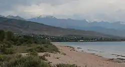 Kichi Jargylchak as seen from the beach at Ak Terek | |
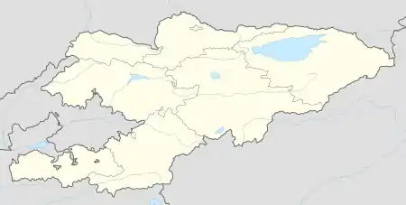  Kichi-Jargylchak Location of Kichi Jargylchak in Kyrgyzstan | |
| Coordinates: 42.207°N 77.688°E | |
| Country | Kyrgyzstan |
| Region | Issyk Kul |
| District | Jeti-Ögüz |
| Elevation | 1,649 m (5,410 ft) |
| Population (2009) | |
| • Total | 2,918 [1] |
| Time zone | UTC+6 |
Name
The name of the village means "small grist mill".

Sign telling the city limits of Kichi Jargylchak village from the north
See also
- Chong-Jargylchak, a nearby village whose name means "large grist mill"
References
- "2009 population census of the Kyrgyz Republic: Issyk-Kul Region" (PDF). p. 220. Archived from the original (PDF) on 10 August 2011.
- "Classification system of territorial units of the Kyrgyz Republic" (in Kyrgyz). National Statistics Committee of the Kyrgyz Republic. May 2021. pp. 10–12.
- “Кыргызстан” улуттук энциклопедиясы: 4-том. Башкы редактору Асанов Ү. А. К 97. Б.: Мамлекеттик тил жана энциклопедия борбору, 2012. 832 бет, илл. ISBN 978 9967-14-104 -9
This article is issued from Wikipedia. The text is licensed under Creative Commons - Attribution - Sharealike. Additional terms may apply for the media files.