Lake Ferry
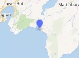
Lake Ferry is a small coastal settlement in Palliser Bay, on the southern coast of the North Island of New Zealand. It is in the South Wairarapa District, located 35 kilometres (22 mi) south-west of Martinborough, on the eastern shore of Lake Ōnoke. The coast is a popular fishing location and the settlement is a mixture of permanent and holiday homes. There is a historic hotel close to the sea coast where Lake Ōnoke flows into Palliser Bay. The name of the settlement and the hotel arises from a ferry service that previously operated across the lake outlet.[1][2]
Lake Ferry | |
|---|---|
 View towards Remutaka Range from Lake Ferry hotel | |
| |
| Coordinates: 41.39421°S 175.14374°E | |
| Country | New Zealand |
| Region | Wellington |
| Territorial authority | South Wairarapa |
| Time zone | UTC+12 (NZST) |
| • Summer (DST) | UTC+13 (NZDT) |
| Area code(s) | 04 |
The ferry service was established following a drowning in 1850. The ferry operator established the Lake Ferry hotel in 1851 to supplement his income.[1]
The ocean outlet of Lake Ōnoke is frequently closed by natural wave action on the beach, and this can lead to rising water levels in the lake. Natural forces can lead to the opening of the lake outlet, but historically, the lake levels have been controlled by excavating a channel through the beach to the sea, to limit flooding of properties around the lake.[3][4]
Gallery
- Lake Ferry
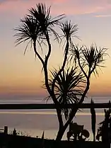 Ti kouka at Lake Ferry
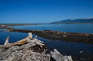 View across Lake Onoke to Remutaka range
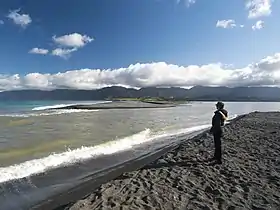 Open outlet of Lake Onoke
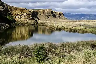 Cliffs and lagoon at Lake Ferry
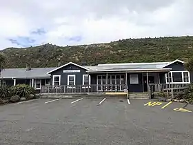 Lake Ferry hotel
 Lake Ferry hotel and village from beach
References
- "Lake Ferry (Lake Onoke)". 100% Pure New Zealand. Retrieved 10 October 2021.
- "Wairarapa places – Palliser District". Te Ara – The Encyclopedia of New Zealand. Retrieved 10 October 2021.
- "Threat of flood in Lower Wairarapa – Lake Ferry rising". Evening Post. CXVII (109). 10 May 1934 – via PapersPast.
- Yorster, Elisa (12 January 2018). "Tensions at lake reignited". Wairarapa Times Age. Retrieved 10 October 2021.
