Laur, Nueva Ecija
Laur, officially the Municipality of Laur (Tagalog: Bayan ng Laur), is a 3rd class municipality in the province of Nueva Ecija in Central Luzon region of Philippines. According to the 2020 census, it has a population of 38,263 people. [3]
Laur | |
|---|---|
| Municipality of Laur | |
 Laur Public Market | |
 Seal | |
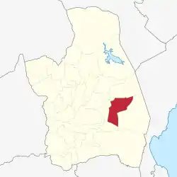 Map of Nueva Ecija with Laur highlighted | |
OpenStreetMap 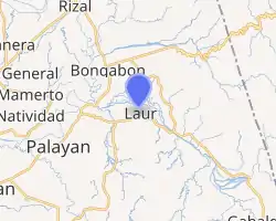
| |
.svg.png.webp)  Laur Location within the Philippines | |
| Coordinates: 15°35′N 121°11′E | |
| Country | Philippines |
| Region | Central Luzon |
| Province | Nueva Ecija |
| District | 3rd district |
| Founded | January 1, 1917 |
| Barangays | 17 (see Barangays) |
| Government | |
| • Type | Sangguniang Bayan |
| • Mayor | Alexander A. Daus |
| • Vice Mayor | John Joe V. Samano |
| • Representative | Rosanna V. Vergara |
| • Municipal Council | Members |
| • Electorate | 22,596 voters (2019) |
| Area | |
| • Total | 295.88 km2 (114.24 sq mi) |
| Elevation | 100 m (300 ft) |
| Highest elevation | 598 m (1,962 ft) |
| Lowest elevation | 58 m (190 ft) |
| Population | |
| • Total | 38,263 |
| • Density | 130/km2 (330/sq mi) |
| • Households | 8,522 |
| Economy | |
| • Income class | 3rd municipal income class |
| • Poverty incidence | 20.99% (2015)[4] |
| • Revenue | ₱174,305,410.50 (2020) |
| • Assets | ₱556,607,311.75 (2020) |
| • Expenditure | ₱147,333,595.19 (2020) |
| • Liabilities | ₱150,528,615.49 (2020) |
| Service provider | |
| • Electricity | Nueva Ecija 2 Area 2 Electric Cooperative (NEECO 2 A2) |
| Time zone | UTC+8 (PST) |
| ZIP code | 3129 |
| PSGC | |
| IDD : area code | +63 (0)44 |
| Native languages | Tagalog Ilocano |
The National Penitentiary (New Bilibid Prisons), currently housed in Muntinlupa of Metro Manila, is scheduled for relocation to Barangay San Isidro.[5][6]
History
Senators Benigno Aquino, Jr. and José Diokno were kept in solitary confinement for exactly thirty days in 1971 within Fort Magsaysay in Laur.
Barangays
Laur is politically subdivided into 17 barangays.
- Barangay I (Poblacion)
- Barangay II (Poblacion)
- Barangay III (Poblacion)
- Barangay IV (Poblacion)
- Betania
- Canantong
- Nauzon
- Pangarulong
- Pinagbayanan
- Sagana
- San Fernando
- San Isidro
- San Josep
- San Juan
- San Vicente
- Siclong
- San Felipe
Climate
| Climate data for Laur, Nueva Ecija | |||||||||||||
|---|---|---|---|---|---|---|---|---|---|---|---|---|---|
| Month | Jan | Feb | Mar | Apr | May | Jun | Jul | Aug | Sep | Oct | Nov | Dec | Year |
| Average high °C (°F) | 27 (81) |
28 (82) |
29 (84) |
31 (88) |
31 (88) |
30 (86) |
30 (86) |
30 (86) |
29 (84) |
29 (84) |
29 (84) |
27 (81) |
29 (85) |
| Average low °C (°F) | 20 (68) |
20 (68) |
21 (70) |
22 (72) |
24 (75) |
24 (75) |
24 (75) |
24 (75) |
24 (75) |
23 (73) |
22 (72) |
21 (70) |
22 (72) |
| Average precipitation mm (inches) | 25 (1.0) |
26 (1.0) |
18 (0.7) |
24 (0.9) |
91 (3.6) |
145 (5.7) |
149 (5.9) |
122 (4.8) |
120 (4.7) |
128 (5.0) |
61 (2.4) |
52 (2.0) |
961 (37.7) |
| Average rainy days | 7.7 | 5.7 | 6.8 | 8.0 | 18.2 | 22.1 | 24.3 | 23.4 | 22.7 | 17.5 | 10.0 | 9.4 | 175.8 |
| Source: Meteoblue[7] | |||||||||||||
Demographics
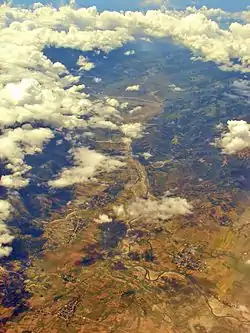
Aerial view of Laur with Dingalan Bay in the distant background
|
| ||||||||||||||||||||||||||||||||||||||||||||||||
| Source: Philippine Statistics Authority [8] [9] [10][11] | |||||||||||||||||||||||||||||||||||||||||||||||||
See also
References
- Municipality of Laur | (DILG)
- "2015 Census of Population, Report No. 3 – Population, Land Area, and Population Density" (PDF). Philippine Statistics Authority. Quezon City, Philippines. August 2016. ISSN 0117-1453. Archived (PDF) from the original on May 25, 2021. Retrieved July 16, 2021.
- Census of Population (2020). "Region III (Central Luzon)". Total Population by Province, City, Municipality and Barangay. PSA. Retrieved 8 July 2021.
- https://psa.gov.ph/sites/default/files/City%20and%20Municipal-level%20Small%20Area%20Poverty%20Estimates_%202009%2C%202012%20and%202015_0.xlsx; publication date: 10 July 2019; publisher: Philippine Statistics Authority.
- DOJ to transfer national prison to Bilibid, Philstar.
- National enitentiary relocation
- "Laur: Average Temperatures and Rainfall". Meteoblue. Retrieved 4 May 2020.
- Census of Population (2015). "Region III (Central Luzon)". Total Population by Province, City, Municipality and Barangay. PSA. Retrieved 20 June 2016.
- Census of Population and Housing (2010). "Region III (Central Luzon)". Total Population by Province, City, Municipality and Barangay. NSO. Retrieved 29 June 2016.
- Censuses of Population (1903–2007). "Region III (Central Luzon)". Table 1. Population Enumerated in Various Censuses by Province/Highly Urbanized City: 1903 to 2007. NSO.
- "Province of Nueva Ecija". Municipality Population Data. Local Water Utilities Administration Research Division. Retrieved 17 December 2016.
- "Poverty incidence (PI):". Philippine Statistics Authority. Retrieved 28 December 2020.
- https://psa.gov.ph/sites/default/files/NSCB_LocalPovertyPhilippines_0.pdf; publication date: 29 November 2005; publisher: Philippine Statistics Authority.
- https://psa.gov.ph/sites/default/files/2003%20SAE%20of%20poverty%20%28Full%20Report%29_1.pdf; publication date: 23 March 2009; publisher: Philippine Statistics Authority.
- https://psa.gov.ph/sites/default/files/2006%20and%202009%20City%20and%20Municipal%20Level%20Poverty%20Estimates_0_1.pdf; publication date: 3 August 2012; publisher: Philippine Statistics Authority.
- https://psa.gov.ph/sites/default/files/2012%20Municipal%20and%20City%20Level%20Poverty%20Estima7tes%20Publication%20%281%29.pdf; publication date: 31 May 2016; publisher: Philippine Statistics Authority.
- https://psa.gov.ph/sites/default/files/City%20and%20Municipal-level%20Small%20Area%20Poverty%20Estimates_%202009%2C%202012%20and%202015_0.xlsx; publication date: 10 July 2019; publisher: Philippine Statistics Authority.
External links
 |
Wikimedia Commons has media related to Laur, Nueva Ecija. |
- Laur Profile at PhilAtlas.com
- Philippine Standard Geographic Code
- Philippine Census Information
- Local Governance Performance Management System
Places adjacent to Laur, Nueva Ecija | |
|---|---|


 Province of Nueva Ecija Province of Nueva Ecija | |
|---|---|
Palayan (capital) | |
| Municipalities | |
| Component cities | |
This article is issued from Wikipedia. The text is licensed under Creative Commons - Attribution - Sharealike. Additional terms may apply for the media files.