Lusikisiki
Lusikisiki is a town in the Ingquza Hill Local Municipality in the Eastern Cape Province, South Africa. The name is onomatopoeic, derived from the rustling sound of reeds in the wind,[2] named by the local Xhosa people of the AmaMpondo tribe. Lusikisiki is 45 kilometers inland from and north of Port St Johns. The town is positioned along the R61 (future N2 Wild Coast Toll Route) leading to Mthatha to the west and Durban to the north-east.
Lusikisiki | |
|---|---|
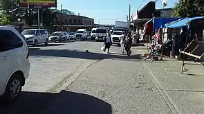 Main road of Lusikisiki Town. | |
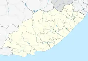  Lusikisiki 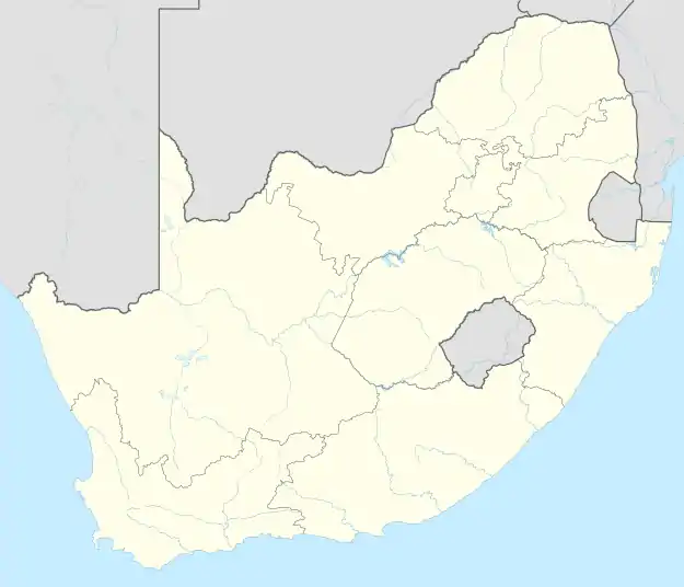 Lusikisiki | |
| Coordinates: 31.368°S 29.576°E | |
| Country | South Africa |
| Province | Eastern Cape |
| District | O.R.Tambo |
| Municipality | Ingquza Hill |
| Area | |
| • Total | 4.09 km2 (1.58 sq mi) |
| Population (2011)[1] | |
| • Total | 4,028 |
| • Density | 980/km2 (2,600/sq mi) |
| Racial makeup (2011) | |
| • Black African | 94.0% |
| • Coloured | 1.9% |
| • Indian/Asian | 1.8% |
| • White | 0.7% |
| • Other | 1.6% |
| First languages (2011) | |
| • Xhosa | 81.3% |
| • English | 8.3% |
| • Zulu | 2.2% |
| • Other | 8.2% |
| Time zone | UTC+2 (SAST) |
| Postal code (street) | 4820 |
| PO box | 4820 |
| Area code | 039 |
Climate
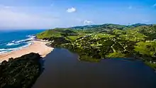
Lusikisiki receives high levels of rainfall, ranging between 874mm - 1060mm of rain per annum.[3] Rainfall is considered unseasonal, although Lusikisiki receives the majority of its rainfall during summer.[4] Winter temperatures reach their lowest in July, averaging 8 degrees Celsius at night. The area lies within Forest and Indian Coastal Thicket biomes, and White Milkwood (Sideroxylon inerme) are common.
History
Pre-colonial
Before European habitation in Lusikisiki, the AmaMpondo chief's kraal occupied what is now the present town village. In 1894 European settlers started settling in Lusikisiki after Mpondoland was annexed by the Cape Colony and a magistrate took up residence there.[5]
Apartheid era
In 1953 the South African Apartheid government made attempts to persuade the people of Lusikisiki to accept the rule of Bantu authorities which they had established. The government worked with Paramount Chief Botha Sigcau to attempt to start a rehabilitation scheme in Pondoland.[6] The scheme was presented to the Lusikisiki community but was rejected. A few days later, the police entered the area.[7] A man called Mngqinga led a large local group to attack the police. This was later known as the Lusikisiki Revolt.
Notable people
- Khotso Sethuntsa - Sangoma
- Stella Sigcau - 1st female Prime Minister of the Bantustan of Transkei & South African national minister
- Simphiwe Dana - musician
- Mpho Mbiyozo - rugby union player
Crime
Crime rate in Lusikisiki has rank number 1 in South Africa, these crimes includes; domestic robbery & sexual harassment.[8]
See also
References
- "Main Place Lusikisiki". Census 2011.
- RE Raper - HSRC. Dictionary of Southern African Place Names.
- "Climate Lusikisiki: Temperature, Climograph, Climate table for Lusikisiki - Climate-Data.org". en.climate-data.org. Retrieved 2018-02-09.
- "Lusikisiki climate". www.saexplorer.co.za. Retrieved 2018-02-09.
- http://catholickokstad.mariannhillmedia.org/lusiki/ Accessed 15 January 2018
- Thembela Kepe (2005) Magwa Tea Venture in South Africa: Politics, Land and Economics, Social Dynamics, 31:1, 261-279, DOI: 10.1080/02533950508628704
- tinashe (2011-06-10). "Lusikisiki and Bizana". South African History Online. Retrieved 2018-02-09.
- "Lusikisiki again a hotspot for rape incidences". Dispatch LIVE. 22 February 2021.
External links
 |
Wikimedia Commons has media related to Lusikisiki. |
- http://www.sahistory.org.za/archive/sketch-map-locations-lusikisiki-district-identification-place-residence-oral-informants
- http://www.heraldlive.co.za/news/2017/11/18/new-hope-brews-magwa-tea-estate/
- http://www.heraldlive.co.za/news/2017/07/13/majola-tea-estate-wound/
Municipalities and communities of OR Tambo District Municipality, Eastern Cape | ||
|---|---|---|
District seat: Mthatha | ||
| Ingquza Hill | .svg.png.webp) OR Tambo District within South Africa | |
| Port St Johns | ||
| Nyandeni | ||
| Mhlontlo | ||
| King Sabata Dalindyebo | ||
Authority control  |
|---|