Lysychnyky
Lysychnyky (Ukrainian: Лиси́чники) is a village (selo) in Chortkiv Raion of Ternopil Oblast, of Western Ukraine. The population of the village is just about 647 people. Local government is administered by Kasperivska village council.[1] Lysychnyky belongs to Zalishchyky urban hromada, one of the hromadas of Ukraine.[2]
Lysychnyky
Лисичники | |
|---|---|
Village | |
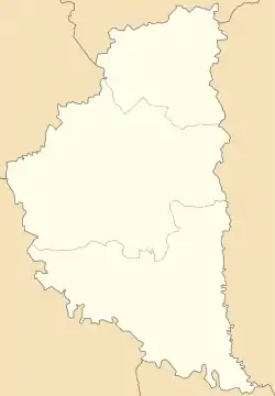  Lysychnyky | |
| Coordinates: 48°41′55″N 25°50′54″E | |
| Country |  Ukraine Ukraine |
| Province |  Ternopil Oblast Ternopil Oblast |
| District | Chortkiv Raion |
| Established | 1641 |
| Area | |
| • Total | 19.790 km2 (7.641 sq mi) |
| Elevation | 243 m (797 ft) |
| Population | |
| • Total | 284.06 |
| • Density | 2.510/km2 (6.50/sq mi) |
| Time zone | UTC+2 (EET) |
| • Summer (DST) | UTC+3 (EEST) |
| Postal code | 48653 |
| Area code | +380 3554 |
| Website | село Лисичники (in Ukrainian) |
Geography
The village is situated along of the Seret River Area of the village totals is 2.510 km2 and is located at an altitude of 243 meters above sea level.
Village Lysychnyky is a distant 132 kilometres (82 mi) from the administrative center of Ternopil, 18 kilometres (11 mi) from the district center Zalischyky and 32 kilometres (20 mi) from the urban-type settlement Tovste.
History and Attractions
The first written record dates from the 1641,[3] though on the outskirts of village discovered archaeological sights of Upper Paleolithic and ancient culture.[4]
Until 18 July 2020, Lysychnyky belonged to Zalishchyky Raion. The raion was abolished in July 2020 as part of the administrative reform of Ukraine, which reduced the number of raions of Ternopil Oblast to three. The area of Zalishchyky Raion was merged into Chortkiv Raion.[5][6]
In the village was preserved Church of the Protection Blessed Virgin Mary (1898).
References
- Kasperivska village council Archived 2015-04-02 at the Wayback Machine
- "Залищицкая городская громада" (in Russian). Портал об'єднаних громад України.
- Lysychnyky village: street map, description Archived 2015-01-28 at archive.today
- АРХЕОЛОГІЧНІ ПАМ'ЯТКИ ТРИПІЛЬСЬКОЇ КУЛЬТУРИ НА ТЕРИТОРІЇ УКРАЇНИ. (N – 76) (in Ukrainian)
- "Про утворення та ліквідацію районів. Постанова Верховної Ради України № 807-ІХ". Голос України (in Ukrainian). 2020-07-18. Retrieved 2020-10-03.
- "Нові райони: карти + склад" (in Ukrainian). Міністерство розвитку громад та територій України.