Nīca Municipality
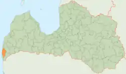
Nīca Municipality (Latvian: Nīcas novads) is a municipality in Courland, Latvia. The administrative center is the village of Nīca. As of 2020, the municipality's population was 3,100.[3]
Nīca Municipality
Nīcas novads | |
|---|---|
 Flag  Coat of arms | |
 | |
| Country |  Latvia Latvia |
| Formed | 2009 |
| Centre | Nīca |
| Government | |
| • Council Chair | Agris Petermanis (For The Development of Nīca Municipality) |
| Area | |
| • Total | 350.83 km2 (135.46 sq mi) |
| • Land | 324.42 km2 (125.26 sq mi) |
| • Water | 26.41 km2 (10.20 sq mi) |
| Population (2021)[2] | |
| • Total | 3,113 |
| • Density | 8.9/km2 (23/sq mi) |
| Website | www |
Geography
_-_Uldis_Osis_-_Panoramio.jpg.webp)
The municipality is located in western Latvia, on the coast of the Baltic Sea. The westernmost point in Latvia is located within its territory. The highest elevation point is Pūsēnu hill (Latvian: Pūsēnu kāpa) at 37 m (121 ft). Parts of the municipality lie below sea level. Its geography is dominated by coastal plains, and its territory is part of the Bartava Plain (Latvian: Bārtavas līdzenums) region.
History
The municipality was formed in 2009 by merging Nīca parish and Otaņķi parish, as part of the 2009 administrative reform.
Subdivision
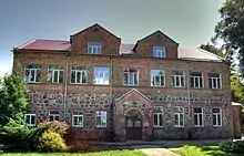
The municipality is subdivided into 2 parishes, namely:
References
- https://data.stat.gov.lv/pxweb/lv/OSP_PUB/START__ENV__DR__DRT/DRT010/; Central Statistical Bureau of Latvia; retrieved: 25 February 2021.
- https://data.stat.gov.lv/pxweb/lv/OSP_PUB/START__POP__IR__IRS/IRD060/; Central Statistical Bureau of Latvia; retrieved: 15 June 2021.
- "ISG020. Population number and its change by statistical region, city, town, 21 development centres and county". Central Statistical Bureau of Latvia. 2020-01-01. Retrieved 2021-02-12.
 |
Wikimedia Commons has media related to Nīca Municipality. |
External links
.svg.png.webp)
Authority control  | |
|---|---|
| National libraries | |
| Other | |