Namozine, Virginia
Namozine is a rural unincorporated community near the eastern tip of Amelia County, just south of the Appomattox River in the U.S. state of Virginia. It is the easternmost village in the county and is situated around the intersections of SR 708 (Namozine Road) with SR 623 (Chesdin Lake Road) and SR 622 (Mill Quarter Road). Just to the southeast, Namozine Creek forms the county line, flowing roughly northeast into the Appomattox at Lake Chesdin.
Namozine | |
|---|---|
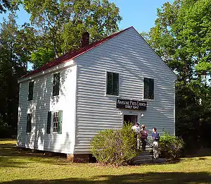 Namozine Presbyterian Church | |
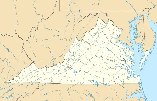  Namozine Location within the Commonwealth of Virginia  Namozine Namozine (the United States) | |
| Coordinates: 37°14′59″N 77°43′30″W | |
| Country | United States |
| State | Virginia |
| County | Amelia |
| Elevation | 280 ft (90 m) |
| Time zone | UTC−5 (Eastern (EST)) |
| • Summer (DST) | UTC−4 (EDT) |
| ZIP codes | 23850, 23833 |
| Area code(s) | 804 |
| GNIS feature ID | 1690039 |
Namozine is bisected by the border between ZIP codes 23850 (Ford, VA) and 23833 (Church Road, VA); both post offices are across the line in Dinwiddie County. The nearest volunteer fire station to Namozine is at Mannboro, 6 miles west. A station named Namozine Volunteer Fire & EMS Co. 4 is located over 15 miles to the east, in Petersburg.[1]
The word "Namozine" (with several variant spellings, originally "Nummisseen" or "Nammisseen"[2]) appears to have been used for the creek before it was used for the hamlet in Amelia County. The name in one form or another dates back at least to the early 1700s,[3] although the community itself may have been called Terrapin Creek until 1841. It was a post village, under the name Namozine, from 1841 until around the turn of the 20th century;[4][5] the post office has since closed. An establishment called Whites Store existed as far back as the time of the Civil War,[6] however; and the spot was still noted as "Whites Store", rather than Namozine, on older 20th-century USGS topographic maps.[7]
The historic Namozine Presbyterian Church is located at the intersection of Route 708 (Namozine Road) and Route 622 (originally Green's Road[6]). The Rev. Richard McIlwaine, eleventh president of Hampden–Sydney College, briefly served as pastor just before the Civil War.[8] During the final days of the fighting, Namozine was the site of the Battle of Namozine Church; the church itself was used as a field hospital by both sides. An on-site historical plaque that summarizes the engagement reads in part:[9]
Namozine Presbyterian Church, built in 1847, fortunately survived the battle. It remains virtually unchanged since its date of construction.
Other historic churches at Namozine include Union Baptist, an African American congregation whose distinctive brick building stands less than half a mile east, also on Namozine Road.
References
- Namozine Volunteer Fire & EMS Co. 4, official website. Retrieved 25 November 2021.
- Walter A. Watson, Land Patents, "Notes on Southside Virginia", Bulletin of the Virginia State Library, Richmond, September 1925, Volumes 15-16, Nos. 2-4, pages 140 and 326. Edited by Henry R. McIlwaine. Retrieved 30 November 2021.
- Wilhelmena Rhodes Kelly and Linda Rhodes Jones, The Long & Winding Trail to Jamestowne, Virginia 1607. Xlibris, 2014. ISBN 9781465365439. Retrieved 30 November 2021.
- Virginius Cornick Hall Jr. "Virginia Post Offices, 1798-1859", The Virginia Magazine of History and Biography, vol. 81, no. 1, January 1973, Virginia Historical Society, page 79. Retrieved 4 December 2021.
- Henry Gannett. A Gazetteer of Virginia, U.S. Geological Survey, Bulletin No. 232, Series F: Geography, 40, page 105. Washington, DC: Government Printing Office, 1904. Retrieved 10 December, 2021.
- John S. Salmon, The Official Virginia Civil War Battlefield Guide, page 473. Mechanicsburg, PA: Stackpole Books, 2001, copyright Virginia Department of Historic Resources. Retrieved 7 December 2021.
- USGS Topographic Map, Winterpock, VA, TopoZone. Retrieved 25 November 2021.
- Richard McIlwaine, Memories of Three Score Years and Ten, Table of Contents and pages 150ff. New York and Washington: The Neale Publishing Company, 1908. Retrieved 25 November 2021.
- "Namozine Church: Pursuit Catches Up", The Historical Marker Database, J.J. Prats, Editor and Publisher, Powell, Ohio. Retrieved 25 November 2021.
External links
Amelia County Historical Society, owner of Namozine Presbyterian Church
Municipalities and communities of Amelia County, Virginia, United States | ||
|---|---|---|
| CDP | 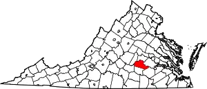 Map of Virginia highlighting Amelia County | |
| Unincorporated communities | ||
| ||