Nugal, Somalia
Nugal (Somali: Nugaal, Arabic: نوغال, Italian: Nogal), traditionally known as Nugaaleed-Bari or Bari-Nugaal, is an administrative region (gobol) in northern Somalia.[3]
Nugal
Nugaal Nogal | |
|---|---|
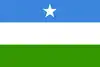 Flag 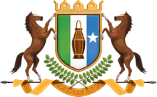 Coat of arms | |
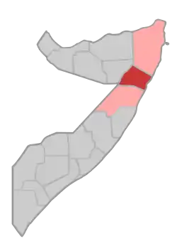 Location in northern Somalia. | |
| Coordinates: 6°6′47″N 47°59′17″E | |
| Country |  Somalia Somalia |
| Regional State |  Puntland Puntland |
| Capital | Garowe |
| Government | |
| • Governor | Omar Abdullahi Mohamed |
| Elevation | 1,650 m (5,410 ft) |
| Population (2015) | |
| • Total | 516,749 [1] |
| Time zone | UTC+3 (EAT) |
| Area code(s) | +252 |
| HDI (2019) | 0.378[2] low · 6th |
Overview
It is bordered by Somaliland to the west, Bari to the north, and Mudug to the south and the Somali Region of Ethiopia. The Somali Sea flanks the province to the east.
Nugal is centered on Garowe, which serves as the capital of the autonomous Puntland macro-region. The segments of the Nugaal valley from Garowe eastwards is traditionally referred to as Bari-Nugaaleed or Bari-Nugaal, whilst segments of the valley which converge into the Iyah plains are called Jednugaal. Nonetheless, Nugaal proper traditionally refers to segments of the valley west of Garowe.[4]
A major geographic feature of the region is the Nugaal Valley, a large shallow drainage basin fed by the Nugal and Dheer seasonal rivers during the April–June rainy season.
Kobo
Towards the east, Nugaal Valley is separated from Nugaaleed-Bari via the region known as Kobo. Kobo was described in colonial sources ruminating about Dervish strength as follows:[5]
During all this time the Mullah and the majority of his karias (tribal encampments) had remained in the Eastern Nogal, in the area known as Kobo, roughly comprised in the triangle Halin, Gerrowei, Kallis. His strategical position here was a very strong one. It was secure from any possible danger of surprise, and he commanded the main routes to the south
— Colonel Kenna
Districts
The Nugal region consists of five districts:[6]
- Burtinle District
- Eyl District
- Garowe District
- Dangorayo District
- Xarxar District
Major towns
References
- "Puntland Issues Report of population Estimation of Its Residents". 27 May 2015.
- "Sub-national HDI - Area Database - Global Data Lab". hdi.globaldatalab.org. Retrieved 2018-09-13.
- "Somalia". The World Factbook. Langley, Virginia: Central Intelligence Agency. Retrieved 6 December 2013.
- Ismaaciil Mire , A. F. Cali ("Idaajaa.") · 1974
- Official History of the Operations in Somaliland, 1901-04 Britain. War Office. General Staff · 1907 , PAGE 230
- "Nugaal Region" (PDF). Retrieved 30 January 2014.
External links
 |
Wikimedia Commons has media related to Nugaal Region. |
| History |
|  | |||||||
|---|---|---|---|---|---|---|---|---|---|
| Geography |
| ||||||||
| Politics | |||||||||
| Economy | |||||||||
| Society |
| ||||||||
| |||||||||


| | ||
| |||