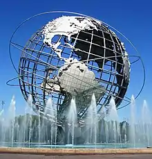
Queens Community Board 1
The Queens Community Board 1 is a local advisory group in New York City, encompassing the neighborhoods of Astoria, Long Island City, Queensbridge, Ditmars, Ravenswood, Steinway, Garden Bay, and Woodside, in the Borough of Queens.[3] It also includes Rikers Island, the citywide correctional complex, which is within the Borough of the Bronx but connected by its only bridge to Astoria.[4] The Board's district is delimited by the East River on both west and north, by the Brooklyn-Queens Expressway on the east, and by Northern Boulevard, the Long Island Rail Road and Bridge Plaza North on the south.
Queens Community District 1
Queens Community Board 1 | |
|---|---|
| Country |  United States United States |
| State |  New York New York |
| City |  New York City New York City |
| Borough |  Queens Queens |
| Neighborhoods | |
| Government | |
| • Type | Community board |
| • Body | Queens Community Board 1 |
| • Chairperson | Marie Torniali |
| • District Manager | Florence Koulouris |
| Area | |
| • Total | 6.2 sq mi (16 km2) |
| Population (2016) | |
| • Total | 172,468 |
| • Density | 28,000/sq mi (11,000/km2) |
| Ethnicity | |
| • African-American | 6.3% |
| • Asian | 15.9% |
| • Hispanic and Latino Americans | 27.2% |
| • White | 47.8% |
| • Others | 2.9% |
| Time zone | UTC−5 (Eastern) |
| • Summer (DST) | UTC−4 (EDT) |
| ZIP codes | 11101, 11102, 11103, 11105, 11106, and 11370 |
| Area codes | 718, 347, and 929, and 917 |
| Police Precincts | 114th (website) |
| Website | www1 |
| [1] [2] | |
As of September 21, 2015, the current chairperson is to be determined by vote, and the District Manager is Florence Koulouris.
Demographics
| Year | Pop. | ±% |
|---|---|---|
| 1980 | 185,198 | — |
| 1990 | 188,549 | +1.8% |
| 2000 | 211,220 | +12.0% |
| 2010 | 191,105 | −9.5% |
| 2012-2016 Est. | 172,468 | −9.8% |
| Source: NYC Planning (1980-2004, 2016) | ||
As of the United States Census, 2000, the Community Board had a population of 211,220, up from 188,549 in 1990 and 185,198 in 1980.
Of them (as of 2000), 88,606 (41.9%) were White non-Hispanic, 21,581 (10.2%) were African-American, 27,399 (13.0%) were Asian or Pacific Islander, 475 (0.2%) were American Indian or Native Alaskan, 3,099 (1.5%) were of some other race, 12,368 (5.9%) were of two or more races, and 57,692 (27.3%) were Hispanic.
23.4% of the population benefited from public assistance as of 2004, which was up from 13.2% in 2000.
Geography
The land area is 3,702.0 acres (14.981 km2), or 5.8 square miles (15 km2).
References
- "NYC Planning | Community Profiles". communityprofiles.planning.nyc.gov. Retrieved August 23, 2019.
- "Queens Community District 1 profile.pdf" (PDF). docs.google.com. NYC Department of Planning. Retrieved August 23, 2019.
- Queens Community Boards Archived 2013-11-10 at the Wayback Machine, New York City. Accessed June 30, 2013.
- A City of Neighborhoods Archived August 26, 2008, at the Wayback Machine, New York City Department of City Planning, retrieved on August 3, 2008.
External links
| | |||||||