Remlap, Alabama
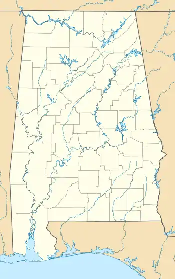
Remlap is a census-designated place in Blount County, Alabama, United States, located along Alabama State Route 75, 11.7 miles (18.8 km) southwest of Oneonta. Remlap has a post office with ZIP code 35133.[3][4]
Remlap, Alabama | |
|---|---|
  Remlap, Alabama  Remlap, Alabama | |
| Coordinates: 33°49′00″N 86°36′03″W | |
| Country | United States |
| State | Alabama |
| County | Blount |
| Area | |
| • Total | 16.48 sq mi (42.68 km2) |
| • Land | 16.27 sq mi (42.14 km2) |
| • Water | 0.21 sq mi (0.54 km2) |
| Elevation | 741 ft (226 m) |
| Population (2020) | |
| • Total | 2,624 |
| • Density | 161.26/sq mi (62.26/km2) |
| Time zone | UTC-6 (Central (CST)) |
| • Summer (DST) | UTC-5 (CDT) |
| ZIP code | 35133 |
| Area code(s) | 205, 659 |
| GNIS feature ID | 125561[2] |
Remlap is named for the area's Palmer family; the community's name is "Palmer" spelled backwards.[5]
References
- "2020 U.S. Gazetteer Files". United States Census Bureau. Retrieved October 29, 2021.
- "Remlap". Geographic Names Information System. United States Geological Survey.
- United States Postal Service (2012). "USPS - Look Up a ZIP Code". Retrieved 2012-02-15.
- "Postmaster Finder - Post Offices by ZIP Code". United States Postal Service. Retrieved June 7, 2013.
- Gallant, Frank K. (February 16, 2012). A Place Called Peculiar: Stories about Unusual American Place-Names. Courier Dover Publications. p. 72. ISBN 9780486483603.
- "Census of Population and Housing". Census.gov. Retrieved June 4, 2016.
Municipalities and communities of Blount County, Alabama, United States | ||
|---|---|---|
| Cities | 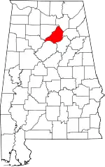 Map of Alabama highlighting Blount County | |
| Towns | ||
| CDPs | ||
| Other unincorporated communities | ||
| Footnotes | ‡This populated place also has portions in an adjacent county or counties | |
| ||
This article is issued from Wikipedia. The text is licensed under Creative Commons - Attribution - Sharealike. Additional terms may apply for the media files.