Rural Municipality of Alexander
The Rural Municipality of Alexander (French: Municipalité rurale d'Alexander)[1] is a rural municipality in the Eastern region of Manitoba, Canada. The town of Powerview-Pine Falls lies adjacent to the municipality, as does the Sagkeeng First Nation Indian reserve.
Alexander | |
|---|---|
| Rural Municipality of Alexander | |
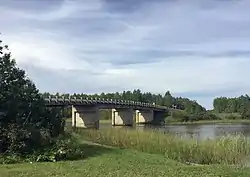 | |
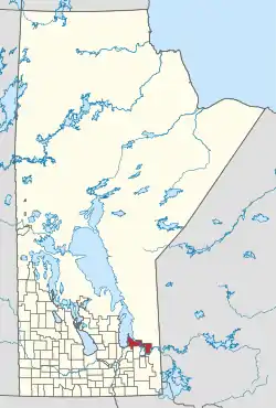 Location of Alexander in Manitoba | |
| Coordinates: 50°25′20″N 96°04′30″W | |
| Country | Canada |
| Province | Manitoba |
| Incorporated as an LGD | January 1, 1945 |
| Incorporated as a rural municipality | January 1, 1997 |
| Area | |
| • Total | 1,569.62 km2 (606.03 sq mi) |
| Population (2016) | |
| • Total | 3,333 |
| Time zone | UTC-6 (CST) |
| • Summer (DST) | UTC-5 (CDT) |
| Administrative office | St. Georges |
| Website | www |
The municipality contains all of Manitoba's Belair Provincial Forest in its westernmost part, plus the northern half of Brightstone Sand Hills Provincial Forest in its central part.
History
It was first incorporated as a Local Government District in 1945 and received its present status as a rural municipality on 1 January 1997. The RM had been under a boil water advisory since April 18, 2006, until a $5-million water treatment plant had been installed in September 2019.[2]
Communities
| Community | Location / Notes | Coordinates |
|---|---|---|
| Albert Beach[3] | on the shore of Traverse Bay, Lake Winnipeg | 50°40′50″N 96°30′49″W |
| Belair[4] | between Lester Beach and PTH 59 | 50°36′20″N 96°33′16″W |
| Bird River[5] | on the Bird River upstream from Lac du Bonnet | 50°24′46″N 95°40′46″W |
| Great Falls[6] | site of the Great Falls Generating Station on the Winnipeg River | 50°27′43″N 96°0′35″W |
| Gull Lake[7] | on Gull Lake | 50°24′22″N 96°31′10″W |
| Hillside Beach[8] | on Hillside Point on Lake Winnipeg | 50°40′6″N 96°33′49″W |
| Lester Beach[9] | north of Grand Beach Provincial Park on Lake Winnipeg | 50°35′9″N 96°34′32″W |
| Pinawa Bay[10] | on the Lee River | 50°19′27″N 95°47′31″W |
| Poplar Bay[11] | near Poplar Bay Provincial Park on Lac du Bonnet | 50°22′27″N 95°46′49″W |
| St. Georges[12] | on the Winnipeg River, upstream from Fort Alexander | 50°32′22″N 96°8′56″W |
| Silver Falls[13] | site of the Silver Falls Airport and Silver Falls Water Aerodrome | 50°30′54″N 96°5′56″W |
| Stead[14] | on PTH 304 | 50°25′44″N 96°26′47″W |
| Sunset Bay[15] | on the Lee River | 50°20′27″N 95°48′18″W |
| Traverse Bay[16] | east of Albert Beach, on Traverse Bay, Lake Winnipeg | 50°40′24″N 96°29′8″W |
| White Mud Falls[17] | on the Winnipeg River downstream from Great Falls | 50°28′0″N 96°3′55″W |
References
- "Census Profile, 2016 Census - Alexander, Rural municipality [Census subdivision], Manitoba and Manitoba [Province]". Census Profile, 2016 Census. Statistics Canada. Retrieved 26 September 2017.
- "New water-treatment plant ends 13-year boil-water advisory". Winnipeg Free Press. September 25, 2019. p. B3.
- "Albert Beach". Geographical Names. Natural Resources Canada. Retrieved 25 September 2017.
- "Bélair". Geographical Names. Natural Resources Canada. Retrieved 25 September 2017.
- "Bird River". Geographical Names. Natural Resources Canada. Retrieved 25 September 2017.
- "Great Falls Generating Station". Geographical Names. Natural Resources Canada. Retrieved 25 September 2017.
- "Gull Lake". Geographical Names. Natural Resources Canada. Retrieved 25 September 2017.
- "Hillside Beach". Geographical Names. Natural Resources Canada. Retrieved 25 September 2017.
- "Lester Beach". Geographical Names. Natural Resources Canada. Retrieved 25 September 2017.
- "Pinawa Bay". Geographical Names. Natural Resources Canada. Retrieved 25 September 2017.
- "Poplar Bay". Geographical Names. Natural Resources Canada. Retrieved 25 September 2017.
- "St-Georges". Geographical Names. Natural Resources Canada. Retrieved 25 September 2017.
- "Silver Falls". Geographical Names. Natural Resources Canada. Retrieved 25 September 2017.
- "Stead". Geographical Names. Natural Resources Canada. Retrieved 25 September 2017.
- "Sunset Bay". Geographical Names. Natural Resources Canada. Retrieved 25 September 2017.
- "Traverse Bay". Geographical Names. Natural Resources Canada. Retrieved 25 September 2017.
- "White Mud Falls". Geographical Names. Natural Resources Canada. Retrieved 25 September 2017.
External links
 |
Wikimedia Commons has media related to Rural Municipality of Alexander. |
- Official website
- Map of Alexander R.M. at Statcan
- Manitoba Historical Society - Rural Municipality of Alexander
Places adjacent to Rural Municipality of Alexander | ||||||||||||||||
|---|---|---|---|---|---|---|---|---|---|---|---|---|---|---|---|---|
| ||||||||||||||||



Division No. 1, Manitoba (Eastern Manitoba) | ||
|---|---|---|
| Towns | 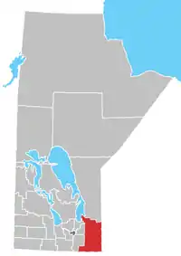 | |
| Local government districts | ||
| Rural municipalities | ||
| First Nations | ||
| Indian reserves |
| |
| Unorganized areas | ||
| Unincorporated communities | ||
This article is issued from Wikipedia. The text is licensed under Creative Commons - Attribution - Sharealike. Additional terms may apply for the media files.