Salamonie Township, Huntington County, Indiana
Salamonie Township is one of twelve townships in Huntington County, Indiana, United States. As of the 2010 census, its population was 2,049 and it contained 973 housing units.[1]
Salamonie Township | |
|---|---|
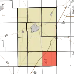 Location in Huntington County | |
| Coordinates: 40°41′27″N 85°23′23″W | |
| Country | United States |
| State | Indiana |
| County | Huntington |
| Government | |
| • Type | Indiana township |
| Area | |
| • Total | 36.49 sq mi (94.5 km2) |
| • Land | 36.3 sq mi (94 km2) |
| • Water | 0.19 sq mi (0.5 km2) 0.52% |
| Elevation | 876 ft (267 m) |
| Population (2010) | |
| • Total | 2,049 |
| • Density | 56.4/sq mi (21.8/km2) |
| GNIS feature ID | 0453822 |
History
Salamonie Township was organized in 1835.[2] It was named from the Salamonie River.[3]
Geography
According to the 2010 census, the township has a total area of 36.49 square miles (94.5 km2), of which 36.3 square miles (94 km2) (or 99.48%) is land and 0.19 square miles (0.49 km2) (or 0.52%) is water.[1] The stream of Weasel Creek runs through this township.
Cities and towns
Unincorporated towns
Adjacent townships
- Rock Creek Township (north)
- Rockcreek Township, Wells County (northeast)
- Liberty Township, Wells County (east)
- Chester Township, Wells County (southeast)
- Jackson Township, Wells County (south)
- Van Buren Township, Grant County (southwest)
- Jefferson Township (west)
- Lancaster Township (northwest)
Cemeteries
The township contains eight cemeteries: Woodlawn, Masonic, Spring Hill, Mitchell, Red Men, Thompson Home, West Union, and Good-Jones.[4]
Major highways


Education
Salamonie township contains one elementary school: Salamonie School.
Salamonie Township residents may obtain a free library card from the Warren Public Library in Warren.[5]
Demographics
| Historical population | |||
|---|---|---|---|
| Census | Pop. | %± | |
| 1890 | 2,346 | — | |
| 1900 | 3,152 | 34.4% | |
| 1910 | 2,665 | −15.5% | |
| 1920 | 2,547 | −4.4% | |
| 1930 | 2,029 | −20.3% | |
| 1940 | 2,291 | 12.9% | |
| 1950 | 2,268 | −1.0% | |
| 1960 | 2,515 | 10.9% | |
| 1970 | 2,513 | −0.1% | |
| 1980 | 2,018 | −19.7% | |
| 1990 | 2,404 | 19.1% | |
| 2000 | 2,529 | 5.2% | |
| 2010 | 2,049 | −19.0% | |
| US Decennial Census[6] | |||
References
- "Population, Housing Units, Area, and Density: 2010 - County -- County Subdivision and Place -- 2010 Census Summary File 1". United States Census. Archived from the original on 2020-02-12. Retrieved 2013-05-10.
- History of Huntington County, Indiana: From the Earliest Time to the Present. Brant & Fuller. 1887. pp. 791.
- Bash, Frank Sumner (1914). History of Huntington County, Indiana: A Narrative Account of Its Historical Progress, Its People, and Its Principal Interests. The Lewis Publishing Company. pp. 115.
- "Millions of Cemetery Records - Find a Grave". Find a Grave.
- "How do I get a library card?". Warren Public Library. 14 February 2017. Retrieved 8 March 2018.
- "Township Census Counts: STATS Indiana".
External links
Municipalities and communities of Huntington County, Indiana, United States | ||
|---|---|---|
| City | 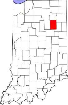 Map of Indiana highlighting Huntington County | |
| Towns | ||
| Townships | ||
| Unincorporated communities | ||
| Footnotes | ‡This populated place also has portions in an adjacent county or counties | |
| ||