Sary-Mogol
Sary-Mogol (Kyrgyz: Сары-Могол) is a village in Osh Region of Kyrgyzstan. It is part of the Alay District.[1] Its population was 3,391 in 2009.[2] It lies in the Alay Valley, north of the river Kyzyl-Suu, 32 km west of Sary-Tash.
Sary-Mogol
Сары-Могол | |
|---|---|
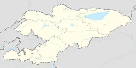  Sary-Mogol | |
| Coordinates: 39°40′30″N 72°53′00″E | |
| Country | Kyrgyzstan |
| Region | Osh |
| District | Alay |
| Elevation | 2,980 m (9,780 ft) |
| Population (2009) | |
| • Total | 3,391 |
| Time zone | UTC+6 |
Climate
| Climate data for Sary-Mogol | |||||||||||||
|---|---|---|---|---|---|---|---|---|---|---|---|---|---|
| Month | Jan | Feb | Mar | Apr | May | Jun | Jul | Aug | Sep | Oct | Nov | Dec | Year |
| Average high °C (°F) | −10.9 (12.4) |
−8.5 (16.7) |
−3.4 (25.9) |
1.5 (34.7) |
6.9 (44.4) |
11.8 (53.2) |
14.2 (57.6) |
14.3 (57.7) |
10.5 (50.9) |
3.6 (38.5) |
−4 (25) |
−10.1 (13.8) |
2.2 (35.9) |
| Daily mean °C (°F) | −16.1 (3.0) |
−13.4 (7.9) |
−8.3 (17.1) |
−3.3 (26.1) |
1.6 (34.9) |
6 (43) |
8.7 (47.7) |
8.4 (47.1) |
4.5 (40.1) |
−2.6 (27.3) |
−10.2 (13.6) |
−15.5 (4.1) |
−3.3 (26.0) |
| Average low °C (°F) | −21.2 (−6.2) |
−18.5 (−1.3) |
−14 (7) |
−9.3 (15.3) |
−4.7 (23.5) |
−0.8 (30.6) |
2.3 (36.1) |
2 (36) |
−1.8 (28.8) |
−8.8 (16.2) |
−16.5 (2.3) |
−21.1 (−6.0) |
−9.4 (15.2) |
| Average precipitation mm (inches) | 19 (0.7) |
27 (1.1) |
39 (1.5) |
39 (1.5) |
56 (2.2) |
95 (3.7) |
107 (4.2) |
78 (3.1) |
37 (1.5) |
25 (1.0) |
23 (0.9) |
24 (0.9) |
569 (22.3) |
| Source: Climate-Data.org [3] | |||||||||||||
References
- "Classification system of territorial units of the Kyrgyz Republic" (in Kyrgyz). National Statistics Committee of the Kyrgyz Republic. May 2021. pp. 46–48.
- "2009 population census of the Kyrgyz Republic: Osh Region" (PDF). Archived from the original (PDF) on 10 August 2011. Retrieved 20 January 2017.
- "Climate: Sary-Moghol". Climate-Data.org. Retrieved 8 December 2021.
This article is issued from Wikipedia. The text is licensed under Creative Commons - Attribution - Sharealike. Additional terms may apply for the media files.