Sierra del Carmen
The Sierra del Carmen, also called the Sierra Maderas del Carmen, is a northern finger of the Sierra Madre Oriental in the state of Coahuila, Mexico. The Sierra begins at the Rio Grande at Big Bend National Park and extends southeast for about 72 kilometres (45 mi), reaching a maximum elevation of 2,720 metres (8,920 ft). Part of the Sierra del Carmen is protected in the Maderas del Carmen Biosphere Reserve as part of a bi-national effort to conserve a large portion of the Chihuahua Desert in Mexico and Texas.[1]
| Sierra del Carmen | |
|---|---|
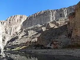 Boquillas Canyon | |
| Highest point | |
| Elevation | 2,720 m (8,920 ft) |
| Prominence | 1,360 m (4,460 ft)  |
| Coordinates | 29.03158°N 102.61473°W |
| Geography | |
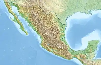  Sierra del Carmen | |
| Country | Mexico, United States |
| State | Coahuila, Texas |
| Parent range | Sierra Madre Oriental |
Geography
Some authorities include the Chisos and other mountains of Big Bend National Park as part of the Sierra del Carmen. From the Mexican side of the Rio Grande, the Sierra runs southeast for about 72 kilometres (45 mi) to 28’ 40° North latitude and a maximum width of about 32 kilometres (20 mi). Elevations increase toward the south culminating in several peaks with heights of more than 2,400 metres (8,000 ft) and a maximum altitude of 2,720 metres (8,920 ft).[2] The western side of the Sierra del Carmen features a high limestone escarpment that formed along a fault line.[3]
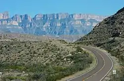
The Sierra del Carmen is an isolated range, a sky island, that rises above the Chihuahua Desert. Because of its elevation, higher than any other mountain ranges in the Bolson de Mapimi, the Sierra del Carmen is home to flora and fauna that are more characteristic of the mountains of the western United States than Mexico. At lower elevations, desert vegetation surrounds the higher elevations. Oak and oak-pine forests are found at elevations of 1,300 to 1,800 metres (4,400 to 5,900 ft). Above 1,800 metres (5,900 ft), the forest is dominated by pine. Conifer species such as Douglas fir, Engelmann spruce, and Durango fir are found at elevations of 2,000 metres (6,600 ft) or more.
The Sierra del Carmen is home to 446 species of birds, 3,600 species of insects, more than 1,500 plant species, and 75 mammals.[4] Among the mammals are American black bear, beaver, and cougar.[5] A small subspecies of white-tail deer, the Carmen Mountains white-tailed deer is found in the Sierra.[6] Extirpated from the region and not at present found in the Sierra are pronghorn and the Mexican wolf.
There are no rivers, paved highways, or towns in the Sierra, which has been called one of the most remote places on earth.[7] Drainage of the mountains is by small, mostly ephemeral streams on the east side of the Sierra to the Rio Grande. Off the western side of the Sierra, small streams leaving the mountains disappear quickly in the desert of the Bolson de Mapimi.[2]
Climate
The climate of the Sierra del Carmen is arid to semi-arid with more humid conditions at higher elevations. Annual precipitation is between 250 and 510 mm (10 and 20 in). Most precipitation is in the summer; snow often falls in the winter. The nearest weather station representative of the Sierra del Carmen is in Big Bend National Park which shares a similar climate.
| Climate data for Big Bend National Park. Elevation: 1,609 m (5,279 ft) (1942-2010) | |||||||||||||
|---|---|---|---|---|---|---|---|---|---|---|---|---|---|
| Month | Jan | Feb | Mar | Apr | May | Jun | Jul | Aug | Sep | Oct | Nov | Dec | Year |
| Record high °C (°F) | 27.8 (82.0) |
28.9 (84.0) |
35.6 (96.1) |
35.6 (96.1) |
37.2 (99.0) |
39.4 (102.9) |
38.9 (102.0) |
37.2 (99.0) |
36.1 (97.0) |
34.4 (93.9) |
31.7 (89.1) |
30.6 (87.1) |
39.4 (102.9) |
| Average high °C (°F) | 14.7 (58.5) |
16.6 (61.9) |
20.3 (68.5) |
24.5 (76.1) |
28.2 (82.8) |
30.3 (86.5) |
29.3 (84.7) |
28.7 (83.7) |
26.3 (79.3) |
23.2 (73.8) |
18.4 (65.1) |
15.2 (59.4) |
23.0 (73.4) |
| Daily mean °C (°F) | 8.7 (47.7) |
10.3 (50.5) |
13.5 (56.3) |
17.7 (63.9) |
21.4 (70.5) |
23.8 (74.8) |
23.4 (74.1) |
22.8 (73.0) |
20.6 (69.1) |
17.1 (62.8) |
12.3 (54.1) |
9.3 (48.7) |
16.7 (62.1) |
| Average low °C (°F) | 2.7 (36.9) |
4.0 (39.2) |
6.7 (44.1) |
10.8 (51.4) |
14.7 (58.5) |
17.3 (63.1) |
17.6 (63.7) |
17.0 (62.6) |
14.7 (58.5) |
11.0 (51.8) |
6.2 (43.2) |
3.3 (37.9) |
10.5 (50.9) |
| Record low °C (°F) | −19.4 (−2.9) |
−14.4 (6.1) |
−11.1 (12.0) |
−3.9 (25.0) |
2.8 (37.0) |
7.2 (45.0) |
11.7 (53.1) |
11.1 (52.0) |
1.1 (34.0) |
−7.2 (19.0) |
−10.6 (12.9) |
−15.6 (3.9) |
−19.4 (−2.9) |
| Average precipitation mm (inches) | 17.0 (0.67) |
15.0 (0.59) |
10.0 (0.39) |
16.0 (0.63) |
40.0 (1.57) |
57.0 (2.24) |
87.0 (3.43) |
80.0 (3.15) |
64.0 (2.52) |
39.0 (1.54) |
14.0 (0.55) |
13.0 (0.51) |
452.0 (17.80) |
| Average precipitation days (≥ 0.1 mm) | 3 | 3 | 2 | 3 | 6 | 7 | 10 | 9 | 7 | 5 | 3 | 3 | 61 |
| Source: Weatherbase: Higueras, Nuevo Leon[8] | |||||||||||||
The climatic classification of this station is Bsk (Koppen) or Bsal (Trewartha).
Conservation efforts
The isolation of the Sierra del Carmen and its relatively undisturbed environment has led to conservation efforts in Mexico and jointly with the United States. Much of the Sierra del Carmen has been declared by the government of Mexico the Maderas del Carmen Flora and Fauna Protected Area, a designation which allows many economic activities and private land holdings to continue to exist within the boundaries. The protected area comprises 2,100 km2 (520,000 acres). The Maderas del Carmen is part of a bi-lateral conservation project called the El Carmen—Big Bend Conservation Corridor Initiative which includes contiguous land designated for conservation on both sides of the border totaling more than 12,000 km2 (4,600 sq mi), an area almost as large as the U.S. state of Connecticut. In 2005, Maderas del Carmen became the first designated Wilderness area in Latin America.[9]
The Maderas del Carmen Protected Area was created in 1994, although conservation efforts were initially slowed because the land was privately owned, either in large ranches or in the collective farms called ejidos in Mexico. In 2000 a Mexican corporation, Cementos de Mexico (CEMEX) began to purchase lands for conservation in the region. On CEMEX land livestock and fences were removed and native vegetation encouraged. By 2006, CEMEX owned 790 square kilometres (195,000 acres) in or near the Maderas del Carmen and managed another 25,300 hectares (62,500 acres).[10]
One of the important characteristics of the Sierra del Carmen is that it functions as a "corridor" enabling wildlife to migrate north and south. In the late 1980s the corridor between the Sierra and the mountains of west Texas enabled the black bear to disperse northward and reestablish itself in Big Bend National Park. The black bear had been extirpated from west Texas in the 1950s.[7]
In other initiatives, in 2000, CEMEX in cooperation with conservation organizations in Mexico and Texas began breeding and releasing to the wild bighorn sheep which had been absent from the Sierra del Carmen for more than 50 years.[7]
On October 24, 2011, Mexico and the United States signed an agreement for "Cooperative Action for Conservation in the Big Bend-Rio Bravo Natural Area of Binational Interest."[4]
References
- "Sierra del Carmen". National Wildlife Federation. Retrieved January 19, 2012.
- Google Earth
- "Del Carmen Limestone" http://mrdata.usgs.gov/geology/state/sgmc-unit.php?unit=TXKdm%3B0, accessed 12 Mar 2013
- "U.S., Mexico Announce Binational Cooperative Conservation Action Plan" News Release. U.S. Department of the Interior, 24 October 2011
- "Sierra Maderas del Carmen" RTP-72, http://www.conabio.gob.mx/conocimiento/regionalizacion/doctos/rtp_072.pdf, accessed 13 Mar 2013; McCormack, John "Conserving Evolutionary Process in the Sky Islands of Northern Mexico" http://www.environment.ucla.edu/media/files/McCormack-Article-FIN2.pdf, accessed 13 Mar 2013
- Carmen Mountain White-Tailed Deer" http://lower48plus.com/species-notes/untitled-12.html, accessed 13 Mar 2013
- "Sky island: El Sierra del Carmen" http://mexicolesstraveled.com/sierradelcarmen.htm, accessed 13 Mar 2013
- "Travel Weather Averages". Weatherbase. Retrieved February 24, 2013.
- Robles Gil, Patricio "El Carmen: The First Wilderness Designation in Latin America" International Journal of Wilderness, Vol. 12, No. 2, August 2006, pp 36-40
- Gil, p.39