Silverdale, Kansas
Silverdale is an unincorporated community in Silverdale Township, Cowley County, Kansas, United States.[1]
Silverdale, Kansas | |
|---|---|
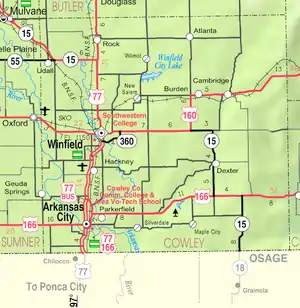 KDOT map of Cowley County (legend) | |
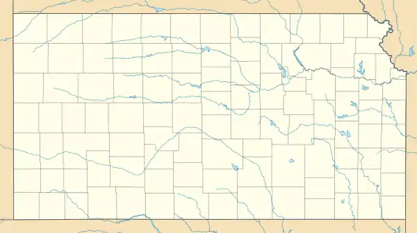  Silverdale  Silverdale | |
| Coordinates: 37°2′31″N 96°54′12″W[1] | |
| Country | United States |
| State | Kansas |
| County | Cowley |
| Township | Silverdale |
| Elevation | 1,089 ft (332 m) |
| Time zone | UTC-6 (CST) |
| • Summer (DST) | UTC-5 (CDT) |
| ZIP code | 67005 |
| Area code | 620 |
| FIPS code | 20-65550[1] |
| GNIS ID | 469029[1] |
History
The post office was established June 5, 1871, and temporarily closed October 19, 1883 before being reopened December 12, 1883. It was permanently closed on July 31, 1964.[2]
In 1912, Silverdale was described as a hamlet with a hotel, general store, bank, and other businesses, and in 1910 the population was 100.[3] Today only a church and limestone quarry remain with perhaps a dozen residences. The quarry specialized in fine cut, quality limestone.
Geography
Silverdale is located in southern Kansas, between U.S. Route 166 and the Oklahoma state line. It is about 8 miles east of Arkansas City and is near the Arkansas River.
Demographics
For statistical purposes, the United States Census Bureau has defined Silverdale as a census-designated place (CDP).
Economy
Silverdale Quality Stone is the only business in the community, which dates back to 1874.[4]
Education
The community is served by Arkansas City USD 470 public school district.
References
- Geographic Names Information System (GNIS) details for Silverdale, Kansas; United States Geological Survey (USGS); October 13, 1978.
- "Kansas Post Offices, 1828-1961, page 2". Kansas Historical Society. Retrieved 6 June 2014.
- "Silverdale - KS-Cyclopedia - 1912". www.ksgenweb.org. Retrieved 13 June 2021.
- "Our History". Silverdale Quality Stone. Archived from the original on June 13, 2021.
Further reading
External links
Municipalities and communities of Cowley County, Kansas, United States | ||
|---|---|---|
| Cities | 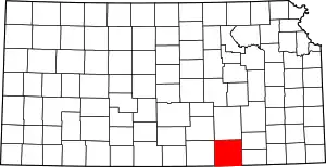 Map of Kansas highlighting Cowley County | |
| Unincorporated communities | ||
| Townships | ||
| Footnotes | †This populated place is designated a Census-Designated Place (CDP) by the United States Census Bureau. ‡This populated place also has portions in an adjacent county or counties. | |
| ||