St. Louis Place
St. Louis Place is a neighborhood of St. Louis, Missouri. It is bounded by Palm Street on the North, Cass Avenue on the South, North Florissant on the East, and North Jefferson on the West.[2] It is home to National Geospatial-Intelligence Agency's West headquarters
St. Louis Place | |
|---|---|
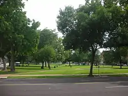 A park in St. Louis Place neighborhood. | |
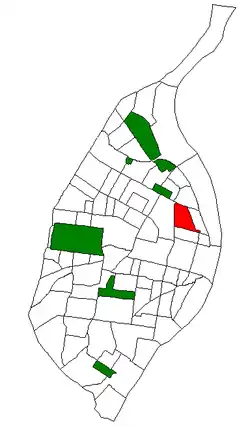 Location (red) of St. Louis Place within St. Louis | |
| Country | United States |
| State | Missouri |
| City | St. Louis |
| Wards | 3, 5 |
| Government | |
| • Aldermen |
|
| Area | |
| • Total | 0.69 sq mi (1.8 km2) |
| Population (2020)[1] | |
| • Total | 2,336 |
| • Density | 3,400/sq mi (1,300/km2) |
| ZIP code(s) | Parts of 63106, 63107 |
| Area code(s) | 314 |
| Website | stlouis-mo.gov |
Demographics
In 2020 St. Louis Place's racial makeup was 89.8% Black, 6.3% White, 0.5% Native American, 0.2% Asian, 2.9% Two or More Races, and 0.4% Some Other Race. 1.4% of the population was of Hispanic or Latino origin.[3]
See also
References
This article is issued from Wikipedia. The text is licensed under Creative Commons - Attribution - Sharealike. Additional terms may apply for the media files.