Sulham
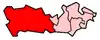
Sulham is a village in West Berkshire, England. The larger village of Tidmarsh is adjacent to Sulham on the west side and of Tilehurst on the east side.

Governance
The two villages of Sulham and Tidmarsh share the combined civil parish council of Tidmarsh with Sulham[1] with most local government functions covered out by the local government level(s) above, which is West Berkshire council.
Geography
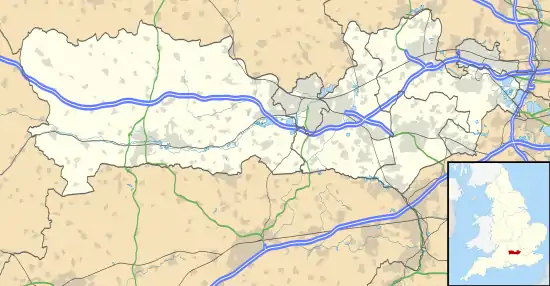
Clockwise from the west, Sulham is surrounded by the civil parishes serving Tidmarsh, Pangbourne, Purley-on-Thames then the partially parished area and partly in Reading settlement of Tilehurst (to the east) and to the south is Theale which has the local roads' junction with the M4 motorway in its south. The middle of the parish is from north to mid-south occupied by Sulham Wood and a similar lengthwise escarpment rises in this area,[1] from 42 metres (the lowest elevation) AOD to 105 metres.
Sulham Woods, a site of Special Scientific Interest (SSSI) form one side of the village, features including many chalk pits and open rolling fields.[2] The place remains architecturally and in land use dominated by the Sulham Hall estate in the north and is otherwise spread out along north-south Sulham Lane which stretches between the villages of Pangbourne and Theale parallel to the River Pang.
Landmarks
Sulham House is Grade II listed country and service wing.[3] It was built about 1710 and has been the home of the Wilder family and their descendants since 1712.[1] They have owned or rented estates in the parish since 1497.[1] A feature of the parish and estate is the elevated Wilder's Folly in the south, a brick tower or dovecote, traditionally said to have been built in 1768 by Reverend Henry Wilder of Sulham House.[1]
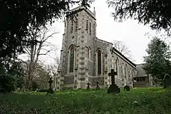
The ecclesiastical parish church, built in 1836, stands next to the house.[1] This is the main settled area of the village forming a clustered nucleus. The church is a listed building, also Grade II.[4] Sulham Farmhouse is Grade II*.[5]
References
- Ford, David Nash (2020). Mid-Berkshire Town and Village Histories. Wokingham: Nash Ford Publishing. pp. 236–239. ISBN 9781905191024.
- Magic Map Application
- Historic England. "Details from listed building database (1288304)". National Heritage List for England. Retrieved 12 December 2014. Sulham House an Flast 1-4
- Historic England. "Details from listed building database (1215063)". National Heritage List for England. Retrieved 12 December 2014. Sulham Parish Church Grade II listing
- Historic England. "Details from listed building database (1288378)". National Heritage List for England. Retrieved 12 December 2014. Sulham Farmhouse Grade II* listing entry
External links
 Media related to Sulham at Wikimedia Commons