Syracuse, Utah
Syracuse is a city in Davis County, Utah, United States. It is situated between the Great Salt Lake and Interstate 15, about 30 miles (48 km) north of Salt Lake City. It is part of the Ogden–Clearfield, Utah Metropolitan Statistical Area. The city has seen rapid growth and development since the 1990s. The city population was 24,331 at the time of the 2010 census,[2] an increase of 158.9% since the 2000 census.
Syracuse, Utah | |
|---|---|
 Syracuse City Municipal Center | |
| Motto(s): Provide quality affordable services while promoting community pride, fostering economic development and managing growth. | |
 Location in Davis County and the state of Utah | |
| Coordinates: 41°5′3″N 112°3′48″W | |
| Country | United States |
| State | Utah |
| County | Davis |
| Settled | 1878 |
| Incorporated | September 3, 1935 |
| City | September 13, 1950 |
| Named for | Syracuse, New York |
| Government | |
| • Type | Mayor-council government |
| • Mayor | Mayor Michael Gailey |
| Area | |
| • Total | 10.18 sq mi (26.37 km2) |
| • Land | 10.18 sq mi (26.35 km2) |
| • Water | 0.01 sq mi (0.02 km2) |
| Elevation | 4,285 ft (1,306 m) |
| Population | |
| • Total | 24,331 |
| • Estimate (2019)[3] | 31,458 |
| • Density | 3,091.39/sq mi (1,193.63/km2) |
| Time zone | UTC-7 (Mountain (MST)) |
| • Summer (DST) | UTC-6 (MDT) |
| ZIP code | 84075 |
| Area code(s) | 385, 801 |
| FIPS code | 49-74810 |
| GNIS feature ID | 1433147[4] |
| Website | www |
While settlers have populated the area since the mid 1800s, Syracuse was incorporated on September 3, 1935. The city was named by early settlers for Syracuse, New York, which was famed for its salt production in the 19th century.[5]
Geography
The city is located in northern Davis County on the eastern side of the Great Salt Lake. It is bordered to the north by West Point, to the northeast and east by Clearfield, and to the southeast by Layton. A causeway on SR 127 connects Syracuse to Antelope Island State Park in the Great Salt Lake.
According to the United States Census Bureau, Syracuse has a total area of 9.6 square miles (24.8 km2), of which 0.01 square miles (0.015 km2), or 0.06%, are water.[2]
Climate
According to the Köppen climate classification, Syracuse experiences either a humid subtropical climate (Cfa) or a humid continental climate (Dfa) depending on which variant of the system is used. Summers are hot and relatively dry, with highs frequently reaching 95 °F (35 °C), with a few days per year reaching 100 °F (38 °C). Rain is provided in the form of infrequent thunderstorms during summer, usually between late July and mid-September during the height of monsoon season. The Pacific storm season usually lasts from about October through May, with precipitation reaching its peak in spring. Snow usually first occurs in late October or early November, with the last occurring sometime in April. Winters are cool and snowy, with highs averaging 36 °F (2 °C) in January. Snowfall averages about 39 inches (99 cm), with approximately 27.41 inches (696 mm) of precipitation annually. Extremes range from −16 °F (−27 °C), set on January 26, 1949, to 106 °F (41 °C), set on July 14, 2002.[6]
| Climate data for Syracuse, Utah (1981–2010 normals) | |||||||||||||
|---|---|---|---|---|---|---|---|---|---|---|---|---|---|
| Month | Jan | Feb | Mar | Apr | May | Jun | Jul | Aug | Sep | Oct | Nov | Dec | Year |
| Record high °F (°C) | 65 (18) |
68 (20) |
78 (26) |
87 (31) |
98 (37) |
102 (39) |
106 (41) |
102 (39) |
97 (36) |
93 (34) |
75 (24) |
66 (19) |
106 (41) |
| Average high °F (°C) | 35.5 (1.9) |
42.5 (5.8) |
52.8 (11.6) |
61.3 (16.3) |
71.1 (21.7) |
82.3 (27.9) |
89.6 (32.0) |
88.5 (31.4) |
78.3 (25.7) |
66.8 (19.3) |
49.7 (9.8) |
37.5 (3.1) |
63.0 (17.2) |
| Average low °F (°C) | 24.8 (−4.0) |
29.3 (−1.5) |
36.3 (2.4) |
43.1 (6.2) |
51.3 (10.7) |
60.1 (15.6) |
66.7 (19.3) |
66.1 (18.9) |
57.7 (14.3) |
45.5 (7.5) |
35.3 (1.8) |
26.5 (−3.1) |
45.2 (7.3) |
| Record low °F (°C) | −16 (−27) |
−11 (−24) |
3 (−16) |
17 (−8) |
21 (−6) |
33 (1) |
37 (3) |
34 (1) |
29 (−2) |
11 (−12) |
−12 (−24) |
−12 (−24) |
−16 (−27) |
| Average precipitation inches (mm) | 3.05 (77) |
2.50 (64) |
2.60 (66) |
2.50 (64) |
2.40 (61) |
1.40 (36) |
0.70 (18) |
0.80 (20) |
1.60 (41) |
1.80 (46) |
2.40 (61) |
2.75 (70) |
24.24 (616) |
| Average snowfall inches (cm) | 12.3 (31) |
7.5 (19) |
3.4 (8.6) |
1.4 (3.6) |
0.1 (0.25) |
0 (0) |
0 (0) |
0 (0) |
0 (0) |
0.5 (1.3) |
5.3 (13) |
9.4 (24) |
39.3 (100) |
| Average precipitation days (≥ 0.01-inch) | 8.3 | 13.8 | 14.3 | 14.0 | 14.5 | 8.1 | 6.9 | 7.0 | 8.0 | 8.4 | 9.7 | 11.8 | 124.8 |
| Average snowy days (≥ 0.1-inch) | 5.2 | 3.3 | 1.9 | 0.9 | 0 | 0 | 0 | 0 | 0 | 0.3 | 2.1 | 4.4 | 18.1 |
| Source: WeatherWX[6] | |||||||||||||
History
Prehistoric Times
The Great Salt Lake was once a large fresh water sea fed by many mountain streams with an outlet to the Pacific ocean. During the Ice Age this great inland sea was the largest lake in the western States. Over thousands of years, it shrunk until it could no longer reach the ocean. Without an outlet, the minerals carried from the mountains gradually accumulated until the waters became saturated with minerals. The Bluff shoreline was formed and extended roughly north and south across Syracuse. After perhaps a thousand years, the waters slowly receded to its present level and the water became very salty.[7]
Native American Presence
Nobody knows exactly when the very first Native Americans came into the Great Basin. As far as we are aware, the first historical description of the Native Americans in the Salt lake Valley was made by Father Escalante, the Franciscan friar who traveled as far north as Utah Lake while en-route to California in 1776. He was told by a band of native Americans that the Salt Lake Valley was occupied by “Puaguampe”(bewitched) who spoke Comanche (identified with Shoshone) ate herbs and lived in houses made of grass and earth.[7]
Interlude of Mountain Men
James Bridger was the first trapper to discover the Great Salt Lake.
In 1822, an announcement in the paper sent dozens of adventure seeking young men to the west. They would later become known as the legendary mountain men. Many were enlisted by the Rocky Mountain Fur Company, or other fur companies. In 1824, on the bear river north of the Uintah mountains, one party trapping there followed the river's sig-zag course into Cache Valley near Logan. There they wintered, catching beaver until the streams froze over. One cold night they were discussing where they thought the bear river might possibly empty. They made a wager on it and Jim Bridger or “Old Gabe” lucked out so he would be burdened with the journey. After following the river through the Wasatch mountains, Jim came to the mouth which flowed into a large body of water. He tasted the water and found it salty. Jim retraced his steps back to the other mountain men in Cache valley and exclaimed “I have found an arm of the Pacific Ocean!” Actually he’d found the Great Salt Lake, but to his credit it was still a good find. That same spring, a group of independent trappers out of Taos, New Mexico came down Spanish Fork Canyon into Utah Valley about April. They too saw the great Salt Lake and they became the first trappers to traverse what is now Davis county.[7]
The Early Days
With the Homestead Act of 1862, land became available for settlement. The first person to work the land was David Cook. He plowed in the spring of 1876 and sowed grain that fall. Joseph Bodily also homesteaded eighty acres and built the first log cabin in 1877.
The fertile land would not produce much in a desert without water, but by 1884 the extended Hooper Canal brought water from the Weber River. With water, homesteads developed near the lakeshore. Soon hay and grain grew in abundance. Serious raising of dairy cows came when a group of farmers built a cheese factory.
Within twenty years of the first settlers, most of the land was under cultivation. It didn't take long before the farmers near the lake realized some of the land was well suited for fruit farming. Artesian wells with cement holding ponds and the Hooper Canal provided irrigation for several hundred acres of apples, pears, peaches, and plums. By the turn of the century, the Syracuse area became the largest producer of fruit in Davis County.[7]
How We Got Our Name
William Galbraith, a salt maker on the lake, printed the name Syracuse on his salt bags. The name came from a salt company he knew of in Syracuse, New York. The name was later used by the Syracuse Bathing Resort, built in 1887 by Daniel C. Adams. He was determined to have the finest resort on the lake, and was the only spot along the shore of the Great Salt Lake with a natural grove of trees. The Union Pacific Railroad constructed the Ogden and Syracuse Railway in 1887. The railway linked the Syracuse Resort to the main line between Ogden and Salt Lake City. The name "Syracuse" was subsequently adopted as the name of our city.[7]
Local Businesses
The first general store was built by Isaac Barton in 1888. In 1891, he sold his store to the Walker Brothers. On November 16, 1891, the Syracuse post office was commissioned. John Coles was the first postmaster and the post office was set up in a room in his home. Thomas and Clara Schofield later bought his farm and Clara Schofield became the postmaster until May 15, 1905, when the post office was discontinued.
On the bench above the Bluff, dry farming appeared about 1887. Alma Stoker, Richard Venable, and Richard Hamblin were some of the first who cleared the land. Deep wells were dug to water livestock and small gardens. In 1894, the Davis/Weber Canal Company brought water to this portion of thirsty land.
In 1882, the L.D.S. Church created the Kaysville-South Hooper Branch. In 1885, meetings were held in a one-room school built below the Bluff and in 1892, meetings were moved to a red, brick school house on the bench. On December 1, 1895, the Syracuse Ward was created. Three years later the L.D.S. Church built an elegant meeting house where the center of town is today. Soon after, a central school, amusement hall, and several businesses sprang up, such as the Syracuse Mercantile, Rampton's Blacksmith Shop, Homers' Barbershop, the Kaysville Canning Factory, and the Bountiful Lumber Yard. These businesses helped unify the community and were also responsible for the population growth shifting from lower Syracuse to the Bench.[7]
Farming
Syracuse was always a farming community with a little salt mixed in. With irrigation, new row crops were introduced: sugar beets in 1893, potatoes in 1894, tomatoes in 1898, and peas in 1902. The Syracuse Canning Factory started up in 1898, canning tomatoes, pickles, and all kinds of fruit.
With irrigation available to most of the land, the community of Syracuse took on a new look. Instead of log cabins, new frame and brick homes dotted the landscape. Graveled roads linked Syracuse to nearby communities. Goods and services improved and almost anything a family needed could be purchased at the Syracuse Mercantile Store.[7]
World War II
World War II brought changes; jobs were plentiful, many farmers worked their farms part-time, taking full-time jobs at Hill Air Force Base or the Naval Supply Depot. One-hundred and twenty Syracuse young men served in the armed forces.
In the spring of 1941 the decision to build an inland Naval Supply Depot in neighboring Clearfield had an immediate impact on our community. Choice farm land was taken out of production and huge warehouses were built. This was very upsetting as their slow way of life had been suddenly interrupted, but this reaction soon passed when many job opportunities opened and depressed people had cash jingling in their pockets for the first time. Many full-time farmers overnight became full=time roofers or ware-house keepers. The impact on the local economy cannot be estimated. Women of Syracuse wore slacks for the first time as they became defense workers on the home front.
After the bombing of Pearl Harbor on December 7, 1941, the Syracuse community changed dramatically. Housing was a problem with so many people moving into the area. Many homes had part of the house converted into an apartment. Even chicken coops were made into apartments. Although the community of Syracuse continued to be predominantly agricultural no longer was it solely dependent upon the fertile soil. During World War II every state in the union had at least one prisoner of war camp. Utah had six . The German prisoner of war camp in Utah was located in the southwest corner of the Naval Supply depot with part of the camp in Syracuse. Prisoners of war were used when and where labor was needed at the Naval Supply Depot, mostly in the lumber yard open area where they could be observed easily. Where labor was short because of lack of manpower, prisoners helped the local farmers. The war ended in August of 1945 after two atom bombs were dropped on Hiroshima and Nagasaki, Japan.
Within a year, most of the Syracuse servicemen were back and Syracuse attempted to become normal once more. Possibly the greatest influence of change which came to Syracuse after the war was when the veterans came back home to Syracuse from all parts of the world. With them came new ways and ideas. Eventually the Naval Supply Depot would gradually diminish its objectives and after several years, the state legislature passed laws which made it a freeport center for goods and services.[7]
Our First Mayor
In 1935, Syracuse formed a Town Board with Thomas J. Thurgood as the first Town Board President. On September 13, 1950, Utah Governor J. Bracken Lee signed a proclamation which entitled Syracuse to become a third-class city with a population of 837 inhabitants. Alma O. Stoker was the Board President at the time and became the first official Mayor. The first city service offered was culinary water. Other new services were also offered such as: garbage pickup services, natural gas, sewer lines, and police and fire protection.[7]
Antelope Island
Syracuse became linked to Antelope Island State Park in 1969, with construction of a causeway. The island located in the middle of the Great Salt Lake has a rich and unique history. A new and improved road to Antelope Island has brought an influx of tourists through the heart of Syracuse. Today, Antelope Island provides a variety of recreational activities for hikers, horseback riders, campers, and boaters.[8]
Demographics
| Historical population | |||
|---|---|---|---|
| Census | Pop. | %± | |
| 1890 | 299 | — | |
| 1900 | 299 | 0.0% | |
| 1910 | 553 | 84.9% | |
| 1920 | 629 | 13.7% | |
| 1930 | 890 | 41.5% | |
| 1940 | 732 | −17.8% | |
| 1950 | 837 | 14.3% | |
| 1960 | 1,061 | 26.8% | |
| 1970 | 1,843 | 73.7% | |
| 1980 | 3,702 | 100.9% | |
| 1990 | 4,658 | 25.8% | |
| 2000 | 9,398 | 101.8% | |
| 2010 | 24,331 | 158.9% | |
| 2019 (est.) | 31,458 | [3] | 29.3% |
| U.S. Decennial Census[9] | |||
As of the census of 2010, there were 24,331 people, and 6,362 households residing in the city. The population density was 2,793.46 people per square mile (1,736.69/km2). There were 6,534 housing units at an average density of 298.6 per square mile (115.3/km2). The racial makeup of the city was 94.6% White, 2.9% Asian, 1.2% African American, 0.7% Native American, 0.6% Pacific Islander, 2.7% from other races. Hispanic or Latino of any race were 6% of the population.
There were 6,362 households, out of which 42.0% (2010) had children under the age of 18 living with them, 83.3% (2000) were married couples living together, 5.4% (2000) had a female householder with no husband present, and 9.1% (2000) were non-families. 7.1% (2000) of all households were made up of individuals, and 2.2% (2000) had someone living alone who was 65 years of age or older. The average household size was 3.81 (2010) and the average family size was 4.02 (2010).
In the city, the population was diverse with 42.0% (2010) under the age of 18, 10.6% (2000) from 18 to 24, 30.7% (2000) from 25 to 44, 14.9% (2000) from 45 to 64, and 4.5% (2010) who were 65 years of age or older. The median age was 26.5 years (2010). For every 100 females, there were 102.56 males (2010). For every 100 females age 18 and over, there were 101.4 males (2000).
The median income for a household in the city was $58,223 (2000), and the median income for a family was $60,000 (2000). Males had a median income of $41,346 (2000) versus $24,792 (2000) for females. The per capita income for the city was $16,989 (2000). About 2.1% (2000) of families and 2.4% (2000) of the population were below the poverty line, including 2.9% (2000) of those under age 18 and 6.5% (2000) of those age 65 or over.
City Parks
For a complete list of the City of Syracuse's parks and available facilities for public rental and recreation, please check out this link.
- Bluff Ridge Park
- Canterbury Park
- Centennial Park
- Equestrian Park
- Founders Park
- Fremont Park
- Jensen Nature Park
- Legacy Park
- Linda Vista Park
- Monterey Park
- Rock Creek Park
- Stoker Park
- Trailside Park
- Tuscany Park
Schools
- Syracuse Elementary
- Bluff Ridge Elementary
- Cook Elementary
- Buffalo Point Elementary
- Syracuse Arts Academy (elementary charter school)
- Syracuse Arts Academy Junior High (junior high counterpart to the elementary Arts Academy)
- Syracuse Jr. High School
- Syracuse High School
- Island View Residential Treatment Center
References
- "2019 U.S. Gazetteer Files". United States Census Bureau. Retrieved August 7, 2020.
- "Geographic Identifiers: 2010 Demographic Profile Data (G001): Syracuse city, Utah". American Factfinder. U.S. Census Bureau. Archived from the original on February 13, 2020. Retrieved January 11, 2016.
- "Population and Housing Unit Estimates". United States Census Bureau. May 24, 2020. Retrieved May 27, 2020.
- "US Board on Geographic Names". United States Geological Survey. 2007-10-25. Retrieved 2008-01-31.
- https://syracuseut.gov/244/Syracuse-History
- "NOWData - WeatherWX".
- Syracuse Historical Commission (1994). The Community of Syracuse: 1820 to 1995 Our Heritage: Centennial Edition. Cedar Fort, Inc. pp. Chapter 12.
- "Antelope Island State Park". Utah State Parks. Retrieved 2021-11-24.
- United States Census Bureau. "Census of Population and Housing". Retrieved June 2, 2014.
External links
 |
Wikimedia Commons has media related to Syracuse, Utah. |
- Official website
- Syracuse history, from the city website
- Local Syracuse, Utah Weather, live weather data provided by a personal weather station located in the Hansen Meadows subdivision.
Places adjacent to Syracuse, Utah | |
|---|---|


Municipalities and communities of Davis County, Utah, United States | ||
|---|---|---|
| Cities | 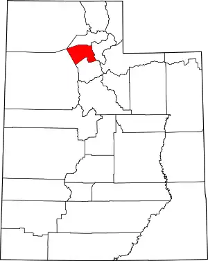 Map of Utah highlighting Davis County | |
| ||
Authority control  | |
|---|---|
| General | |
| National libraries | |