Te Anau
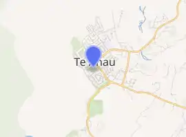
Te Anau is a town in the Southland region of the South Island of New Zealand. In Maori, Te-Anau means the Place of the Swirling Waters.[2] It is on the eastern shore of Lake Te Anau in Fiordland. Te Anau is 155 kilometres north of Invercargill and 171 kilometres to the southwest of Queenstown (via state highway 6). Manapouri lies 21 kilometres to the south. Te Anau lies at the southern end of the Milford Road, (State Highway 94) 117 kilometres to the south of Milford Sound / Piopiotahi.
Te Anau | |
|---|---|
 | |
| |
| Coordinates: 45°25′S 167°43′E | |
| Country | New Zealand |
| Region | Southland |
| Territorial authority | Southland District |
| Area | |
| • Total | 5.57 km2 (2.15 sq mi) |
| Population (June 2021)[1] | |
| • Total | 2,930 |
| • Density | 530/km2 (1,400/sq mi) |
| Postcode(s) | 9600 |
| Area code(s) | 03 |
History
The first Europeans (C.J. Nairn and W.J. Stephen) to visit the lake were led by Maori guides visited in 1852. The lake was formally surveyed first in 1863.[3] The township was surveyed in 1893. This was soon after the Milford Track opened. The town only really started to grow after the opening of the Homer Tunnel and road route to Milford in 1953.[4]
Demographics
The population of Te Anau was 1642 people in 1971 and this climbed to 2384 people in 1976, 2610 people in 1981 before declining to 1785 people in 1996.[5] The 2013 census recorded the town's population as 1,911.[6] This had increased to 2538 people in the 2018 census. The median age was 39.4 years. There were 1038 occupied private dwellings, 573 unoccupied private dwellings and a further 54 occupied non private dwellings in Te Anau.[7]
Economy
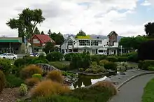
Tourism and farming are the predominant economic activities in the area. Lying as it does at the borders of Fiordland National Park, it is the gateway to a wilderness area famed for tramping and spectacular scenery. Many tourists come to Te Anau to visit the famous nearby fiords Milford Sound / Piopiotahi and Doubtful Sound / Patea. The town is also used as a base for those undertaking the Milford Track and the Kepler Track, the latter being a 4-day loop from Te Anau. Visitors to the area also partake in activities such as kayaking, cycling, jet boat riding, fishing and hunting, farm tours and seaplane/helicopter sightseeing. In 2014, readers of New Zealand's Wilderness magazine voted Te Anau as the best location in New Zealand for tramping (hiking) opportunities.[8] The town has a wide range of accommodation, with over 4,000 beds available in summer.[9]
Geography
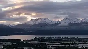
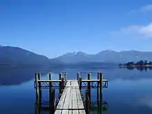
Lake Te Anau is the largest lake in the South Island and within New Zealand second only to Lake Taupō. Rising on the west side of Lake Te Anau, the Kepler and Murchison mountain ranges are evident from most of Te Anau. Many species of bird life are also found locally, notably the endangered Takahē which can be found at the Fiordland Wildlife Park. The Department of Conservation office in Te Anau is active in protecting endangered native birds[10]
Attractions
Te Anau hosts the Kepler Challenge in early December each year.
A local attraction is the Te Ana-au Caves across Lake Te Anau from the town. The caves include an underground glowworm grotto, which can be viewed from a punt during daily guided tours.[11]
Education
Te Anau has two schools; Fiordland College and Te Anau Primary school.
Transport
Te Anau is served by Te Anau Airport which is 15 km south of the town on State Highway 95. It was proposed in 2016 to develop the airport in order to enable commercial flights in from Christchurch in order to boost tourism.[12]
Daylight savings
Te Anau proposed to make daylight savings permanent in the town in 2021. This would enable tourists to the tourist town an extra hour to see the sights.[13][14] Locals propose to call this "Te Anau time".[15][16]
References
- "Population estimate tables - NZ.Stat". Statistics New Zealand. Retrieved 22 October 2021.
- "Community History - Te Anau and Manapouri". www.teanau.net.nz. Retrieved 4 April 2021.
- "Lake Te Anau | lake, New Zealand". Encyclopedia Britannica. Retrieved 4 April 2021.
- "Te Anau | NZHistory, New Zealand history online". nzhistory.govt.nz. Retrieved 4 April 2021.
- Taonga, New Zealand Ministry for Culture and Heritage Te Manatu. "Town populations in Southland, 1891–2013". teara.govt.nz. Retrieved 23 September 2021.
- 2013 Census QuickStats about a place : Te Anau
- "2018 Census place summaries | Stats NZ". www.stats.govt.nz. Retrieved 29 March 2021.
- Southland District Council News
- "Te Anau". New Zealand on the Web Limited. Retrieved 1 May 2013.
- Southland Times
- "Te Anau Glow Worm Caves".
- "'Developing Te Anau, Manapouri, Invercargill key to Southland's tourism future' - symposium". Stuff. 22 July 2016. Retrieved 25 September 2021.
- "Te Anau locals want daylight savings time to stay". RNZ. 20 September 2021. Retrieved 25 September 2021.
- "Daylight saving: Fiordland tourist town Te Anau decides to stay in 'summer time' forever". NZ Herald. Retrieved 25 September 2021.
- "Fiordland tourist town of Te Anau to move into daylight saving for good". Newshub. Retrieved 25 September 2021.
- "New marketing ideas to lift visitor numbers to Fiordland include permanently expanding daylight hours". Stuff. 19 September 2021. Retrieved 25 September 2021.
External links
 |
Wikimedia Commons has media related to Te Anau. |
 |
Wikivoyage has a travel guide for Te Anau. |
- Visit Fiordland- the Regional Tourism Organisation for the Fiordland region
- Historic images of Te Anau from the collection of the Museum of New Zealand Te Papa Tongarewa
Authority control  |
|---|