Teng County
Teng County or Tengxian (simplified Chinese: 藤县; traditional Chinese: 藤縣; pinyin: Téng Xiàn; Zhuang: Dwngz Yen) is a county of eastern Guangxi, China. It is under the administration of the prefecture-level city of Wuzhou. As of 2002, it had a population of 930,000 residing in an area of 3,945.62 km2 (1,523.41 sq mi).
Teng County
藤县 · Dwngz Yen | |
|---|---|
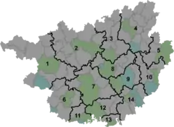  Tengxian Location of the seat in Guangxi | |
| Coordinates: 23°22′32″N 110°54′52″E | |
| Country | People's Republic of China |
| Region | Guangxi |
| Prefecture-level city | Wuzhou |
| County seat | Tengzhou (藤州镇) |
| Area | |
| • Total | 3,945.62 km2 (1,523.41 sq mi) |
| Population (2002) | |
| • Total | 930,000 |
| • Density | 240/km2 (610/sq mi) |
| Time zone | UTC+8 (China Standard) |
| Postal code | 543300 |
| Area code(s) | 0774 |
Administrative divisions
Teng County administers 15 towns and 1 township.[1]
Towns:
|
|
The only township is Pingfu Township (平福乡)
Notable people
Climate
| Climate data for Tengxian (1981−2010) | |||||||||||||
|---|---|---|---|---|---|---|---|---|---|---|---|---|---|
| Month | Jan | Feb | Mar | Apr | May | Jun | Jul | Aug | Sep | Oct | Nov | Dec | Year |
| Record high °C (°F) | 29.7 (85.5) |
34.7 (94.5) |
33.7 (92.7) |
35.5 (95.9) |
36.9 (98.4) |
37.8 (100.0) |
39.4 (102.9) |
38.7 (101.7) |
38.1 (100.6) |
35.8 (96.4) |
33.6 (92.5) |
30.3 (86.5) |
39.4 (102.9) |
| Average high °C (°F) | 17.1 (62.8) |
18.1 (64.6) |
21.1 (70.0) |
26.2 (79.2) |
30.2 (86.4) |
32.3 (90.1) |
33.8 (92.8) |
33.7 (92.7) |
32.1 (89.8) |
29.0 (84.2) |
24.3 (75.7) |
19.7 (67.5) |
26.5 (79.7) |
| Daily mean °C (°F) | 12.1 (53.8) |
13.7 (56.7) |
16.9 (62.4) |
21.9 (71.4) |
25.3 (77.5) |
27.4 (81.3) |
28.4 (83.1) |
28.2 (82.8) |
26.7 (80.1) |
23.3 (73.9) |
18.2 (64.8) |
13.6 (56.5) |
21.3 (70.4) |
| Average low °C (°F) | 8.7 (47.7) |
10.7 (51.3) |
14.0 (57.2) |
18.8 (65.8) |
22.0 (71.6) |
24.3 (75.7) |
24.8 (76.6) |
24.6 (76.3) |
22.9 (73.2) |
19.1 (66.4) |
13.9 (57.0) |
9.5 (49.1) |
17.8 (64.0) |
| Record low °C (°F) | −1.2 (29.8) |
−0.3 (31.5) |
1.2 (34.2) |
6.8 (44.2) |
13.0 (55.4) |
17.5 (63.5) |
19.1 (66.4) |
20.2 (68.4) |
15.1 (59.2) |
6.6 (43.9) |
2.7 (36.9) |
−2.9 (26.8) |
−2.9 (26.8) |
| Average precipitation mm (inches) | 58.2 (2.29) |
74.3 (2.93) |
88.4 (3.48) |
156.8 (6.17) |
241.3 (9.50) |
210.7 (8.30) |
196.2 (7.72) |
166.9 (6.57) |
106.5 (4.19) |
54.9 (2.16) |
44.1 (1.74) |
33.2 (1.31) |
1,431.5 (56.36) |
| Average relative humidity (%) | 77 | 81 | 83 | 83 | 83 | 84 | 81 | 82 | 79 | 75 | 75 | 75 | 80 |
| Source: China Meteorological Data Service Center | |||||||||||||
References
- 2011年统计用区划代码和城乡划分代码:藤县 (in Chinese). National Bureau of Statistics of the People's Republic of China. Retrieved 2012-08-12.

This article is issued from Wikipedia. The text is licensed under Creative Commons - Attribution - Sharealike. Additional terms may apply for the media files.