Terek, Kara-Kulja
Terek is a village in Osh Region of Kyrgyzstan. It is part of the Kara-Kulja District.[1] Its population was 1,300 in 2009.[2]
Terek | |
|---|---|
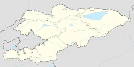  Terek | |
| Coordinates: 40°21′36″N 74°12′00″E | |
| Country | Kyrgyzstan |
| Region | Osh |
| District | Kara-Kulja |
| Elevation | 2,179 m (7,149 ft) |
| Population (2009) | |
| • Total | 1,300 |
| Time zone | UTC+6 |
Geography
It is located to the east of the Alai Mountains and west of the Tian Shan mountain range and lies at an altitude of 2,179 m (7,149 ft).
The town of Kyzyl-Jar is 8 km (5 mi) to the south, and Oy-Tal is 9 km (6 mi) to the east.
References
- "Classification system of territorial units of the Kyrgyz Republic" (in Kyrgyz). National Statistics Committee of the Kyrgyz Republic. May 2021. pp. 57–59.
- "2009 population census of the Kyrgyz Republic: Osh Region" (PDF). Archived from the original (PDF) on 10 August 2011. Retrieved 2011-08-10.
Populated places in Kara-Kulja District, Osh Region | ||
|---|---|---|
Seat: Kara-Kulja | ||
| Villages |  | |
This article is issued from Wikipedia. The text is licensed under Creative Commons - Attribution - Sharealike. Additional terms may apply for the media files.