Texas State Highway 288
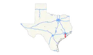
State Highway 288 (SH 288) is a north–south highway in the southeastern portion of the U.S. state of Texas, between I-45 in downtown Houston and Freeport, where it terminates on FM 1495. The route was originally designated by 1939, replacing the southern portion of SH 19.
  | ||||
|---|---|---|---|---|
 | ||||
| Route information | ||||
| Length | 61.03 mi[1] (98.22 km) | |||
| Existed | 1939–present | |||
| Major junctions | ||||
| South end |   SH 36 / FM 1495 in Freeport SH 36 / FM 1495 in Freeport | |||
  Beltway 8 / Sam Houston Tollway Beltway 8 / Sam Houston Tollway I-610 in Houston I-610 in Houston  I-69 / US 59 in Houston I-69 / US 59 in Houston | ||||
| North end |  I-45 in Houston I-45 in Houston | |||
| Location | ||||
| Counties | Brazoria, Harris | |||
| Highway system | ||||
| ||||


Route description
In Harris County, SH 288 is the South Freeway, a divided freeway known for having one of the widest medians of the local road system. It begins as freeway status from its northern terminus at Interstate 69/U.S. Route 59 just south of downtown southward through south Houston. It reaches an intersection with I-610 and continues south through newer subdivisions. It reaches an intersection with State Highway 6, after which it loses its freeway status. From the Harris-Brazoria County Line to Freeport, it is referred to as the Nolan Ryan Expressway, in recognition of Baseball Hall of Fame pitcher Nolan Ryan who grew up in Alvin, Texas, which is not directly on this road. Brazoria County will be calling the tolled portion of the highway, located within the county, the Brazoria County Expressway.[2] North of Angleton, the route returns to freeway status passing west of Angleton, near the Texas Gulf Coast Regional Airport, and around the southwestern side of Lake Jackson. It then turns southward toward Freeport. In Freeport, it is known as Brazosport Boulevard. It reaches its southern terminus at State Highway 36 on the southwest side of town.
Toll Lanes
To help alleviate congestion on SH 288, TxDOT (originally HCTRA) and BCTRA constructed toll lanes (also known as the Brazoria County Expressway) in the median of the existing freeway. The toll lanes currently begin at County Road 58 in Manvel and terminate at I-69/US 59 in Houston for a total length of 15 miles (24.1 km). A nine-mile southern extension to the proposed Grand Parkway (SH 99) is planned. The entire length of the SH 288 toll lanes will have two lanes in each direction. TxDOT has jurisdiction on the portion located in Harris County, beginning at I-69/US 59 and terminate at the Harris/Brazoria County line at Clear Creek located just north of FM 2234 for a total of 10.3 miles (16.6 km).[3] BCTRA will construct the portion located in Brazoria County in two phases. Phase 1 will be from the Harris/Brazoria County line, southward to just south of County Road 58 (Croix Road) for a total of 5 miles (8.0 km)[4] while phase 2, to be built by TxDot's Toll Operations Division, will continue southward to the Grand Parkway (TX 99) for the remaining 10.7 miles (17.2 km). Design work for the entire project began in the summer of 2015.[5] Construction on the toll lanes in Harris County began in November 2016[6] and construction of phase 1 in Brazoria County begun in June 2017.[4][2] The SH 288 toll lanes opened on November 16, 2020 and were free to use until November 30. All tolls on the facility will be collected electronically and an EZ Tag, TxTag or TollTag is required for passage.[7][8]
History
State Highway 288 was designated on September 26, 1939 as the renumbering of the portion of State Highway 19 south of downtown Houston. On August 1, 1962, SH 288 was extended to FM 1495. On June 25, 1981, SH 288 was rerouted from I-45 to MacGregor Way in Houston on the new freeway. The original routing ran southward along Almeda Road in Houston. The route traveled southward through Fresno, past the Houston Southwest Airport, before reaching Bonney. This entire portion of the route from US 90A southward was transferred to Farm to Market Road 521 and Spur 300 on December 14, 1981, as SH 288 was rerouted onto the new freeway from US 90A to Spur 300.[9] The route then traveled east through downtown Angleton, continuing southeast before reaching Freeport. This original section is now part of County Road 543 and Farm to Market Road 523. SH 288 was redirected southward from Angleton when the city of Clute became more populated, then continued southward to a new intersection with State Highway 36 west of Freeport. On November 18, 1983, SH 288 was rerouted on the new freeway from MacGregor Way to US 90A. The entire remaining section from FM 521 north of Angleton to Clute was transferred first to Texas State Highway 227 on September 26, 1986, and later Business Highway 288 on October 25, 1990 when the bypass around the western side of Lake Jackson opened. The section from Clute south to Freeport was transferred to SH 227, and the section concurrent with SH 36 became SH 36 on February 23, 1989. On August 15, 1989, SH 288 was extended south over part of SH 227 and concurrent with SH 36, restoring the lost section from Clute to Freeport.
Major intersections
All exits are unnumbered.
| County | Location | mi | km | Destinations | Notes |
|---|---|---|---|---|---|
| Brazoria | Freeport | 0.00 | 0.00 | FM 1495 – Port Freeport, Brazos Harbor | Southern termini of SH 288/SH36; south end of SH 36 overlap |
| SH 36 north – Jones Creek, West Columbia | Interchange; north end of SH 36 overlap | ||||
 FM 523 north – Surfside FM 523 north – Surfside | |||||
| | Frontage Road | South end of freeway; northbound exit and southbound entrance | |||
| Lake Jackson |   SH 288 Bus. north / SH 332 east – Clute Business District, Angleton, Surfside SH 288 Bus. north / SH 332 east – Clute Business District, Angleton, Surfside | South end of SH 332 overlap | |||
| Lake Jackson–Clute line | Main Street / Contractor Road / Copper Road | ||||
| Dixie Drive | |||||
| Lake Jackson | Plantation Drive | ||||
 Oak Drive / Veterans Memorial Parkway / This Way / West Way Oak Drive / Veterans Memorial Parkway / This Way / West Way | Access to Brazosport Memorial Hospital | ||||
| SH 332 west (Oyster Creek Drive) / Abner Jackson Parkway / This Way | North end of SH 332 overlap | ||||
 FM 2004 – Richwood FM 2004 – Richwood | |||||
| Angleton |  County Road 220 – Brazoria Airport County Road 220 – Brazoria Airport | ||||
| County Road 290 | Southbound exit and northbound entrance | ||||
 SH 35 – Angleton, West Columbia, Bay City SH 35 – Angleton, West Columbia, Bay City | |||||
| County Road 44 | Southbound access via FM 523 exit and Frontage Road | ||||
| FM 523 – Alvin, Angleton | North end of freeway | ||||
| |   SH 288 Bus. to FM 521 – Rosharon, Angleton SH 288 Bus. to FM 521 – Rosharon, Angleton | Interchange | |||
| |  FM 1462 – Rosharon, Alvin FM 1462 – Rosharon, Alvin | Interchange | |||
| |  SH 99 Toll (Grand Parkway) SH 99 Toll (Grand Parkway) | Proposed interchange | |||
| | County Road 56 (Meridiana Parkway) | Interchange | |||
| Manvel |  SH 6 – Alvin, Sugar Land SH 6 – Alvin, Sugar Land | Interchange | |||
| Del Bello Road | Interchange; southbound exit and entrance only | ||||
| County Road 58 | South end of freeway | ||||
| SH 288 Toll (Brazoria County Expressway) | South end of SH 288 Toll Lanes | ||||
| | County Road 101 (Bailey Road / Pomona Parkway) | ||||
| Pearland | County Road 59 (Magnolia Parkway) | Formerly Southfork Drive | |||
 FM 518 – Pearland FM 518 – Pearland | |||||
| Hughes Ranch Road / Discovery Bay Drive | Access from Toll Lanes only; southbound exit and northbound entrance | ||||
| Brazoria–Harris county line |  FM 2234 (Shadow Creek Parkway) / McHard Road FM 2234 (Shadow Creek Parkway) / McHard Road | ||||
| Harris | Sam Houston Tollway | Northbound left exit and southbound left entrance | |||
| Pearland–Houston line | Beltway 8 (Frontage Road) | ||||
| Sam Houston Tollway | Access from Toll Lanes only; southbound right exit and northbound right entrance | ||||
| Houston | Almeda-Genoa Road | ||||
| Orem Drive | |||||
| Airport Boulevard | |||||
| Reed Road | |||||
| Bellfort Avenue / Holmes Road | Northbound exit and southbound entrance | ||||
| I-610 (South Loop Freeway) | IH 610 west exit 38A, east exits 38A-C; ramps to IH 610 westbound closed until January 2022 | ||||
| Holly Hall Street | Southbound exit and northbound entrance | ||||
  US 90 Alt. (Old Spanish Trail) / Holcombe Boulevard US 90 Alt. (Old Spanish Trail) / Holcombe Boulevard | |||||
| Holcombe Boulevard west – Texas Medical Center | Access from Toll Lanes only; northbound right exit and southbound right entrance | ||||
| South MacGregor Way / North MacGregor Way – Texas Medical Center, Houston Zoo | |||||
| Binz Street / Calumet Street | Southbound access via Southmore Boulevard exit | ||||
| SH 288 Toll south | Southbound exit only | ||||
| Southmore Boulevard / Blodgett Street / Wheeler Avenue | |||||
| I-69 / US 59 south – Victoria | I-69 north exits 128 & 129A | ||||
| I-69 / US 59 north / Elgin Avenue / Tuam Avenue – Cleveland | Northbound exit and southbound entrance; I-69 exit 128B | ||||
| SH 288 Toll | North end of SH 288 Toll Lanes; northbound entrance only | ||||
| Chenevert Street | Northbound exit and southbound entrance | ||||
| 61.03 | 98.22 | I-45 – Dallas, Galveston, IAH, Hobby Airport | Northern terminus; I-45 exits 46A-B | ||
1.000 mi = 1.609 km; 1.000 km = 0.621 mi
| |||||
Business route
Business State Highway 288 | |
|---|---|
| Location | Lake Jackson-Bonney |
| Length | 20.3 mi (32.7 km) |
| Existed | 1990–present |

SH 288 has one business route.
Business State Highway 288-B (Bus. SH 288) is a bypass of SH 288 through Angleton, Richwood and Clute. The route was created in 1987 as SH 227, which was redesignated as Business SH 288-B on October 25, 1990.

Major junctions
The entire route is in Brazoria County.
| Location | mi[10] | km | Destinations | Notes | |
|---|---|---|---|---|---|
| Lake Jackson | 0.00 | 0.00 | SH 288 south | Southern terminus | |
| Clute |  SH 322 east – Surfside SH 322 east – Surfside | Interchange | |||
| SH 322 west / SH 288 north – Lake Jackson | Interchange; southbound exit and northbound entrance | ||||
| 1.5 | 2.4 | Whitten Street | Partial interchange via northbound exit ramp and connector road southbound; no northbound entrance | ||
| 1.6 | 2.6 | Wilson Road / Leder Street / Mockingbird Street | Partial interchange via northbound entrance ramp and connector road southbound; no northbound exit | ||
| Richwood | 5.5 | 8.9 | FM 2004 – Santa Fe | ||
| Angleton | 11.2– 11.4 | 18.0– 18.3 |  Loop 274 north Loop 274 north | Interchange; southern terminus of Loop 274; northbound left exit and southbound left entrance; serves as a bypass of downtown Angleton | |
| 11.8 | 19.0 | SH 35 – Bay City, Alvin | |||
| 12.6 | 20.3 | Loop 274 south | Northern terminus of Loop 274 | ||
| 14.4 | 23.2 | FM 523 / SH 35 Byp. | |||
| | 18.6 | 29.9 | SH 288 – Houston, Lake Jackson | Interchange | |
| | 20.3 | 32.7 | FM 521 – Houston, Brazoria | Northern terminus | |
| 1.000 mi = 1.609 km; 1.000 km = 0.621 mi | |||||
External links
References
- Transportation Planning and Programming Division (n.d.). "State Highway No. 288". Highway Designation Files. Texas Department of Transportation. Retrieved 2008-04-07.
- "Brazoria County Expressway".
- "Drive288 Project Details". Retrieved May 24, 2017.
- "Brazoria County awards bid for Expressway construction". City of Pearland. May 3, 2017. Retrieved May 24, 2017.
- "Design work to begin on Texas 288 toll lanes". Brazoria County. January 29, 2014.
- "Construction begins on Highway 288 expansion". Harris County. November 15, 2016. Retrieved May 18, 2017.
- Fresh drive: This is what the new 288 toll road looks like for one of the first drivers Click2Houston.com (KPRC-TV) Published on November 12, 2020, and updated on November 16, 2020 (Retrieved 22 November 2020)
- "Drive288 FAQ". Retrieved May 28, 2017.
- Transportation Planning and Programming Division (n.d.). "Farm to Market Road No. 521". Highway Designation Files. Texas Department of Transportation.
- "Overview of Bus. SH 288". Google Maps. Google, Inc. Retrieved June 16, 2021.