Timeline of the 2021 Atlantic hurricane season
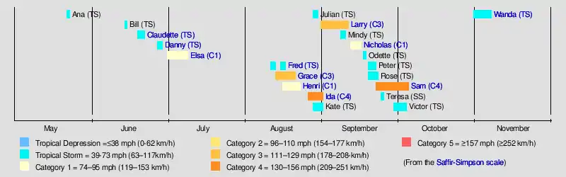
The 2021 Atlantic hurricane season was the third most active Atlantic hurricane season on record with 21 named storms, and the sixth consecutive year in which there was above-average tropical cyclone activity[nb 1][2] The season officially began on June 1, 2021, and ended on November 30, 2021. These dates, adopted by convention, historically describe the period in each year when most Northern Atlantic tropical cyclones form.[3] However, tropical cyclone formation is possible at any time of the year, as was the case this season, when Tropical Storm Ana formed on May 22. The season's final system, Tropical Storm Wanda, dissipated on November 7. Of the season's 21 named storms, seven became hurricanes, and four further intensified into major hurricanes.[nb 2][5] The season's most devastating storm was Hurricane Ida. It made landfall in Louisiana with maximum sustained winds of 150 mph (240 km/h), destroying coastal communities in its path; parts of the New Orleans metropolitan area were left without power for several weeks.[6] The storm caused an estimated $64.5 billion (2021 USD) in damages and resulted in at least 95 deaths.[7] Over half of those deaths occurred in New York and New Jersey, as the hurricane's remnants brought rains that triggered widespread flooding throughout that region.[6] Rains from its predecessor tropical wave also caused damaging floods and landslides across Venezuela, resulting in at least 20 deaths.[8]
| Timeline of the 2021 Atlantic hurricane season | |||||
|---|---|---|---|---|---|
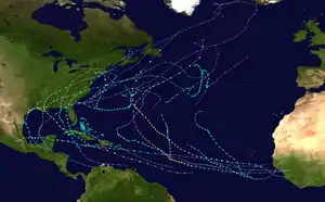 Season summary map | |||||
| Season boundaries | |||||
| First system formed | May 22, 2021 | ||||
| Last system dissipated | November 7, 2021 | ||||
| Strongest system | |||||
| Name | Sam | ||||
| Maximum winds | 155 mph (250 km/h) (1-minute sustained) | ||||
| Lowest pressure | 929 mbar (hPa; 27.43 inHg) | ||||
| Longest lasting system | |||||
| Name | Sam | ||||
| Duration | 13 days | ||||
This timeline documents tropical cyclone formations, strengthening, weakening, landfalls, extratropical transitions, and dissipations during the season. It includes information that was not released throughout the season, meaning that data from post-storm reviews by the National Hurricane Center, such as a storm that was not initially warned upon, has been included.
By convention, meteorologists use one time zone when issuing forecasts and making observations: Coordinated Universal Time (UTC), and also use the 24-hour clock (where 00:00 = midnight UTC).[9] The National Hurricane Center uses both UTC and the time zone where the center of the tropical cyclone is currently located. The time zones utilized (east to west) are: Greenwich, Cape Verde, Atlantic, Eastern, and Central.[10] In this timeline, all information is listed by UTC first, with the respective regional time zone included in parentheses. Additionally, figures for maximum sustained winds and position estimates are rounded to the nearest 5 units (knots, miles, or kilometers), following National Hurricane Center practice. Direct wind observations are rounded to the nearest whole number. Atmospheric pressures are listed to the nearest millibar and nearest hundredth of an inch of mercury.
Timeline
May
May 22
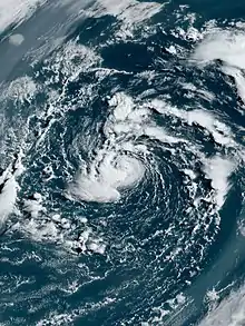
- 06:00 UTC (2:00 a.m. AST) at 34.2°N 62.1°W – Subtropical Storm Ana forms from an extratropical cyclone about 200 mi (325 km) northeast of Bermuda.[11]
May 23
- 00:00 UTC (8:00 p.m. AST, May 23) at 34.7°N 61.8°W – Subtropical Storm Ana transitions to a tropical storm about 235 mi (280 km) northeast of Bermuda.[11]
- 06:00 UTC (2:00 a.m. AST) at 35.4°N 61.1°W – Tropical Storm Ana reaches peak intensity with winds of 45 mph (75 km/h) and a minimum central pressure of 1004 mbar (29.65 inHg), about 295 mi (470 km) northeast of Bermuda.[11]
- 18:00 UTC (2:00 p.m. AST) at 36.8°N 58.7°W – Tropical Storm Ana transitions to a post-tropical cyclone about 455 mi (730 km) northeast of Bermuda, and subsequently opens up into a trough.[11]
June
June 1
- The 2021 Atlantic hurricane season officially begins.[3]
June 14
- 06:00 UTC (2:00 a.m. EDT) at 33.2°N 75.9°W – Tropical Depression Two forms from a stationary front about 125 mi (205 km) east-southeast of Cape Fear, North Carolina.[12]
- 18:00 UTC (2:00 p.m. EDT) at 36.7°N 69.8°W – Tropical Depression Two strengthens into Tropical Storm Bill about 155 mi (250 km) east of Cape Hatteras, North Carolina.[12]
June 15
- 12:00 UTC (8:00 a.m. AST) at 39.4°N 64.0°W – Tropical Storm Bill reaches its peak intensity with maximum sustained winds of 65 mph (100 km/h) and a minimum central pressure of 992 mbar (29.29 inHg), about 345 mi (555 km) east-southeast of Chatham, Massachusetts.[12]
June 16
- 00:00 UTC (8:00 p.m. AST, June 15) at 42.5°N 57.9°W – Tropical Storm Bill transitions into a post-tropical cyclone about 370 mi (595 km) east-southeast of Halifax, Nova Scotia, and later degenerates into a trough of low pressure.[12]
June 19
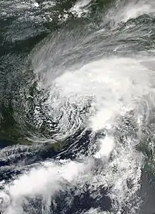
- 09:00 UTC (04:00 a.m. CDT) at 28.9°N 90.9°W – Tropical Storm Claudette forms about 45 mi (70 km) southwest of New Orleans, Louisiana.[nb 3][14]
- 21:00 UTC (4:00 pm CDT) at 32.2°N 87.9°W – Tropical Storm Claudette weakens into a tropical depression about 95 mi (155 km) south of Montgomery, Alabama. [15]
June 21
- 09:00 UTC (05:00 am EDT) at 35.6°N 77.6°W – Tropical Depression Claudette restrengthens into a tropical storm about 65 mi (105 km) east-southeast of Raleigh, North Carolina.[16]
- 21:00 UTC (5:00 pm EDT) at 37.5°N 72.1°W – Tropical Storm Claudette reaches peak intensity with winds of 45 mph (70 km/h) and a minimum central pressure of 1,004 millibars (29.6 inHg) about 280 mi (450 km) south-southwest of Nantucket, Massachusetts.[17]
June 22
- 03:00 UTC (11:00 p.m. AST, June 21) at 39.0°N 69.0°W – Tropical Storm Claudette dissipates about 160 mi (255 km) south-southeast of Nantucket.[18]
June 27
- 18:00 UTC (2:00 p.m. EDT) at 29.8°N 72.8°W – Tropical Depression Four forms from a non-tropical low about 460 mi (740 km) east-southeast of Charleston, South Carolina.[19]
June 28
- 06:00 UTC (2:00 a.m. EDT) at 30.7°N 76.1°W – Tropical Depression Four strengthens into Tropical Storm Danny about 260 mi (415 km) southeast of Charleston.[19]
- 18:00 UTC (2:00 p.m. EDT) at 32.0°N 79.5°W – Tropical Storm Danny reaches peak intensity with winds of 45 mph (75 km/h) and a minimum central pressure of 1,009 mbar (29.8 inHg), about 50 mi (85 km) south-southeast of Charleston.[19]
- 23:20 UTC (7:20 p.m. EDT) at 32.3°N 80.5°W – Tropical Storm Danny makes landfall on Pritchards Island, north of Hilton Head, South Carolina, with sustained winds of 40 mph (65 km/h).[19]
June 29
- 00:00 UTC (8:00 p.m. EDT, June 28) at 32.4°N 80.7°W – Tropical Storm Danny weakens into a tropical depression inland over eastern South Carolina, and later dissipates over eastern Georgia.[19]
July
July 1
- 03:00 UTC (11:00 p.m. AST, June 30) at 9.6°N 46.3°W – Tropical Depression Five forms about 1,020 mi (1,640 km) east-southeast of the Windward Islands.[nb 4][21]
- 09:00 UTC (5:00 a.m. AST) at 9.4°N 48.8°W – Tropical Depression Five strengthens into Tropical Storm Elsa about 865 mi (1,390 km) east-southeast of the Windward Islands.[22]
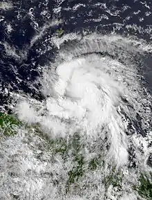
July 2
- 11:45 UTC (7:45 a.m. AST) at 12.9°N 59.8°W – Tropical Storm Elsa strengthens into a Category 1 hurricane about 20 mi (30 km) west-southwest of Barbados.[23]
- 21:00 UTC (5:00 p.m. AST) at 14.2°N 63.7°W – Hurricane Elsa reaches peak intensity with winds of 85 mph (135 km/h) and a minimum central pressure of 991 mbar (29.3 inHg) about 180 mi (290 km) west-northwest of Saint Vincent.[24]
July 3
- 15:00 UTC (11:00 a.m. AST) at 17.0°N 71.6°W – Hurricane Elsa weakens into a tropical storm about 40 mi (65 km) south of Isla Beata, off the near the southern coast of Hispaniola.[25]
July 5
- 18:00 UTC (2:00 p.m. AST) at 22.2°N 81.6°W – Tropical Storm Elsa makes landfall on the south coast of Cuba about 85 mi (135 km) southeast of Havana.[26]
July 7
- 00:00 UTC (8:00 p.m. EDT, July 6) at 26.6°N 83.1°W – Tropical Storm Elsa re-strengthens into a Category 1 hurricane about 100 mi (160 km) south-southwest of Tampa, Florida.[27]
- 06:00 UTC (2:00 a.m. EDT) at 27.9°N 83.5°W – Hurricane Elsa weakens into a tropical storm about 60 mi (95 km) west of Tampa.[28]
- 15:00 UTC (11:00 a.m. EDT) at 29.9°N 83.6°W – Tropical Storm Elsa makes landfall in Taylor County, Florida about 65 mi (105 km) north-northwest of Cedar Key, Florida.[29]
July 9
- 21:00 UTC (5:00 p.m. EDT) at 43.0°N 69.5°W – Tropical Storm Elsa transitions into a post-tropical cyclone about 90 mi (145 km) east-northeast of Boston, Massachusetts.[30]
August
August 11
- 00:00 UTC (8:00 p.m. AST, August 10) at 17.3°N 66.1°W – Tropical Storm Fred forms as the result of interaction between a series of tropical waves about 60 mi (95 km) south-southeast of Ponce, Puerto Rico.[nb 5][32]
- 17:00 UTC (1:00 p.m. AST) at 18.4°N 70.1°W – Tropical Storm Fred makes landfall near San Cristóbal, Dominican Republic with maximum sustained winds of 45 mph (75 km/h).[32]
August 12
- 00:00 UTC (8:00 p.m. EDT, August 11) at 19.2°N 71.7°W – Tropical Storm Fred weakens to a tropical depression over central Hispaniola, 50 mi (85 km) southeast of Cap-Haïtien, Haiti.[32]
August 13
- 00:00 UTC (8:00 p.m. EDT, August 12) at 21.2°N 75.5°W – Tropical Depression Fred re-strengthens to a tropical storm about 60 mi (95 km) east-northeast of Holguín, Cuba.[32]
- 12:00 UTC (8:00 a.m. EDT) at 22.0°N 77.7°W – Tropical Storm Fred again weakens into a tropical depression as it simultaneously makes landfall on Cayo Romano, on the northern coast of Cuba.[32]
- 21:00 UTC (5:00 p.m. AST) at 15.4°N 51.8°W – Tropical Depression Seven forms about 675 mi (1,085 km) east of the Leeward Islands.[nb 6][34]
August 14
- 00:00 UTC (8:00 a.m. EDT, August 13) at 22.5°N 80.2°W – Tropical Depression Fred degenerates into an open trough over central Cuba.[32]
- 09:00 UTC (5:00 a.m. AST) at 15.8°N 55.6°W – Tropical Depression Seven strengthens into Tropical Storm Grace about 420 mi (675 km) east of the Leeward Islands.[35]
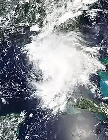
August 15
- 12:00 UTC (8:00 a.m. EDT) at 25.7°N 84.7°W – Remnants of Fred re-develop into a tropical storm about 185 mi (295 km) west of Naples, Florida.[32]
- 21:00 UTC (5:00 p.m. AST) at 17.0°N 67.3°W – Tropical Storm Grace weakens into a tropical depression about 200 mi (320 km) east-southeast of Santo Domingo, Dominican Republic.[36]
August 16
- 03:00 UTC (11:00 p.m. AST, August 15) at 33.2°N 62.7°W – Tropical Depression Eight forms about 135 mi (215 km) east-northeast of Bermuda.[37]
- 18:00 UTC (1:00 p.m. CDT) at 29.5°N 85.4°W – Tropical Storm Fred reaches peak intensity with maximum sustained winds of 65 mph (100 km/h) and a minimum central pressure of 991 mbar (29.26 inHg), about 30 mi (45 km) southwest of Apalachicola, Florida.[32]
- 19:00 UTC (2:00 p.m. CDT) at 29.7°N 85.4°W – Tropical Storm Fred makes landfall at peak intensity on the St. Joseph Peninsula, just northwest of Cape San Blas, in the Florida Panhandle.[32]
- 21:00 UTC (5:00 p.m. AST) at 31.0°N 62.9°W – Tropical Depression Eight strengthens into Tropical Storm Henri about 145 mi (235 km) southeast of Bermuda.[38]
August 17
- 06:00 UTC (2:00 a.m. EDT) at 18.1°N 74.5°W – Tropical Depression Grace re-strengthens into a tropical storm about 230 mi (370 km) east of Montego Bay, Jamaica.[39]
- 12:00 UTC (8:00 a.m. EDT) at 32.8°N 85.2°W – Tropical Storm Fred weakens to a tropical depression over eastern Alabama.[32]
August 18
- 00:00 UTC (8:00 p.m. EDT, August 17) at 35.9°N 83.6°W – Tropical Storm Fred becomes a post-tropical low over eastern Tennessee.[32]
- 15:00 UTC (11:00 a.m. EDT) at 19.4°N 82.2°W – Tropical Storm Grace strengthens into a Category 1 hurricane about 65 mi (105 km) west of Grand Cayman.[40]
August 19
- 00:00 UTC (8:00 p.m. EDT, August 18) at 41.2°N 78.2°W – Post-Tropical Cyclone Fred becomes an extratropical low over central Pennsylvania, and subsequently dissipates.[32]
- 09:45 UTC (4:45 a.m. CDT) at 20.1°N 87.5°W – Hurricane Grace makes landfall on the eastern portion of the Yucatan Peninsula about 10 mi (15 km) south of Tulum, Mexico.[41]
- 15:00 UTC (10:00 a.m. CDT) at 20.2°N 88.8°W – Hurricane Grace weakens into a tropical storm about 110 mi (175 km) east of Campeche.[42]
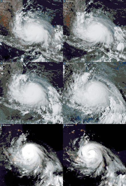
August 20
- 12:00 UTC (7:00 a.m. CDT) at 20.6°N 93.7°W – Tropical Storm Grace re-strengthens into a Category 1 hurricane about 185 mi (300 km) east-northeast of Veracruz, Mexico.[43]
August 21
- 00:00 UTC (7:00 p.m. CDT, August 20) at 20.7°N 95.7°W – Hurricane Grace intensifies to Category 2 strength about 105 mi (170 km) north-northeast of Veracruz.[44]
- 03:00 UTC (10:00 p.m. CDT, August 20) at 20.7°N 96.3°W – Hurricane Grace intensifies to Category 3 strength about 75 mi (120 km) east-southeast of Tuxpan, Mexico.[45]
- 06:00 UTC (1:00 a.m. CDT) at 20.6°N 97.2°W – Hurricane Grace reaches peak intensity with winds of 125 mph (200 km/h) and a minimum central pressure of 962 mbar (28.4 inHg) as it makes landfall just south of Tuxpan about 115 mi (185 km) north-northwest of Veracruz.[46]
- 09:00 UTC (4:00 a.m. CDT) at 20.5°N 97.8°W – Hurricane Grace weakens to Category 2 strength about 45 mi (70 km) southwest of Tuxpan.[47]
- 12:00 UTC (7:00 a.m. CDT) at 19.9°N 98.3°W – Hurricane Grace weakens to Category 1 strength about 60 mi (95 km) east-northeast of Mexico City.[48]
- 15:00 UTC (10:00 a.m. CDT) at 19.7°N 98.9°W – Hurricane Grace weakens into a tropical storm about 25 mi (40 km) north-northeast of Ciudad de Mexico.[49]
- 15:00 UTC (11:00 a.m. EDT) at 34.4°N 72.5°W – Tropical Storm Henri strengthens into a Category 1 hurricane about 180 mi (290 km) east-southeast of Cape Hatteras, North Carolina.[50]
- 21:00 UTC (4:00 p.m. CDT) at 19.6°N 100.1°W – Tropical Storm Grace degenerates into a disturbance about 65 mi (105 km) west-northwest of Ciudad de Mexico.[nb 7][53]
August 22
- 09:00 UTC (5:00 a.m. EDT) at 40.1°N 71.2°W – Hurricane Henri reaches peak intensity with winds of 75 mph (120 km/h) and a minimum central pressure of 986 mbar (29.1 inHg) about 120 mi (195 km) south of Providence, Rhode Island.[54]
- 12:00 UTC (8:00 a.m. EDT) at 40.7°N 71.3°W – Hurricane Henri weakens into a tropical storm about 75 mi (120 km) south of Providence.[55]
- 16:15 UTC (12:15 p.m. EDT) at 41.3°N 71.8°W – Tropical Storm Henri makes landfall near Westerly, Rhode Island with maximum sustained winds of 60 mph (95 km/h) about 15 mi (25 km) north-northeast of Montauk Point, New York.[56]
August 23
- 00:00 UTC (8:00 p.m EDT, August 22) at 41.7°N 72.8°W – Tropical Storm Henri weakens into a tropical depression about 10 mi (15 km) southwest of Hartford, Connecticut.[57]
- 21:00 UTC (5:00 p.m. EDT) at 41.6°N 73.6°W – Tropical Depression Henri transitions into a post-tropical cyclone about 50 mi (80 km) west-southwest of Hartford.[58]
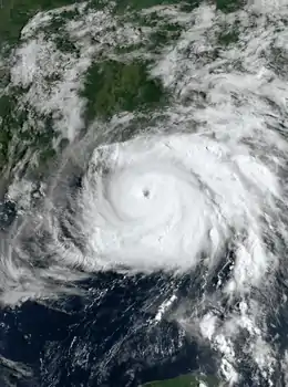
August 26
- 15:00 UTC (11:00 a.m. EDT) at 16.9°N 79.2°W – Tropical Depression Nine forms about 115 mi (185 km) south-southwest of Negril, Jamaica.[59]
- 21:20 UTC (5:20 p.m. EDT) at 18.0°N 79.8°W – Tropical Depression Nine strengthens into Tropical Storm Ida about 100 mi (160 km) west-southwest of Negril.[60]
August 27
- 17:15 UTC (1:15 p.m. EDT) at 21.4°N 82.4°W – Tropical Storm Ida strengthens into a Category 1 hurricane about 30 mi (50 km) east-southeast of Isla de la Juventud.[61]
- 18:00 UTC (2:00 p.m. EDT) at 21.6°N 82.7°W – Hurricane Ida makes landfall on Isla de la Juventud about 145 mi (235 km) east of the western tip of Cuba.[62]
- 23:25 UTC (7:25 p.m. EDT) at 22.3°N 83.3°W – Hurricane Ida makes landfall on Pinar del Rio, Cuba with maximum sustained winds of 80 mph (130 km/h) about 85 mi (135 km) southwest of Havana.[63]
August 28
- 06:00 UTC (2:00 a.m. AST) at 13.7°N 49.8°W – Tropical Depression Ten forms from a tropical wave about 805 mi (1,295 km) east of the Leeward Islands.[64]
- 18:00 UTC (1:00 p.m. CDT) at 25.5°N 86.6°W – Hurricane Ida intensifies to Category 2 strength about 380 mi (610 km) southeast of Houma, Louisiana.[65]
- 18:00 UTC (2:00 p.m. AST) at 32.2°N 51.0°W – Tropical Depression Eleven forms from a tropical wave about 805 mi (1,295 km) east of Bermuda.[66]
August 29
- 06:00 UTC (1:00 a.m. CDT) at 27.6°N 88.7°W – Hurricane Ida intensifies to Category 3 strength about 185 mi (300 km) southeast of Houma.[67]
- 06:00 UTC (2:00 a.m. AST) at 33.5°N 49.3°W – Tropical Depression Eleven strengthens into Tropical Storm Julian about 890 mi (1,435 km) east of Bermuda.[66]
- 07:00 UTC (2:00 a.m. CDT) at 27.7°N 88.8°W – Hurricane Ida intensifies to Category 4 strength about 175 mi (280 km) southeast of Houma.[68]
- 16:55 UTC (11:55 a.m. CDT) at 29.1°N 90.2°W – Hurricane Ida reaches peak intensity with winds of 150 mph (240 km/h) and a minimum central pressure of 929 mb (27.4 inHg) about 45 mi (70 km) southeast of Houma and simultaneously makes landfall near Port Fourchon, Louisiana.[69][70]
- 19:00 UTC (2:00 p.m. CDT) at 29.3°N 90.4°W – Hurricane Ida makes landfall southwest of Galliano, Louisiana about 25 mi (40 km) west-northwest of Grand Isle, Louisiana.[71]
- 23:00 UTC (6:00 p.m. CDT) at 29.7°N 90.5°W – Hurricane Ida weakens to Category 3 strength about 5 mi (10 km) east of Houma.[72]
August 30
- 02:00 UTC (9:00 p.m. CDT, August 29) at 30.1°N 90.6°W – Hurricane Ida weakens to Category 2 strength about 40 mi (65 km) east-southeast of Baton Rouge, Louisiana.[73]
- 05:00 UTC (12:00 a.m. CDT) at 30.5°N 90.7°W – Hurricane Ida weakens to Category 1 strength about 30 mi (50 km) east of Baton Rouge.[74]
- 06:00 UTC (6:00 a.m. GMT) at 38.9°N 40.0°W – Tropical Storm Julian reaches peak intensity with maximum sustained winds of 60 mph (95 km/h) and a minimum central pressure of 993 mbar (29.3 inHg).[66]
- 06:00 UTC (2:00 a.m. AST) at 20.5°N 50.6°W – Tropical Depression Ten strengthens into Tropical Storm Kate.[64]
- 09:00 UTC (4:00 a.m. CDT) at 31.0°N 90.8°W – Hurricane Ida weakens into a tropical storm about 50 mi (80 km) north-northeast of Baton Rouge.[75]
- 12:00 UTC (12:00 a.m. GMT) at 40.6°N 37.9°W – Tropical Storm Julian completes extratropical transition and merges with a frontal system about 865 mi (1,390 km) east-southeast of Cape Race, Newfoundland.[66]
- 12:00 UTC (8:00 a.m. AST) at 21.3°N 50.8°W – Tropical Storm Kate reaches peak intensity with maximum sustained winds of 45 mph (75 km/h) and a minimum central pressure of 1,004 mbar (29.6 inHg), about 770 mi (1,240 km) east-northeast of the Leeward Islands.[64]
- 21:00 UTC (4:00 p.m. CDT) at 32.6°N 90.3°W – Tropical Storm Ida weakens into a tropical depression about 20 mi (30 km) north-northeast of Jackson, Mississippi.[76]
August 31
- 12:00 UTC 8:00 a.m. AST) at 23.2°N 50.9°W – Tropical Storm Kate weakens into a tropical depression.[64]
- 21:00 UTC (8:00 p.m. CVT) at 11.2°N 21.1°W – Tropical Depression Twelve forms about 335 mi (540 km) southeast of Cabo Verde.[77]
September
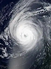
September 1
- 09:00 UTC (8:00 a.m. CVT) at 12.3°N 24.8°W – Tropical Depression Twelve strengthens into Tropical Storm Larry about 175 mi (280 km) south of Cabo Verde.[78]
- 12:00 UTC (8:00 a.m. AST) at 26.6°N 52.3°W – Tropical Depression Kate degenerates into an elongated trough about 960 mi (1,545 km) northeast of the northern Leeward Islands, and subsequently dissipates.[64]
- 15:00 UTC (11:00 a.m. EDT) at 38.3°N 80.2°W – Tropical Depression Ida transitions into a post-tropical cyclone about 70 mi (115 km) north of Roanoke, Virginia.[79]
September 2
- 09:00 UTC (5:00 a.m. AST) at 13.0°N 32.3°W – Tropical Storm Larry strengthens into a Category 1 hurricane about 545 mi (875 km) west-southwest of Cabo Verde.[80]
September 3
- 21:00 UTC (5:00 p.m. AST) at 15.0°N 42.0°W – Hurricane Larry intensifies to Category 2 strength about 1,320 mi (2,125 km) east of the Leeward Islands.[81]
September 4
- 03:00 UTC (11:00 p.m. AST, September 3) at 16.3°N 44.6°W – Hurricane Larry intensifies to Category 3 strength about 1,140 mi (1,835 km) east of the Leeward Islands.[82]
September 5
- 15:00 UTC (11:00 a.m. AST) at 19.5°N 49.7°W Hurricane Larry reaches peak intensity with winds of 125 mph (200 km/h) and a minimum central pressure of 955 mbar (28.2 inHg) about 1,285 mi (2,070 km) southeast of Bermuda.[83]
September 8
- 15:00 UTC (11:00 p.m. AST) at 27.7°N 58.3°W – Hurricane Larry weakens to Category 2 strength about 500 mi (805 km) southeast of Bermuda.[84]
- 21:00 UTC (4:00 p.m. CDT) at 29.0°N 86.3°W – Tropical Storm Mindy forms about 90 mi (145 km) west-southwest of Apalachicola, Florida.[85]
- 22:00 UTC (5:00 p.m. CDT) at 29.2°N 86.1°W – Tropical Storm Mindy reaches peak intensity with winds of 45 mph (70 km/h) and a minimum central pressure of 1004 mbar (29.6 inHg) about 75 mi (120 km) west-southwest of Appalachicola.[86]
September 9
- 01:15 UTC (8:15 p.m. CDT, September 8) at 29.7°N 85.2°W – Tropical Storm Mindy makes landfall in St. Vincent Island, Florida with maximum sustained winds of 45 mph (70 km/h) about 10 mi (15 km) west-southwest of Apalachicola.[87]
- 09:00 UTC (5:00 a.m. EDT) at 30.8°N 83.0°W – Tropical Storm Mindy weakens into a tropical depression about 80 mi (125 km) south-southeast of Valdosta, Georgia.[88]
- 15:00 UTC (9:00 a.m. EDT) at 32.0°N 61.6°W – Hurricane Larry weakens to Category 1 strength about 190 mi (305 km) east of Bermuda.[89]
September 10
- 03:00 UTC (11:00 p.m. EDT, September 9) at 32.5°N 75.0°W – Tropical Depression Mindy transitions into a post-tropical cyclone about 285 mi (460 km) east of Charleston, South Carolina.[90]
September 11
- 03:45 UTC (11:45 p.m. AST, September 10) at 47.4°N 54.5°W – Hurricane Larry makes landfall near South East Bight, Newfoundland and Labrador with maximum sustained winds of 80 mph (130 km/h) about 85 mi (135 km) west-southwest of St. John's.[91]
- 15:00 UTC (11:00 a.m. AST) at 54.0°N 48.2°W – Hurricane Larry transitions into a post-tropical cyclone about 1,150 mi (1,850 km) west-southwest of Reykjavik, Iceland.[92]
September 12
- 15:00 UTC (10:00 a.m. CDT) at 20.5°N 94.8°W – Tropical Storm Nicholas forms about 130 mi (210 km) northeast of Veracruz, Mexico.[93]
September 14
- 03:00 UTC (10:00 p.m. CDT, September 13) at 28.4°N 95.8°W – Tropical Storm Nicholas strengthens into a Category 1 hurricane about 20 mi (30 km) southeast of Matagorda, Texas, and simultaneously reaches peak intensity with maximum sustained winds of 75 mph (120 km/h) and a minimum central pressure of 988 mb (29.18 inHg).[94]
- 05:30 UTC (12:30 a.m. CDT) at 28.4°N 95.8°W – Hurricane Nicholas makes landfall west-southwest of Sargent Beach, Texas, with maximum sustained winds of 75 mph (120 km/h) about 20 mi (30 km) northeast of Matagorda.[95]
- 09:00 UTC (4:00 a.m. CDT) at 29.3°N 95.6°W – Hurricane Nicholas weakens into a tropical storm about 30 mi (50 km) south-southwest of Houston, Texas.[96]
September 15
- 00:00 UTC (7:00 p.m. CDT, September 14) at 29.9°N 94.4°W – Tropical Storm Nicholas weakens into a tropical depression about 25 mi (40 km) west of Port Arthur, Texas.[97]
September 16
- 09:00 UTC (4:00 a.m. CDT) at 29.4°N 91.6°W – Tropical Depression Nicholas transitions into a post-tropical cyclone about 60 mi (95 km) south-southeast of Lafayette, Louisiana.[98]
September 17
- 18:00 UTC (2:00 p.m. EDT) at 35.9°N 72.7°W – Tropical Storm Odette forms from a surface trough associated with a mid- to upper-level low about 175 mi (280 km) east of the North Carolina–Virginia border.[99]
September 18
- 06:00 UTC (2:00 a.m. AST) at 37.6°N 70.1°W – Tropical Storm Odette reaches peak intensity with maximum winds of 45 mph (75 km/h) and a minimum central pressure of 1,005 mbar (29.68 inHg).[99]
- 12:00 UTC (8:00 a.m. AST) at 38.3°N 68.3°W – Tropical Storm Odette transitions into an extratropical cyclone about 290 mi (465 km) east-southeast of Atlantic City, New Jersey, and subsequently opens up into a trough.[nb 8][99]
September 19
- 03:00 UTC (11:00 p.m. AST, September 18) at 16.4°N 53.1°W – Tropical Depression Sixteen forms about 670 mi (1,080 km) east of the northern Leeward Islands.[100]
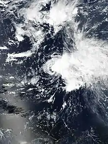
- 09:00 UTC (5:00 a.m. AST) at 18.1°N 53.5°W – Tropical Depression Sixteen strengthens into Tropical Storm Peter about 630 mi (1,015 km) east of the Leeward Islands.[101]
- 09:00 UTC (8:00 a.m. CVT) at 11.8°N 28.2°W – Tropical Depression Seventeen forms about 330 mi (530 km) southwest of southernmost Cabo Verde Islands.[102]
- 21:00 UTC (8:00 p.m. CVT) at 14.3°N 29.9°W – Tropical Depression Seventeen strengthens into Tropical Storm Rose about 370 mi (595 km) west of the southernmost Cabo Verde Islands.[103]
September 20
- 03:00 UTC (11:00 p.m. AST, September 19) at 18.6°N 58.5°W – Tropical Storm Peter attains its peak intensity with maximum sustained winds of 50 mph (85 km/h) and a minimum central pressure of 1004 mb (29.65 inHg), about 305 mi (485 km) east of the northern Leeward Islands.[104]
September 21
- 03:00 UTC (11:00 p.m. AST, September 20) at 18.7°N 35.0°W – Tropical Storm Rose attains its peak intensity with maximum sustained winds of 50 mph (85 km/h) and a minimum central pressure of 1003 mb (29.62 inHg), about 750 mi (1,210 km) west-northwest of the southernmost Cabo Verde Islands.[105]
- 21:00 UTC (5:00 p.m. AST) at 20.5°N 65.0°W – Tropical Storm Peter weakens to a tropical depression, about 160 mi (260 km) east-northeast of San Juan, Puerto Rico.[106]
September 22
- 03:00 UTC (11:00 p.m. AST, September 21) at 22.9°N 37.9°W – Tropical Storm Rose weakens into a tropical depression about 1,020 mi (1,645 km) west-northwest of the Cabo Verde Islands.[107]
- 21:00 UTC (5:00 p.m. AST) at 10.1°N 33.0°W – Tropical Depression Eighteen forms about 2,030 mi (3,265 km) east-southeast of the Northern Leeward Islands.[108]
September 23
- 03:00 UTC (11:00 p.m. AST, September 22) at 22.1°N 67.0°W – Tropical Depression Peter degenerates into a remnant low about 260 mi (420 km) north-northwest of San Juan.[109]
- 09:00 UTC (9:00 a.m. GMT) at 25.2°N 41.6°W – Tropical Depression Rose transitions into a post-tropical cyclone about 1,300 mi (2,090 km) west-northwest of the Cabo Verde Islands.[110]
- 15:00 UTC (11:00 a.m. AST) at 10.9°N 38.1°W – Tropical Depression Eighteen strengthens into Tropical Storm Sam about 1,745 mi (2,805 km) east-southeast of the Northern Leeward Islands.[111]
September 24
- 09:00 UTC (5:00 a.m. AST) at 11.5°N 42.2°W – Tropical Storm Sam strengthens into a Category 1 hurricane about 1,470 mi (2,365 km) east-southeast of the Northern Leeward Islands.[112]
- 21:00 UTC (5:00 p.m. AST) at 34.5°N 64.5°W – Subtropical Storm Teresa forms about 155 mi (245 km) north of Bermuda, and simultaneously reaches peak intensity with maximum sustained winds of 45 mph (75 km/h) and a minimum central pressure of 1008 mb (29.77 inHg).[113]
September 25
- 03:00 UTC (11:00 p.m. AST, September 24) at 12.4°N 45.9°W – Hurricane Sam intensifies to Category 2 strength about 1,215 mi (1,950 km) east-southeast of the Northern Leeward Islands.[114]
- 15:00 UTC (11:00 a.m. AST) at 12.9°N 47.6°W – Hurricane Sam intensifies to Category 3 strength about 1,095 mi (1,760 km) east-southeast of the Northern Leeward Islands.[115]
- 15:00 UTC (11:00 a.m. AST) at 34.3°N 65.0°W – Subtropical Storm Teresa weakens into a subtropical depression about 140 mi (225 km) north of Bermuda.[116]
- 21:00 UTC (5:00 p.m. AST) at 13.3°N 48.5°W – Hurricane Sam intensifies to Category 4 strength about 1,025 mi (1,655 km) east-southeast of the Northern Leeward Islands.[117]
- 21:00 UTC (5:00 p.m. AST) at 34.4°N 64.3°W – Subtropical Depression Teresa degenerates into a remnant low about 150 mi (240 km) north of Bermuda.[118]
September 26
- 21:00 UTC (5:00 p.m. AST) at 14.2°N 50.5°W – Hurricane Sam reaches peak intensity with winds of 155 mph (250 km/h) and a minimum central pressure of 929 mbar (27.43 inHg).[119] about 880 mi (1,415 km) east-southeast of the Northern Leeward Islands.[120]
September 27
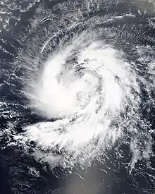
- 15:00 UTC (11:00 a.m. AST) at 15.7°N 52.1°W – Hurricane Sam weakens to Category 3 strength about 745 mi (1,200 km) east-southeast of the Northern Leeward Islands.[121]
September 28
- 09:00 UTC (5:00 a.m. AST) at 17.2°N 53.9°W – Hurricane Sam re-intensifies to Category 4 strength about 610 mi (980 km) east of the Northern Leeward Islands.[122]
September 29
- 12:00 UTC (11:00 a.m. CVT) at 7.8°N 24.1°W – Tropical Depression Twenty forms from a tropical wave about 535 mi (860 km) south of the Cabo Verde Islands.[123]
- 18:00 UTC (5:00 p.m. CVT) at 8.1°N 25.1°W – Tropical Depression Twenty strengthens into Tropical Storm Victor south of the Cabo Verde Islands.[123]
October
October 1
- 09:00 UTC (5:00 a.m. AST) at 26.6°N 61.7°W – Hurricane Sam reaches its secondary peak intensity, with winds of 150 mph (240 km/h) and a minimum central pressure of 934 mbar (27.6 inHg), about 435 mi (700 km) south-southeast of Bermuda.[124]
- 12:00 UTC (8:00 a.m. AST) at 11.4°N 33.0°W – Tropical Storm Victor reaches peak intensity with maximum sustained winds of 65 mph (100 km/h) and a minimum central pressure of 997 mbar (29.4 inHg), about 690 mi (1,110 km) west-southwest of the Cabo Verde Islands.[123]
October 2
- 18:00 UTC (2:00 p.m. AST) at 13.5°N 37.7°W – Tropical Storm Victor weakens to a tropical depression about 950 mi (1,530 km) west of the Cabo Verde Islands.[123]
- 21:00 UTC (5:00 p.m. AST) at 35.4°N 58.2°W – Hurricane Sam weakens to Category 3 strength about 435 mi (700 km) east-northeast of Bermuda.[125]
October 3
- 09:00 UTC (5:00 a.m. AST) at 37.3°N 55.9°W – Hurricane Sam weakens to Category 2 strength about 665 mi (1,070 km) south-southwest of Cape Race, Newfoundland.[126]
October 4
- 12:00 UTC (8:00 a.m. AST) at 17.8°N 43.1°W – Tropical Depression Victor degenerates into a trough more than 1,380 mi (2,220 km) west of the Cabo Verde Islands, and later dissipates.[123]
- 21:00 UTC (9:00 p.m. GMT) at 45.1°N 42.5°W – Hurricane Sam weakens to Category 1 strength about 520 mi (840 km) east of Cape Race, Newfoundland.[127]
October 5
- 09:00 UTC (9:00 a.m. GMT) at 51.0°N 39.4°W – Hurricane Sam transitions to a post-tropical cyclone about 690 mi (1110 km) east-northeast of Cape Race, Newfoundland.[128]
October 31
- 03:00 UTC (11:00 p.m. AST, October 30) at 36.2°N 45.4°W – Subtropical Storm Wanda forms from a nor'easter about 1020 mi (1640 km) west of the Azores.[129][130]
November
November 1
- 21:00 UTC (9:00 p.m. GMT) at 34.2°N 42.2°W – Subtropical Storm Wanda transitions to a tropical storm about 885 mi (1425 km) west-southwest of the Azores.[131]
November 7
- 15:00 UTC (3:00 p.m. GMT) at 40.2°N 33.5°W – Tropical Storm Wanda transitions to a post-tropical cyclone about 380 mi (610 km) west-northwest of the Azores.[132]
November 30
- The 2021 Atlantic hurricane season officially ends.[3]
See also
 Tropical cyclones portal
Notes
- An average Atlantic hurricane season, as defined by the National Oceanic and Atmospheric Administration, has 12 tropical storms, six hurricanes and two major hurricanes.[1]
- Hurricanes reaching Category 3 (111 miles per hour (179 km/h)) and higher on the 5-level Saffir–Simpson wind speed scale are considered major hurricanes.[4]
- Due to the threat the developing system posed to the Gulf Coast of the United States, the National Hurricane Center initiated advisories it, designating it Potential Tropical Cyclone Three at 21:00 UTC (4:00 p.m. CDT) on June 17.[13]
- Due to the threat the developing system posed to the countries and territories in the Lesser Antilles, the National Hurricane Center initiated advisories it, designating it Potential Tropical Cyclone Five at 21:00 UTC (5:00 p.m. AST) on June 30.[20]
- Due to the threat the developing system posed to the countries and territories in the Lesser Antilles, the National Hurricane Center initiated advisories it, designating it Potential Tropical Cyclone Six at 21:00 UTC (5:00 p.m. AST) on August 9. [31]
- Due to the threat the developing system posed to the countries and territories in the Leeward Islands, the National Hurricane Center initiated advisories on it, designating it Potential Tropical Cyclone Seven at 15:00 UTC (11:00 a.m. AST) on August 12.[33]
- The remnants of Grace emerged offshore of the Pacific coast of west-central Mexico, where they reorganized as Tropical Storm Marty on August 23.[51][52]
- The National Hurricane Center monitored Odette's remnants for possible tropical transition from September 19 to September 24. Though the cyclone did lose its frontal features, it never produced a sufficient amount of deep convection to be considered a tropical or subtropical cyclone again.[99]
References
- "Background Information: North Atlantic Hurricane Season". College Park, Maryland: NOAA Climate Prediction Center. Retrieved September 19, 2021.
- Rice, Doyle (November 30, 2021). "Lots of storms but a slow finish: Busy 2021 Atlantic hurricane season ends today". USA Today. Retrieved November 30, 2021.
- "Hurricane Season Information". Frequently Asked Questions About Hurricanes. Miami, Florida: NOAA Atlantic Oceanographic and Meteorological Laboratory. June 1, 2018. Retrieved April 13, 2021.
- "Saffir-Simpson Hurricane Wind Scale". Miami, Florida: National Hurricane Center. Retrieved September 14, 2021.
- Masters, Jeff (November 30, 2021). "Top-10 weirdest things about the bonkers 2021 Atlantic hurricane season". New Haven, Connecticut: Yale Climate Connections. Retrieved November 30, 2021.
- Reimann, Nicholas (September 18, 2021). "Tropical Storm Odette Swirls Off East Coast With Peter's Formation Imminent As Hurricane Season Shows No Signs Of Slowing". Forbes. Retrieved September 18, 2021.
- "Billion-Dollar Weather and Climate Disasters: Events". Asheville, North Carolina: National Centers for Environmental Information. Retrieved October 8, 2021.
- DREF Plan of Action – Venezuela: Floods (PDF) (Report). International Federation of the Red Cross and Red Crescent Societies. September 2, 2021. Retrieved October 8, 2021 – via ReliefWeb.
- "Understanding the Date/Time Stamps". Miami, Florida: NOAA National Hurricane Center. Retrieved July 10, 2020.
- "Update on National Hurricane Center Products and Services for 2020" (PDF). Miami, Florida: National Hurricane Center. April 20, 2020. Retrieved May 17, 2020.
- Reinhart, Brad (August 3, 2021). Tropical Cyclone Report: Tropical Storm Ana (PDF) (Report). Miami, Florida: National Hurricane Center. Retrieved August 30, 2021.
- Brown, Daniel (September 27, 2021). Tropical Cyclone Report: Tropical Storm Bill (PDF) (Report). Miami, Florida: National Hurricane Center. Retrieved September 27, 2021.
- Pasch, Richard (June 17, 2021). "Potential Tropical Cyclone Three Advisory Number 1". nhc.noaa.gov. Miami, Florida: National Hurricane Center. Retrieved June 17, 2021.
- Blake, Eric (June 19, 2021). "Tropical Storm Claudette Advisory Number 7". www.nhc.noaa.gov. Miami, Florida: National Hurricane Center. Retrieved June 19, 2021.
- Cangialosi, John (June 19, 2021). "Tropical Storm Claudette Advisory Number 9". www.nhc.noaa.gov. Miami, Florida: National Hurricane Center. Retrieved June 19, 2021.
- Reinhart, Brad; Blake, Eric (June 21, 2021). "Tropical Storm Claudette Advisory Number 15". www.nhc.noaa.gov. Miami, Florida: National Hurricane Center. Retrieved June 22, 2021.
- Stewart, Stacy (June 21, 2021). "Tropical Storm Claudette Advisory Number 17". www.nhc.noaa.gov. Miami, Florida: National Hurricane Center. Retrieved June 22, 2021.
- Pasch, Richard (June 22, 2021). "Remnants Of Claudette Advisory Number 18". www.nhc.noaa.gov. Miami, Florida: National Hurricane Center. Retrieved June 22, 2021.
- Latto, Andy (October 14, 2021). Tropical Cyclone Report: Tropical Storm Danny (PDF) (Report). Miami, Florida: National Hurricane Center. Retrieved October 14, 2021.
- Beven, Jack (June 30, 2021). Potential Tropical Cyclone Five Advisory Number 1 (Report). Miami, Florida: National Hurricane Center. Retrieved June 30, 2021.
- Papin, Philippe; Brown, Daniel (July 1, 2021). Tropical Depression Five Advisory Number 2 (Report). Miami, Florida: National Hurricane Center. Retrieved July 1, 2021.
- Pasch, Richard (July 1, 2021). Tropical Storm Elsa Advisory Number 3 (Report). Miami, Florida: National Hurricane Center. Retrieved July 1, 2021.
- Beven, Jack; Latto, Andy; Zelinsky, David (July 2, 2021). Hurricane Elsa Tropical Cyclone Update (Report). Miami, Florida: National Hurricane Center. Retrieved July 2, 2021.
- Beven, Jack (July 2, 2021). Hurricane Elsa Advisory Number 10 (Report). Miami, Florida: National Hurricane Center. Retrieved July 12, 2021.
- Beven, Jack (July 3, 2021). Tropical Storm Elsa Advisory Number 13 (Report). Miami, Florida: National Hurricane Center. Retrieved July 3, 2021.
- Pasch, Richard (July 5, 2021). Tropical Storm Elsa Intermediate Advisory Number 21A (Report). Miami, Florida: National Hurricane Center. Retrieved July 5, 2021.
- Stewart, Stacy; Latto, Andy (July 7, 2021). Hurricane Elsa Intermediate Advisory Number 27A (Report). Miami, Florida: National Hurricane Center. Retrieved July 7, 2021.
- Beven, Jack (July 7, 2021). Tropical Storm Elsa Intermediate Advisory Number 28A (Report). Miami, Florida: National Hurricane Center. Retrieved July 7, 2021.
- Pasch, Richard (July 7, 2021). Tropical Storm Elsa Advisory Number 30 (Report). Miami, Florida: National Hurricane Center. Retrieved July 7, 2021.
- Zelinsky, David (July 9, 2021). Post-Tropical Cyclone Elsa Advisory Number 39 (Report). Miami, Florida: National Hurricane Center. Retrieved July 12, 2021.
- Papin, Philippe; Brown, Daniel (August 9, 2021). Potential Tropical Cyclone Six Advisory Number 1 (Report). Miami, Florida: National Hurricane Center. Retrieved August 9, 2021.
- Berg, Robbie (November 19, 2021). Tropical Cyclone Report: Tropical Storm Fred (PDF) (Report). Miami, Florida: National Hurricane Center. Retrieved November 21, 2021.
- Berg, Robbie (August 13, 2021). Potential Tropical Cyclone Seven Advisory Number 1 (Report). Miami, Florida: National Hurricane Center. Retrieved August 13, 2021.
- Berg, Robbie (August 13, 2021). Tropical Depression Seven Advisory Number 2 (Report). Miami, Florida: National Hurricane Center. Retrieved August 13, 2021.
- Latto, Andy (August 14, 2021). Tropical Storm Grace Advisory Number 4 (Report). Miami, Florida: National Hurricane Center. Retrieved August 15, 2021.
- Pasch, Richard (August 15, 2021). Tropical Depression Grace Advisory Number 10 (Report). Miami, Florida: National Hurricane Center. Retrieved August 15, 2021.
- Zelinsky, David (August 16, 2021). Tropical Depression Eight Advisory Number 1 (Report). Miami, Florida: National Hurricane Center. Retrieved August 16, 2021.
- Latto, Andy (August 16, 2021). Tropical Storm Henri Advisory Number 4 (Report). Miami, Florida: National Hurricane Center. Retrieved August 16, 2021.
- Stewart, Stacy (August 17, 2021). Tropical Storm Grace Intermediate Advisory Number 15A (Report). Miami, Florida: National Hurricane Center. Retrieved August 17, 2021.
- Pasch, Richard (August 18, 2021). Hurricane Grace Advisory Number 21 (Report). Miami, Florida: National Hurricane Center. Retrieved August 18, 2021.
- Stewart, Stacy (August 19, 2021). Hurricane Grace Tropical Cyclone Update (Report). Miami, Florida: National Hurricane Center. Retrieved August 19, 2021.
- Zelinsky, David (August 19, 2021). Tropical Storm Grace Advisory Number 25 (Report). Miami, Florida: National Hurricane Center. Retrieved August 19, 2021.
- Reinhart, Brad; Cangialosi, John (August 20, 2021). Hurricane Grace Intermediate Advisory Number 28 (Report). Miami, Florida: National Hurricane Center. Retrieved August 20, 2021.
- Papin, Philippe; Beven, Jack (August 21, 2021). Hurricane Grace Intermediate Advisory Number 30A (Report). Miami, Florida: National Hurricane Center. Retrieved August 21, 2021.
- Hurricane Grace Advisory Number 31 (Report). Miami, Florida: National Hurricane Center. August 21, 2021. Retrieved August 21, 2021.
- Hurricane Grace Intermediate Advisory Number 31A (Report). Miami, Florida: National Hurricane Center. August 21, 2021. Retrieved August 21, 2021.
- Hurricane Grace Advisory Number 32 (Report). Miami, Florida: National Hurricane Center. August 21, 2021. Retrieved August 21, 2021.
- Hurricane Grace Intermediate Advisory Number 32A (Report). Miami, Florida: National Hurricane Center. August 21, 2021. Retrieved August 21, 2021.
- Tropical Storm Grace Advisory Number 33 (Report). Miami, Florida: National Hurricane Center. August 21, 2021. Retrieved August 21, 2021.
- Hurricane Henri Advisory Number 23 (Report). Miami, Florida: National Hurricane Center. August 21, 2021. Retrieved August 21, 2021.
- Latto, Andrew (August 21, 2021). Five Day Graphical Tropical Cyclone Outlook (Report). Miami, Florida: National Hurricane Center. Retrieved September 14, 2021.
- Howes, Nathan (August 23, 2021). "Rejuvenated Tropical Storm Marty arises from Grace's remains". The Weather Network. Retrieved September 14, 2021 – via Yahoo! News.
- Remnants of Grace Advisory Number 34 (Report). Miami, Florida: National Hurricane Center. August 21, 2021. Retrieved August 21, 2021.
- Hurricane Henri Advisory Number 26 (Report). Miami, Florida: National Hurricane Center. August 22, 2021. Retrieved August 22, 2021.
- Tropical Storm Henri Intermediate Advisory Number 26A (Report). Miami, Florida: National Hurricane Center. August 22, 2021. Retrieved August 22, 2021.
- Tropical Storm Henri Tropical Cyclone Update (Report). Miami, Florida: National Hurricane Center. August 22, 2021. Retrieved August 22, 2021.
- Tropical Depression Henri Intermediate Advisory Number 28A (Report). Miami, Florida: National Hurricane Center. August 23, 2021. Retrieved August 23, 2021.
- Post-Tropical Cyclone Henri Advisory Number 32 (Report). College Park, Maryland: Weather Prediction Center. August 23, 2021. Retrieved August 23, 2021.
- Brown, Daniel (August 26, 2021). Tropical Depression Nine Advisory Number 1 (Report). Miami, Florida: National Hurricane Center. Retrieved August 26, 2021.
- Brown, Daniel (August 26, 2021). Tropical Storm Ida Tropical Cyclone Update (Report). Miami, Florida: National Hurricane Center. Retrieved August 26, 2021.
- Brown, Daniel (August 27, 2021). Hurricane Ida Tropical Cyclone Update (Report). Miami, Florida: National Hurricane Center. Retrieved August 27, 2021.
- Brown, Daniel (August 27, 2021). Hurricane Ida Intermediate Advisory Number 5A (Report). Miami, Florida: National Hurricane Center. Retrieved August 27, 2021.
- Cangialosi, John (August 27, 2021). Hurricane Ida Tropical Cyclone Update (Report). Miami, Florida: National Hurricane Center. Retrieved August 27, 2021.
- Stacy, Stacy (December 2, 2021). Tropical Cyclone Report: Tropical Storm Kate (PDF) (Report). Miami, Florida: National Hurricane Center. Retrieved December 2, 2021.
- Brown, Daniel (August 28, 2021). Hurricane Ida Intermediate Advisory Number 9A (Report). Miami, Florida: National Hurricane Center. Retrieved August 28, 2021.
- Reinhart, Brad (October 29, 2021). Tropical Cyclone Report: Tropical Storm Julian (PDF) (Report). Miami, Florida: National Hurricane Center. Retrieved October 29, 2021.
- Stewart, Stacy (August 29, 2021). Hurricane Ida Intermediate Advisory Number 11A (Report). Miami, Florida: National Hurricane Center. Retrieved August 29, 2021.
- Stewart, Stacy (August 29, 2021). Hurricane Ida Tropical Cyclone Update (Report). Miami, Florida: National Hurricane Center. Retrieved August 29, 2021.
- Brown, Daniel (August 29, 2021). Hurricane Ida Tropical Cyclone Update (Report). Miami, Florida: National Hurricane Center. Retrieved August 30, 2021.
- Brown, Daniel (August 29, 2021). Hurricane Ida Discussion Number 14 (Report). Miami, Florida: National Hurricane Center. Retrieved August 30, 2021.
- Zelinsky, David (August 29, 2021). Hurricane Ida Tropical Cyclone Update (Report). Miami, Florida: National Hurricane Center. Retrieved August 29, 2021.
- Latto, Andy (August 29, 2021). Hurricane Ida Tropical Cyclone Update (Report). Miami, Florida: National Hurricane Center. Retrieved August 30, 2021.
- Zelinsky, David; Andonian, Alexandria; Nepaul, Heather (August 30, 2021). Hurricane Ida Tropical Cyclone Update (Report). Miami, Florida: National Hurricane Center. Retrieved August 30, 2021.
- Stewart, Stacy (August 30, 2021). Hurricane Ida Tropical Cyclone Update (Report). Miami, Florida: National Hurricane Center. Retrieved August 30, 2021.
- Stewart, Stacy (August 30, 2021). Tropical Storm Ida Advisory Number 17 (Report). Miami, Florida: National Hurricane Center. Retrieved August 30, 2021.
- Brown, Daniel (August 30, 2021). Tropical Depression Ida Advisory Number 19 (Report). Miami, Florida: National Hurricane Center. Retrieved August 30, 2021.
- Beven, Jack (August 31, 2021). Tropical Depression Twelve Advisory Number 1 (Report). Miami, Florida: National Hurricane Center. Retrieved August 31, 2021.
- Stewart, Stacy (September 1, 2021). Tropical Storm Larry Advisory Number 3 (Report). Miami, Florida: National Hurricane Center. Retrieved September 1, 2021.
- Churchill, William (September 1, 2021). Post-Tropical Cyclone Ida Advisory Number 26 (Report). College Park, Maryland: Weather Prediction Center. Retrieved September 1, 2021.
- Pasch, Richard (September 2, 2021). Hurricane Larry Advisory Number 7 (Report). Miami, Florida: National Hurricane Center. Retrieved September 2, 2021.
- Papin, Philippe (September 3, 2021). Hurricane Larry Advisory Number 13 (Report). Miami, Florida: National Hurricane Center. Retrieved September 3, 2021.
- Cangialosi, John (September 4, 2021). Hurricane Larry Advisory Number 15 (Report). Miami, Florida: National Hurricane Center. Retrieved September 4, 2021.
- Pasch, Richard (September 5, 2021). Hurricane Larry Advisory Number 20 (Report). Miami, Florida: National Hurricane Center. Retrieved September 11, 2021.
- Pasch, Richard (September 8, 2021). Hurricane Larry Advisory Number 32 (Report). Miami, Florida: National Hurricane Center. Retrieved September 8, 2021.
- Papin, Philippe (September 8, 2021). Tropical Storm Mindy Advisory Number 1 (Report). Miami, Florida: National Hurricane Center. Retrieved September 8, 2021.
- Beven, Jack (September 8, 2021). Tropical Storm Mindy Tropical Cyclone Update (Report). Miami, Florida: National Hurricane Center. Retrieved September 10, 2021.
- Beven, Jack (September 9, 2021). Tropical Storm Mindy Tropical Cyclone Update (Report). Miami, Florida: National Hurricane Center. Retrieved September 9, 2021.
- Brown, Daniel (September 9, 2021). Tropical Depression Mindy Advisory Number 3...Corrected (Report). Miami, Florida: National Hurricane Center. Retrieved September 9, 2021.
- Pasch, Richard. Hurricane Larry Advisory Number 36 (Report). Miami, Florida: National Hurricane Center. Retrieved September 9, 2021.
- Papin, Philippe (September 9, 2021). Post-Tropical Cyclone Mindy Advisory Number 6 (Report). Miami Florida: National Hurricane Center. Retrieved September 9, 2021.
- Blake, Eric (September 10, 2021). Hurricane Larry Tropical Cyclone Update (Report). National Hurricane Center Miami, Florida. Retrieved September 11, 2021.
- Cangialosi, John (September 11, 2021). Post-Tropical Cyclone Larry Advisory Number 44 (Report). Miami, Florida: National Hurricane Center. Retrieved September 11, 2021.
- Brown, Daniel (September 12, 2021). Tropical Storm Nicholas Advisory Number 1 (Report). Miami, Florida: National Hurricane Center. Retrieved September 12, 2021.
- Pasch, Richard; Blake, Eric; Papin, Philippe (September 13, 2021). Hurricane Nicholas Advisory Number 8...Corrected (Report). Miami, Florida: National Hurricane Center. Retrieved September 13, 2021.
- Blake, Eric (September 14, 2021). Hurricane Nicholas Intermediate Advisory Number 8A (Report). Miami, Florida: National Hurricane Center. Retrieved September 14, 2021.
- Blake, Eric (September 14, 2021). Tropical Storm Nicholas Advisory Number 9 (Report). Miami, Florida: National Hurricane Center. Retrieved September 14, 2021.
- Beven, Jack (September 14, 2021). Tropical Storm Nicholas Intermediate Advisory Number 11a (Report). Miami, Florida: National Hurricane Center. Retrieved September 14, 2021.
- Lamers, Alex (September 16, 2021). Post-Tropical Cyclone Nicholas Advisory Number 17 (Report). College Park, Maryland: Weather Prediction Center. Retrieved September 16, 2021.
- Cangialosi, John (November 3, 2021). Tropical Cyclone Report: Tropical Storm Odette (PDF) (Report). Miami, Florida: National Hurricane Center. Retrieved November 3, 2021.
- Cangialosi, John (September 19, 2021). Tropical Depression Sixteen Advisory Number 1 (Report). Miami, Florida: National Hurricane Center. Retrieved September 19, 2021.
- Stewart, Stacy (September 19, 2021). Tropical Storm Peter Advisory Number 2 (Report). Miami, Florida: National Hurricane Center. Retrieved September 19, 2021.
- Stewart, Stacy (September 19, 2021). Tropical Depression Seventeen Advisory Number 1 (Report). Miami, Florida: National Hurricane Center. Retrieved September 19, 2021.
- Hagen, Andrew; Blake, Eric (September 19, 2021). Tropical Storm Rose Advisory Number 3 (Report). Miami, Florida: National Hurricane Center. Retrieved September 19, 2021.
- Reinhart, Brad (September 19, 2021). Tropical Storm Peter Advisory Number 6 (Report). Miami, Florida: National Hurricane Center. Retrieved September 21, 2021.
- Brown, Daniel (September 20, 2021). Tropical Storm Rose Tropical Cyclone Update (Report). Miami, Florida: National Hurricane Center. Retrieved September 21, 2021.
- Papin, Philippe (September 21, 2021). Tropical Depression Peter Advisory Number 13 (Report). Miami, Florida: National Hurricane Center. Retrieved September 21, 2021.
- Brown, Daniel (September 21, 2021). Tropical Depression Rose Advisory Number 12 (Report). Miami, Florida: National Hurricane Center. Retrieved September 22, 2021.
- Pepin, Philippe (September 22, 2021). Tropical Depression Eighteen Advisory Number 1...Corrected (Report). Miami, florida: National Hurricane Center. Retrieved September 22, 2021.
- Brown, Daniel (September 22, 2021). Remnants Of Peter Advisory Number 18 (Report). Miami, Florida: National Hurricane Center. Retrieved September 23, 2021.
- Cangialosi, John (September 23, 2021). Post-tropical Cyclone Rose Advisory Number 17 (Report). Miami, Florida: National Hurricane Center. Retrieved September 23, 2021.
- Pepin, Philippe (September 23, 2021). Tropical Storm Sam Advisory Number 4 (Report). Miami, Florida: National Hurricane Center. Retrieved September 23, 2021.
- Cangialosi, John (September 24, 2021). Hurricane Sam Advisory Number 7 (Report). Miami Florida: National Hurricane Center. Retrieved September 24, 2021.
- Landsea, Christopher (September 24, 2021). "Subtropical Storm Teresa Advisory Number 1". Miami, Florida: National Hurricane Center. Retrieved September 24, 2021.
- Berg, Robbie (September 24, 2021). Hurricane Sam Advisory Number 10 (Report). Miami, Florida: National Hurricane Center. Retrieved September 24, 2021.
- Latto, Andy (September 25, 2021). Hurricane Sam Advisory Number 12 (Report). Miami, Florida: National Hurricane Center. Retrieved September 25, 2021.
- Hagen, Andrew; Beven, Jack (September 25, 2021). Subtropical Depression Teresa Advisory Number 4 (Report). Miami, Florida: National Hurricane Center. Retrieved September 25, 2021.
- Latto, Andy (September 25, 2021). Hurricane Sam Advisory Number 13 (Report). Miami, Florida: National Hurricane Center. Retrieved September 25, 2021.
- Hagen, Andrew; Beven, Jack (September 25, 2021). Post-Tropical Cyclone Teresa Advisory Number 5 (Report). Miami, Florida: National Hurricane Center. Retrieved September 25, 2021.
- Stewart, Stacy (September 26, 2021). Hurricane Sam Discussion Number 18 (Report). National Hurricane Center Miami, Florida. Retrieved September 26, 2021.
- Latto, Andy (September 26, 2021). Hurricane Sam Advisory Number 17 (Report). Miami, Florida: National Hurricane Center. Retrieved September 26, 2021.
- Hagen, Andrew; Pasch, Richard (September 27, 2021). Hurricane Sam Advisory Number 20 (Report). Miami, Florida: National Hurricane Center. Retrieved September 27, 2021.
- Reinhart, Brad (September 28, 2021). Hurricane Sam Advisory Number 23 (Report). Miami, Florida: National Hurricane Center. Retrieved September 28, 2021.
- Stacy, Stacy (December 2, 2021). Tropical Cyclone Report: Tropical Storm Victor (PDF) (Report). Miami, Florida: National Hurricane Center. Retrieved December 6, 2021.
- Berg, Robbie (October 1, 2021). Hurricane Sam Advisory Number 35 (Report). Miami, Florida: National Hurricane Center. Retrieved October 2, 2021.
- Blake, Eric (October 2, 2021). Hurricane Sam Advisory Number 41 (Report). Miami, Florida: National Hurricane Center. Retrieved October 2, 2021.
- Stewart, Stacy (October 3, 2021). Hurricane Sam Advisory Number 43 (Report). Miami, Florida: National Hurricane Center. Retrieved October 3, 2021.
- Brown, Daniel (October 4, 2021). Hurricane Sam Advisory Number 49 (Report). Miami, Florida: National Hurricane Center. Retrieved October 4, 2021.
- Stewart, Stacy (October 5, 2021). Post-Tropical Cyclone Sam Advisory Number 51 (Report). Miami, Florida: National Hurricane Center. Retrieved October 5, 2021.
- Masters, Jeff; Henson, Bob (October 31, 2021). "Subtropical Storm Wanda forms, exhausting the Atlantic list of storms". New Haven, Connecticut: Yale Climate Connections. Retrieved October 31, 2021.
- Cangialosi, John (October 30, 2021). Subtropical Storm Wanda Advisory Number 1 (Report). Miami Florida: National Hurricane Center. Retrieved October 31, 2021.
- Stewert, Stacy (November 1, 2021). "Tropical Storm Wanda Advisory Number 8". Miami, Florida: National Hurricane Center. Retrieved November 1, 2021.
- Papin, Philippe (November 7, 2021). Post-Tropical Cyclone Wanda Advisory Number 31 (Report). Miami, Florida: National Hurricane Center. Retrieved November 7, 2021..
External links
 |
Wikimedia Commons has media related to 2021 Atlantic hurricane season. |