Transborder agglomeration
A transborder agglomeration is an urban agglomeration or conurbation that extends into multiple sovereign states and/or dependent territories. It includes city-states that agglomerate with its neighbouring countries.
List of transborder agglomerations
Africa
| Main municipalities | Countries | Total population |
|---|---|---|
| Kinshasa–Brazzaville | Democratic Republic of the Congo–Republic of the Congo | 12,000,000 |
| Goma–Gisenyi | Democratic Republic of the Congo–Rwanda | 1,000,000 |
| Lomé–Aflao | Togo–Ghana | 1,100,000 |
| N'djamena–Kousséri | Chad–Cameroon | 1,200,000 |
Asia
| Main municipalities | Countries | Total population |
|---|---|---|
| Astara–Astara | Iran–Azerbaijan | 100,000 |
| Basra–Khorramshahr–Abadan | Iraq–Iran | 2,000,000 |
| Blagoveshchensk–Heihe | Russia–China | 400,000 |
| Dandong–Sinuiju | China–North Korea | 1,000,000 |
| Dhahran–Jubail–Manama | Saudi Arabia–Bahrain | 2,000,000 |
| Fergana–Kyzyl-Kiya | Uzbekistan–Kyrgyzstan | 300,000 |
| Sijori Growth Triangle (Singapore–Johor Bahru–Batam–Bintan) | Singapore–Malaysia–Indonesia | 9,000,000 |
| Greater Bay Area (Guangzhou–Dongguan–Shenzhen–Hong Kong–Macau) | China–Hong Kong–Macau | 71,200,000 |
| Kara-Suu–Qorasuv | Kyrgyzstan–Uzbekistan | 40,000 |
| Lahore–Amritsar | Pakistan–India | 12,000,000 |
| Mukdahan–Savannakhet | Thailand–Laos | 200,000 |
| Padang Besar–Padang Besar | Malaysia–Thailand | 20,000 |
| Tashkent–Saryagash | Uzbekistan–Kazakhstan | 3,000,000 [1] |
| Vientiane–Nong Khai | Laos–Thailand | 900,000 |
Europe
| Main municipalities | Countries | Total population |
|---|---|---|
| Øresund Region (Greater Copenhagen and Malmö) | Denmark–Sweden | 3,964,522 |
| Baarle-Hertog–Baarle-Nassau | Belgium–Netherlands | 9,262 |
| Basel–Huningue–Weil am Rhein (Regio TriRhena) | Switzerland–France–Germany | 2,400,000 |
| Bourg-Madame–Puigcerdà | France–Spain | |
| Como–Chiasso (part of Greater Milan)[2] | Italy–Switzerland | 189,000[3] |
| Saarbrücken–Forbach | Germany–France | 700,000 |
| Geneva–Annemasse–Ferney-Voltaire–Nyon (France–Vaud–Geneva basin or Grand Genève) | Switzerland–France | 890,000 |
| Gorizia–Nova Gorica | Italy–Slovenia | |
| Görlitz–Zgorzelec | Germany–Poland | 85,000 |
| Guben–Gubin | Germany–Poland | 35,000 |
| Hendaye–Irun | France–Spain | |
| Ivangorod–Narva | Russia–Estonia | 69,000 |
| Katowice–Ostrava (the Upper Silesian metropolitan area, including directly cut Český Těšín-Cieszyn) | Poland–Czech Republic | 5,300,000 |
| Komárno–Komárom | Slovakia–Hungary | 56,000 |
| Le Perthus–Els Límits | France–Spain | 700 |
| Basque Eurocity Bayonne-San Sebastián | France–Spain | 620,000 |
| Lille–Roubaix–Tourcoing–Mouscron–Tournai–Kortrijk | France–Belgium | 1,850,000 |
| Longwy–Aubange–Pétange | France–Belgium–Luxembourg | 80,000 |
| Strasbourg–Kehl | France–Germany | 700,000 |
| Konstanz–Kreuzlingen | Germany–Switzerland | 110,000 |
| Kerkrade–Herzogenrath | Netherlands–Germany | 95,000 |
| Frankfurt (Oder)–Słubice | Germany–Poland | 75,000 |
| Haparanda–Tornio | Sweden–Finland | 32,000 |
| Pello–Pello | Sweden–Finland | 4,500 |
| Karesuando–Karesuvanto | Sweden–Finland | 500 |
| Imatra–Svetogorsk | Finland–Russia | 45,000 |
| Rousse–Giurgiu | Bulgaria–Romania | 250,000 |
| Lifford–Strabane | Ireland–Northern Ireland | 18,500 |
| Valka–Valga | Latvia–Estonia | 20,000 |
| Slavonski Brod–Brod | Croatia–Bosnia and Herzegovina | 110,000 |
| Szczecin | Poland–Germany | 763,321 |
North America
| Main municipalities | Countries | Total population |
|---|---|---|
| Paso Canoas | Costa Rica–Panama | |
| Metro Vancouver–Fraser Valley–Whatcom County | Canada–United States | 3,050,000 |
| Detroit–Windsor | United States–Canada | 5,700,000 |
| Port Huron–Sarnia–Point Edward | United States–Canada | 105,776 |
| International Falls–Fort Frances | United States–Canada | 15,000 |
| Sault Ste. Marie–Sault Ste. Marie | United States–Canada | 93,944 |
| Edmunston–Madawaska[4] | Canada–United States | 20,000 |
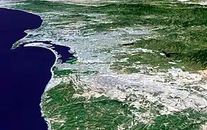
| San Diego–Tijuana | United States–Mexico | 5,105,769[5] |
| Mexicali–Calexico | Mexico–United States | 1,143,000 |
| San Luis Río Colorado–San Luis | Mexico–United States | 227,000 |
| Lukeville–Sonoyta | United States–Mexico | |
| Sasabe–Sáric | United States–Mexico | |
| Nogales–Nogales | United States–Mexico | 240,000 |
| Naco–Naco | United States–Mexico | |
| Douglas–Agua Prieta | United States–Mexico | |
| El Paso–Juárez | United States–Mexico | 2,500,000[6] |
| Presidio–Ojinaga | United States–Mexico | |
| Del Rio–Ciudad Acuña | United States–Mexico | |
| Eagle Pass–Piedras Negras | United States–Mexico | |
| Laredo–Nuevo Laredo | United States–Mexico | 775,481[7] |
| Rio Grande City–Camargo | United States–Mexico | |
| Reynosa–McAllen | Mexico–United States | 1,500,000[8] |
| Brownsville–Matamoros | United States–Mexico | 1,136,995[9] |
South America
References
- "Central Asian cities are overgrown with slums". centre1.com. Retrieved 12 May 2017.
- https://web.archive.org/web/20150924002318/http://www.espon.eu/export/sites/default/Documents/Projects/ESPON2006Projects/StudiesScientificSupportProjects/UrbanFunctions/fr-1.4.3_April2007-final.pdf
- https://web.archive.org/web/20150924002318/http://www.espon.eu/export/sites/default/Documents/Projects/ESPON2006Projects/StudiesScientificSupportProjects/UrbanFunctions/fr-1.4.3_April2007-final.pdf
- Wright, Virginia. "In the Shadow of the Border". Down East: The Magazine of Maine (June 2006).
- "San Diego - Tijuana". World Gazetteer. Archived from the original on 2007-10-01. Retrieved 1 September 2011.
- "The 411 - Fascinating Facts". Guest Life: El Paso/Juarez and Southern New Mexico. Retrieved 17 Feb 2010.
- "Nuevo Laredo Metro area". World Gazetteer. Archived from the original on 9 February 2013. Retrieved 1 September 2011.
- "McAllen Overview". McAllen Chamber of Commerce. Retrieved 26 August 2011.
- "Matamoros-Brownsville". World Gazetteer. Retrieved 22 August 2011.
- "IBGE Cidades (Brazil's Census 2010)".
- "INE (Uruguay's Census 2011)".
- http://www.lapatilla.com/site/2016/08/15/cucuta-y-san-antonio-dos-ciudades-unidas-pero-separadas-por-cierre-frontera/ "...que une ambas ciudades formando una conurbación, los 650.000 habitantes de Cúcuta y los 50.000 de San Antonio supieron que comenzaban tiempos difíciles."
| City proper | |
|---|---|
| Metropolitan area | |
| Urban area/agglomeration | |
| Historical | |
| Related articles | |
 Cities portal • Cities portal •  World portal World portal | |
This article is issued from Wikipedia. The text is licensed under Creative Commons - Attribution - Sharealike. Additional terms may apply for the media files.