Ujhani
Ujhani is an industry-based city and a municipal board in Badaun district in the Indian state of Uttar Pradesh.[2]
Ujhani | |
|---|---|
city | |
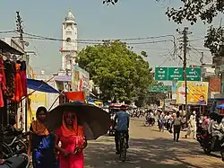 Bareilly Road, Ujhani | |
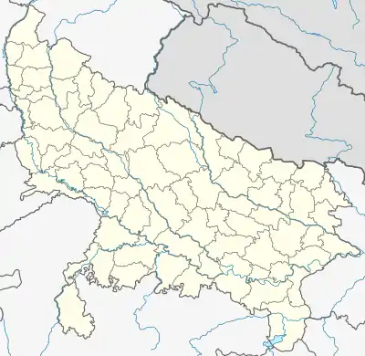  Ujhani Location in Uttar Pradesh, India | |
| Coordinates: 28.35°N 79.02°E | |
| Country |  India India |
| State | Uttar Pradesh |
| District | Badaun |
| Area | |
| • Total | 48 km2 (19 sq mi) |
| Elevation | 192 m (630 ft) |
| Population (2011)[1] | |
| • Total | 125,039 |
| • Density | 2,600/km2 (6,700/sq mi) |
| Demonym(s) | metric |
| Languages | |
| • Official | Hindi |
| Time zone | UTC+5:30 (IST) |
| PIN | 243639 |
| Telephone code | 05832 |
| Vehicle registration | UP 24 |
Geography
Ujhani is located at 28.02°N 79.02°E.[3] It has an average elevation of 192 metres (630 feet).
Demographics
As of 2011 India census,[4] Ujhani had a population of near about 126,000. Males constitute 56% of the population and females 44%. Ujhani has an average literacy rate of 87%, higher than the national average of 74%: male literacy is 88%, and female literacy is 86%. In Ujhani, 15% of the population is under 6 years of age. The area of Ujhani Municipal Council is 48 sq. km.[5]
Location
- Ujhani lies on SH33 (Bareilly-Mathura)
- SH18 originates from here known as Budaun-Meerut or Budaun-Delhi Highway.
- The Uttarakhand border is 155 km to the north and the Himalayan ranges start from about 188 km from here.
Politics
Mant (Assembly constituency) is the Vidhan Sabha constituency.[7] Mathura (Lok Sabha constituency) is the parliamentary constituency.[8]
Transport connectivity

Ujhani is a town directly connected with the main cities like Bareilly, Agra, Mathura, New Delhi, Ghaziabad, Aligarh, Hathras, Jaipur, Kasganj, Pilibhit, and Budaun by bus transport. Railway connectivity to all cities was closed from 1 January 2014 due to gauge conversion. After a long time the railway connectivity has again started with two trains daily to and fro, so after gauge conversion cities including Kanpur, Agra, Mathura, Bharatpur, Jaipur, Hathras, Farrukkhabad, Lalkuan, Haldwani, Kathgodam, Kashipur, Rudrapur, Budaun, Bareilly, Kasganj, Pilibhit, Lucknow, Sitapur, Mailani, Shahjahanpur, Lakhimpur kheeri, Gonda, Tanakpur are well connected.
Education
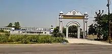
Ujhani is a small town connected to many rural areas. Many children from the villages come here to get education. In recent times with great emphasis on education, there have been many schools and colleges that are being established here. Notable institutions include:
- Ace Institute of Management & Technology
- APS International School
- Asharfi Devi Inter College
- Ayodhya Prasad Saraswati Vidya Mandir
- Ayodhya Prashad Mamorial Mahavidhyalay Ujhani, Badaun
- Banke Bihari Kanya Degree College
- Banke Bihari Law College
- Devnagri Inter college
- Harvilas Goyal Inter College
- Mahatma Gandhi Palika Inter College
- Mother Sheel Memorial Junio High School
- New Little Angel Jr. High School
- Vimla Haribhagwan Agarwal Inter College
Distance
- Budaun - 6 km (City), 11 km (Centre)
See also
References
- http://www.censusindia.gov.in/pca/SearchDetails.aspx?Id=143497
- "Blocks | District Budaun Government Of Uttar Pradesh | India". budaun.nic.in.
- Falling Rain Genomics, Inc - Ujhani
- "Census of India 2001: Data from the 2001 Census, including cities, villages and towns (Provisional)". Census Commission of India. Archived from the original on 16 June 2004. Retrieved 1 November 2008.
- "District Census Handbook Budaun" (PDF). Censusindia.gov.in.
- "Ujhani City Population Census 2011". Census 2011 India. Office of the Registrar General and Census Commissioner, India. Retrieved 29 November 2015.
- "Delimitation of Parliamentary and Assembly Constituencies Order, 2008" (PDF). Election Commission of India official website. Retrieved 11 November 2015.
- "Mathura General (Lok Sabha) Election Results 2019". elections.in. Retrieved 2 March 2021.