Uniontown, Alabama
Uniontown is a city in Perry County, Alabama, in the United States of America. At the 2010 census, the population of the city was 1,775, up from 1,636 in 2000. The census estimate for 2018 gave the population as 2,260. As of 2020, the mayor is Christopher Jones.
Uniontown | |
|---|---|
_-_Masonic_Hall%252C_Water_Avenue_and_North_Street%252C_Uniontown%252C_Perry_County%252C_AL_HABS_ALA%252C53-UNITO%252C3-1.tif.jpg.webp) Uniontown Masonic Hall, taken as part of the Historic American Buildings Survey | |
 Location of Uniontown in Perry County, Alabama. | |
| Coordinates: 32°26′56″N 87°30′44″W | |
| Country | United States |
| State | Alabama |
| County | Perry |
| Area | |
| • Total | 15.19 sq mi (39.35 km2) |
| • Land | 15.18 sq mi (39.31 km2) |
| • Water | 0.02 sq mi (0.04 km2) |
| Elevation | 299 ft (91 m) |
| Population (2020) | |
| • Total | 2,107 |
| • Density | 138.83/sq mi (53.60/km2) |
| Time zone | UTC-6 (Central (CST)) |
| • Summer (DST) | UTC-5 (CDT) |
| ZIP code | 36786 |
| Area code(s) | 334 |
| FIPS code | 01-77904 |
| GNIS feature ID | 0153806 |
| Website | https://www.uniontownal.com/ |
History
Uniontown was first settled in 1818 by the Wood family and was originally known as Woodville. It formally incorporated in 1836.[2] The name was later changed to Uniontown, after this name was suggested by Philip Weaver. He was a local planter, originally from Uniontown, Maryland.[3] Uniontown has four sites listed on the National Register of Historic Places: Fairhope Plantation, Pitts' Folly, the Uniontown Historic District, and Westwood.
Geography
Uniontown is located at 32°26′56″N 87°30′44″W (32.448984, -87.512287).[4]
According to the U.S. Census Bureau, the city has a total area of 1.3 square miles (3.4 km2), all land.
Demographics
| Historical population | |||
|---|---|---|---|
| Census | Pop. | %± | |
| 1850 | 290 | — | |
| 1870 | 1,444 | — | |
| 1880 | 810 | −43.9% | |
| 1890 | 854 | 5.4% | |
| 1900 | 1,047 | 22.6% | |
| 1910 | 1,836 | 75.4% | |
| 1920 | 1,359 | −26.0% | |
| 1930 | 1,424 | 4.8% | |
| 1940 | 1,869 | 31.3% | |
| 1950 | 1,798 | −3.8% | |
| 1960 | 1,993 | 10.8% | |
| 1970 | 2,133 | 7.0% | |
| 1980 | 2,112 | −1.0% | |
| 1990 | 1,730 | −18.1% | |
| 2000 | 1,623 | −6.2% | |
| 2010 | 1,775 | 9.4% | |
| 2020 | 2,107 | 18.7% | |
| U.S. Decennial Census[5] 2013 Estimate[6] | |||
2010 census
At the census[7] of 2010, there were 2,684 people, 720 households, and 530 families living in the city. The population density was 1,365.4 people per square mile (507.1/km2). There were 764 housing units at an average density of 587.7 per square mile (218.3/km2). The racial makeup of the city was 90.6% Black or African American and 9.1% White. .5% of the population were Hispanic or Latino of any race.
Of the 720 households 36.8% had children under the age of 18 living with them, 20.2% were married couples living together, 44.2% had a female householder with no husband present, and 30.5% were non-families. 28.5% of households were one person and 9.5% were one person aged 65 or older. The average household size was 2.69 and the average family size was 3.27.
The age distribution was 35.8% under the age of 18, 9.8% from 18 to 24, 22.9% from 25 to 44, 21.2% from 45 to 64, and 10.3% 65 or older. The median age was 28.4 years. For every 100 females, there were 79.7 males. For every 100 females age 18 and over, there were 72.4 males.
The median household income was $15,054 and the median family income was $17,473. Males had a median income of $34,038 versus $23,438 for females. The per capita income for the city was $9,452. About 43.1% of families and 45.2% of the population were below the poverty line, including 55.2% of those under age 18 and 51.5% of those age 65 or over.
2020 census
| Race | Num. | Perc. |
|---|---|---|
| White (non-Hispanic) | 162 | 7.69% |
| Black or African American (non-Hispanic) | 1,903 | 90.32% |
| Native American | 4 | 0.19% |
| Other/Mixed | 27 | 1.28% |
| Hispanic or Latino | 11 | 0.52% |
As of the 2020 United States census, there were 2,107 people, 704 households, and 319 families residing in the town.
Local events
Uniontown is known for their eleven state high school basketball championships. The last championship team was led by former Auburn University guard Frankie Sullivan, who scored fifty-one points in the championship game.
Notable people
- Augusta Clark, Pennsylvania politician, was born in Uniontown
- Tony Cox, actor, born in Uniontown in 1958
- Erwin Dudley, professional basketball player
- Morris Ernst, lawyer and co-founder of the American Civil Liberties Union
- Eugene Lipscomb, football player, born in Uniontown in 1931
- Zeke Smith, NFL player
- Holland Dai'mon Witherspoon, musician
- Juanita Abernathy, civil rights activist
Climate
The climate in this area is characterized by hot, humid summers and generally mild to cool winters. According to the Köppen Climate Classification system, Uniontown has a humid subtropical climate, abbreviated "Cfa" on climate maps.[9]
References
- "2020 U.S. Gazetteer Files". United States Census Bureau. Retrieved October 29, 2021.
- http://www.encyclopediaofalabama.org/article/h-3139
- Plantation Houses of the Alabama Canebrake and Their Associated Outbuildings MPS NRIS Database, National Register of Historic Places. Retrieved 2 December 2008.
- "US Gazetteer files: 2010, 2000, and 1990". United States Census Bureau. 2011-02-12. Retrieved 2011-04-23.
- "U.S. Decennial Census". Census.gov. Retrieved June 6, 2013.
- "Annual Estimates of the Resident Population: April 1, 2010 to July 1, 2013". Retrieved June 3, 2014.
- "U.S. Census website". United States Census Bureau. Retrieved 2015-08-06.
- "Explore Census Data". data.census.gov. Retrieved 2021-12-12.
- Climate Summary for Uniontown, Alabama
External links
 |
Wikimedia Commons has media related to Uniontown, Alabama. |
Municipalities and communities of Perry County, Alabama, United States | ||
|---|---|---|
| Cities | 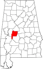 Map of Alabama highlighting Perry County | |
| Unincorporated communities | ||
| ||
Authority control  |
|---|