Villa Soriano
Villa Soriano is a town in the Soriano Department of Uruguay. Historically, it was also known as Santo Domingo de Soriano. It had acquired the status of "Villa" (town) before the Independence of Uruguay.[1]
Villa Soriano
Santo Domingo de Soriano | |
|---|---|
Town | |
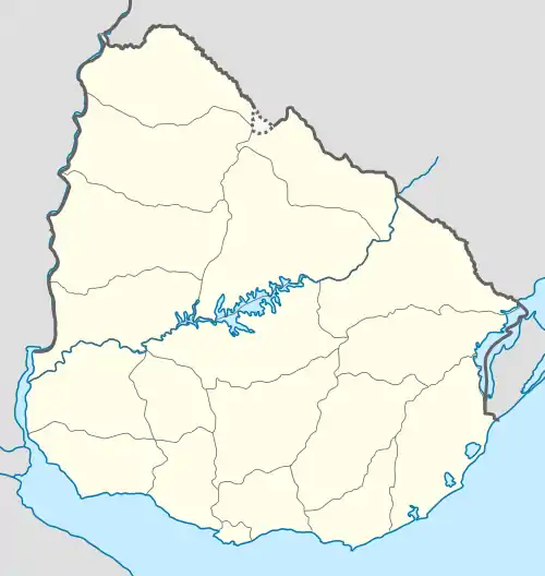  Villa Soriano Location in Uruguay | |
| Coordinates: 33°24′0″S 58°19′12″W | |
| Country |  Uruguay Uruguay |
| Department | Soriano Department |
| Population (2011) | |
| • Total | 1,124 |
| Time zone | UTC -3 |
| Postal code | 75005 |
| Dial plan | +598 453 (+5 digits) |
Location
It is located on the northwest end of Route 96, on the south bank of the river Río Negro, 10 kilometres (6.2 mi) before it discharges into Río Uruguay.
History
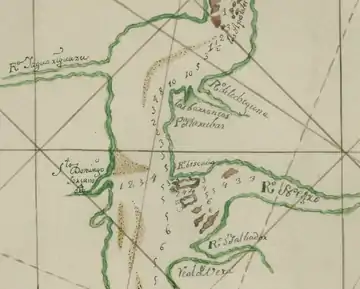
In 1662, a Dominican Mission established a village for the indigenous tribes of the area named Santo Domingo Soriano, located at today Argentinian shore of río Uruguay. It was moved twice, and to its current location in 1708. The construction of its church began in 1751.
The town has strong associations with General José Gervasio Artigas, who is honoured by Uruguayans as the 19th century liberator of the country.

Population
In 2011, Villa Soriano had a population of 1,124.[2][1]
| Year | Population |
|---|---|
| 1908 | 6,303 |
| 1963 | 1,036 |
| 1975 | 1,120 |
| 1985 | 1,068 |
| 1996 | 1,074 |
| 2004 | 1,184 |
| 2011 | 1,124 |
Places of worship
See also
References
- "Statistics of urban localities (1908–2004)" (PDF). INE. 2012. Archived from the original (PDF) on 2009-11-13. Retrieved 5 September 2012.
- "Censos 2011 Cuadros Soriano". INE. 2012. Archived from the original on 10 October 2012. Retrieved 25 August 2012.
External links
- Official site of Villa Soriano (in Spanish)
- SorianoTotal.com 'Villa Soriano' (in Spanish)
- Villa Santo Domingo Soriano (in Spanish)
- Villa Soriano, Uruguay (in Spanish)
- INE map of Villa Soriano and La Loma

Authority control  | |
|---|---|
| General | |
| National libraries | |