Warneton
Warneton (French pronunciation: [waʁnətɔ̃]; Dutch: Waasten) is a commune in the Nord department in northern France. It is part of the Métropole Européenne de Lille.
Warneton | |
|---|---|
.JPG.webp) The town hall in Warneton | |
.svg.png.webp) Coat of arms | |
Location of Warneton 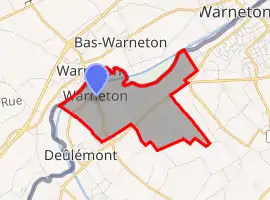
| |
  Warneton  Warneton | |
| Coordinates: 50°44′52″N 2°57′12″E | |
| Country | France |
| Region | Hauts-de-France |
| Department | Nord |
| Arrondissement | Lille |
| Canton | Armentières |
| Intercommunality | Métropole Européenne de Lille |
| Government | |
| • Mayor (2020–2026) | Yvon Pétronin |
| Area 1 | 4.17 km2 (1.61 sq mi) |
| Population | 239 |
| • Density | 57/km2 (150/sq mi) |
| Time zone | UTC+01:00 (CET) |
| • Summer (DST) | UTC+02:00 (CEST) |
| INSEE/Postal code | 59643 /59560 |
| Elevation | 11–25 m (36–82 ft) (avg. 20 m or 66 ft) |
| 1 French Land Register data, which excludes lakes, ponds, glaciers > 1 km2 (0.386 sq mi or 247 acres) and river estuaries. | |
Bounding communes and places
- Warneton, Belgium (part of Comines-Warneton)
- Comines, east
- Quesnoy-sur-Deûle, southeast
- Deûlémont, southwest
History
It was constituted into two zones and had its own mayor and its council. It was merged on June 7, 1946 with Warneton-Sud and Warneton-Bas
Heraldry
.svg.png.webp) Arms of Warneton |
The arms of Warneton are blazoned : Argent, a fess gules. (the Béthune family and the communes of Cuts, Rosny-sur-Seine, Warneton and Noyon use the same arms.) |
Population
| Year | Pop. | ±% |
|---|---|---|
| 2006 | 189 | — |
| 2007 | 189 | +0.0% |
| 2008 | 191 | +1.1% |
| 2009 | 198 | +3.7% |
| 2010 | 211 | +6.6% |
| 2011 | 224 | +6.2% |
| 2012 | 224 | +0.0% |
| 2013 | 225 | +0.4% |
| 2014 | 230 | +2.2% |
| 2015 | 234 | +1.7% |
| 2016 | 239 | +2.1% |
Points of interest
- A blockhaus, used during the advance of the Maginot Line.
People
- Saint John of Warneton
References
- "Populations légales 2018". The National Institute of Statistics and Economic Studies. 28 December 2020.
 |
Wikimedia Commons has media related to Warneton. |
.svg.png.webp)

This article is issued from Wikipedia. The text is licensed under Creative Commons - Attribution - Sharealike. Additional terms may apply for the media files.