Zhytomyr Raion
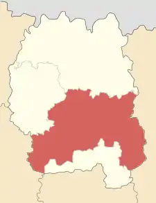
Zhytomyr Raion (Ukrainian: Житомирський район) is a raion (district) of Zhytomyr Oblast, northern Ukraine. Its administrative centre is located at Zhytomyr. The raion covers an area of 1,441 square kilometres (556 sq mi). Population: 613,311 (2021 est.)[1]
Zhytomyr Raion
Житомирський район | |
|---|---|
 Flag  Coat of arms | |
 | |
| Coordinates: 50°12′17″N 28°38′55″E | |
| Country |  Ukraine Ukraine |
| Region | 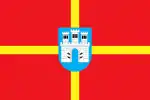 Zhytomyr Oblast Zhytomyr Oblast |
| Admin. center | Zhytomyr |
| Subdivisions | 31 hromadas |
| Area | |
| • Total | 1,441 km2 (556 sq mi) |
| Population (2021)[1] | |
| • Total | 613,311 |
| • Density | 430/km2 (1,100/sq mi) |
| Time zone | UTC+02:00 (EET) |
| • Summer (DST) | UTC+03:00 (EEST) |
| Area code | +380 |
On 18 July 2020, as part of the administrative reform of Ukraine, the number of raions of Zhytomyr Oblast was reduced to four, and the area of Zhytomyr Raion was significantly expanded. [2][3] Before the expansion, the area of the raion was 865.2 square kilometres (334.1 sq mi). The January 2020 estimate of the raion population was 72,213 (2020 est.)[4]
In 1928-39 the raion was known as Troyaniv Raion centered in a town of Troyaniv (today a small village).
References
- "Чисельність наявного населення України (Actual population of Ukraine)" (PDF) (in Ukrainian). State Statistics Service of Ukraine. Retrieved 11 July 2021.
- "Про утворення та ліквідацію районів. Постанова Верховної Ради України № 807-ІХ". Голос України (in Ukrainian). 2020-07-18. Retrieved 2020-10-03.
- "Нові райони: карти + склад" (in Ukrainian). Міністерство розвитку громад та територій України.
- "Чисельність наявного населення України (Actual population of Ukraine)" (PDF) (in Ukrainian). State Statistics Service of Ukraine. Retrieved 30 September 2020.

This article is issued from Wikipedia. The text is licensed under Creative Commons - Attribution - Sharealike. Additional terms may apply for the media files.