2021–22 North American winter
The 2021–22 North American winter is an ongoing winter season occurring across North America, as happens annually, from late 2021 to early 2022. Based on the astronomical definition, winter will begin on the winter solstice on December 21, 2021 and end on the spring equinox on March 20, 2022.[1] Based on the meteorological definition, the first day of winter started on December 1 and the last day will be February 28.[2] These dates historically describe the period in each year when winter storms are most likely to occur. However, winter storms may occur outside of these limits, as shown by the early formation of this season's Mid-October winter storm on October 12. Since both definitions of winter span the start of the calendar year, it is possible to have a winter storm spanning two different years.
| 2021–22 North American winter | |
|---|---|
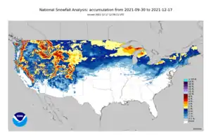 Season summary map of U.S. | |
| Seasonal boundaries | |
| Meteorological winter | December 1 – February 28 |
| Astronomical winter | December 21 – March 20 |
| First event started | October 12, 2021 |
| Last event concluded | Season ongoing |
| Most notable event | |
| Name | December 2021 tornado outbreak and winter storm |
| • Duration | December 9–12, 2021 |
| • Lowest pressure | 974 mb (28.76 inHg) |
| • Fatalities | w+ fatalities |
| • Damage | Unknown (2021 USD) |
| Seasonal statistics | |
| Total storms (RSI) (Cat. 1+) | 0 total |
| Major storms (RSI) (Cat. 3+) | 0 total |
| Maximum snowfall accumulation | 42 inches (110 cm) of snow at Mount Rose, Nevada (October 24–26, 2021) |
| Maximum ice accretion | Unknown |
| Total fatalities | 2 total |
| Total damage | ≥ $450 million (2021 USD) |
| Related articles | |
Seasonal forecasts
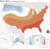
On October 13, 2021, The Weather Channel released its U.S. winter temperature outlooks for the 2021–22 winter season.[3] The forecasts reflected the likelihood of a weak La Niña pattern and weak polar vortex during much of the season. Overall for the winter, significantly above-average temperatures were forecast for most of the Southern Tier, with near-average temperatures in the Central and much of the Northeastern United States. Slightly below-average temperatures were expected in most of the north-central and northwestern U.S. During the first half of the season, a relatively weak La Niña was expected to result in widespread below-average temperatures across the northern half of the country, with widespread above-average temperatures in the southern half. However, as both the La Niña and polar vortex were expected to strengthen later in the season, widespread above-average temperatures were forecast in most of the U.S. during the latter half of the winter, especially in the South and East. Below-average temperatures were still expected to continue in the far Northwestern U.S.[3]
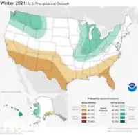
On October 21, 2021, the National Oceanic and Atmospheric Administration's Climate Prediction Center released its U.S. Winter Outlook for the upcoming winter.[4] The temperature and precipitation outlooks reflected a typical La Niña weather pattern during the winter. Significantly above-average temperatures were forecasted across the Southern Tier, especially in the Southeast, with slightly above-average temperatures forecast in the Ohio Valley and Northeast. Near to below-average temperatures were expected in the far northwestern U.S. Below-average precipitation was expected across the far Southern Tier, with particularly in the Southwest, with above-average precipitation forecast in the far Northwestwern U.S., as well as the Ohio Valley and surrounding regions. Near-average precipitation was expected in the Central U.S., Northern Plains, and Northeast. Drought was forecasted to improve and end in the Pacific Northwest, while it was expected to develop or worsen across the Southwest. Drought was not expected in the eastern half of the country.[4]
Seasonal summary
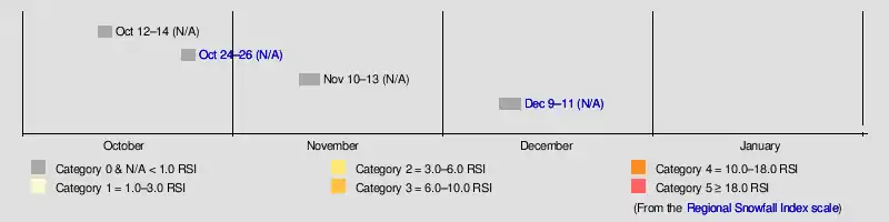
The 2021–22 winter season began with the formation of a significant winter storm in the Western United States on October 12, resulting in heavy snow accumulations of up to 28 in (71 cm) across much of the Intermountain West and over 80 rescues due to blizzard-like conditions in Utah.[5][6] The system was estimated to have caused at least $50 million in damages.[7] After a one-month break in winter weather events due to unfavorable conditions for winter storms, a blizzard began to develop across south-central Canada and the Upper Midwest on November 11.[8]
Events
Mid-October winter storm
  | |
| Duration | October 12–14, 2021 |
|---|---|
| Lowest pressure | 988 mb (29.18 inHg) |
| Maximum snow | 28 in (71 cm) |
| Fatalities | 0 fatalities |
| Damage | ≥ $50 million (2021 USD) |
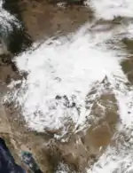
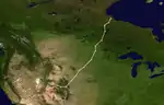
On October 11 at 12:00 UTC, a weak, elongated frontal system formed over the interior West Coast.[9] After remaining disorganized for about 12 hours, the system began to coalesce into a stronger extratropical cyclone over Colorado on October 12.[10] It also began to drop snow over parts of the Rocky Mountains by this point. The system then merged into a well-formed extratropical cyclone with a single-low pressure center by early the next day, beginning to steadily intensify.[11] Snowfall rates began to rapidly increase in bands to the west of the center throughout the day, with up to a foot of snow falling within hours. The system reached its peak intensity of 988 mbar (29.2 inHg) at 21:00 UTC on October 13.[12][13] The extratropical cyclone then began to accelerate to the north, becoming occluded in the process.[14][5] The weakening system then moved into the Canadian Prairies, resulting in some more snow there,[15] before merging into another frontal system on October 15.[16]
The precursor to the system resulted in blizzard conditions across parts of northeastern Utah on October 11, disrupting a 50-mile ultramarathon occurring there. Extremely heavy snowfall rates and winds gusting to tropical storm-force resulted in the race being called off, and over 87 rescues had to be made in the snow.[6] The next day, up to 6 inches (15 cm) of snow fell across mountainous areas of Colorado as the system was organizing.[17] The system also resulted in wind gusts of over 64 mph (103 km/h) in parts of Nevada that day.[18] On October 13, the system moved north into areas such as Wyoming, with 17.4 inches (44 cm) of snow falling in Casper, and even higher totals in the high elevations.[19] Additionally, hurricane-force wind gusts were recorded across parts of eastern Colorado and western South Dakota, with a 74 mph (119 km/h) gust occurring in Wasta. As the storm system reached peak intensity on October 14, heavy snowfall rates resulted in snowfall totals of over 2 feet (0.61 m) in parts of eastern Montana, with the storm's maximum snowfall total of 28 inches (71 cm) occurring in Pony. Larger cities such as Billings and Bozeman also saw 8–12 inches (20–30 cm) of snow from the system. Areas in the Black Hills such as Deadwood and Whitewood measured over 24 inches (61 cm) of snow, with Rapid City also recording 3 inches (7.6 cm).[5] As the system moved into south-central Canada later that day, it also resulted in some light snowfall there before the system dissipated the next day.[20] According to Aon Benfield, the system was estimated to have caused at least $50 million (2021 USD) in damages.[7]
Late October West Coast bomb cyclone
  | |
| Duration | October 23–26, 2021 |
|---|---|
| Lowest pressure | 942 mb (27.82 inHg) |
| Maximum snow | 42 in (110 cm) |
| Fatalities | 2 fatalities |
| Damage | $400 million |
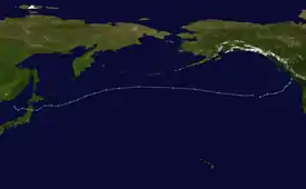
In late October 2021, a powerful bomb cyclone struck the Western United States and Western Canada, bringing severe impacts to the region.
Mid-November blizzard
  | |
| Duration | November 10–13, 2021 |
|---|---|
| Lowest pressure | 988 mb (29.18 inHg) |
| Maximum snow | 20 in (51 cm) |
| Fatalities | 0 fatalities |
| Damage | Unknown |
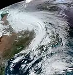
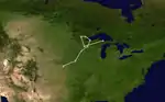
At 15:00 UTC on November 10, an area of low pressure formed over central Kansas,[21] this area moved northeastward over the Great Plains as it deepened, Blizzard Warnings were issued in advance of the storm in Minnesota and South Dakota,[22][23] with High Wind warnings also being issued. The storm moved erratically as it looped oved the arrowhead of Minnesota on November 11–12 before being absorbed the next day over Lake Superior.
While the storm was moving over the Upper Midwest, Storm warnings and Gale warnings were issued for portions of the Great Lakes, waves from Lake Superior caused lakeshore flooding in Grand Marais.[24]
Early December winter storm
 | |
| Duration | December 9–12, 2021 |
|---|---|
| Lowest pressure | 974 mb (28.76 inHg) |
| Maximum snow | 36 in (91 cm) |
| Damage | Unknown |
Late October nor'easter
A strong nor'easter in late October brought high winds, cutting power to more than 600,000 people in New England. Category 2 hurricane-force wind gusts of 113 mph (182 km/h) were recorded in Truro, Massachusetts, 103 mph (166 km/h) in Duxbury, Massachusetts, and 97 mph (156 km/h) in Wellfleet, Massachusetts.[25][26][27][28] Martha's Vineyard, Massachusetts reported a wind gust to 94 mph (151 km/h) and Scituate reported a gust of 87 mph (140 km/h).[29] Unofficial wind gusts of 110 mph (180 km/h) in Wellfleet and 107 mph (172 km/h) in Provincetown, Massachusetts were recorded at exposed coastal locations.[30][31] A plane was damaged at the New Bedford Regional Airport after being blown off the runway. In Hingham, a large tree brought down wires.[29] According to Aon Benfield, damage was estimated at over $200 million (2021 USD.[32] The system would later move out to sea and acquire subtropical characteristics, becoming Subtropical Storm Wanda on October 31, later becoming a full-fledged tropical cyclone two days later. The precusor of Wanda caused a lot of flooding in the tri-state area with heavy amounts of rain.
Season effects
This is a table of all of the events that have occurred in the 2021–22 North American winter. It includes their duration, damage, impacted locations, and death totals. Deaths in parentheses are additional and indirect (an example of an indirect death would be a traffic accident), but were still related to that storm. All of the damage figures are in 2021 USD.
| Regional Snowfall Index scale | |||||
| C0 | C1 | C2 | C3 | C4 | C5 |
| Event name |
Dates active | RSI category | RSI value | Highest gust mph (km/h) |
Minimum pressure (mbar) |
Maximum snow in (cm) |
Maximum ice in (mm) |
Areas affected | Damage (2021 USD) |
Deaths |
|---|---|---|---|---|---|---|---|---|---|---|
| Mid-October winter storm | October 12 – 14 | N/A | N/A | 84 (135) | 988 | 28 (71) | N/A | Intermountain West, Northern Plains, Canadian Prairies | $50 million | None |
| October 2021 Northeast Pacific bomb cyclone | October 24 – 26 | N/A | N/A | 159 (256) | 942 | 42 (110) | N/A | Alaska, Western United States, Western Canada | >$400 million | 2 |
| Mid-November blizzard | November 10 – 13 | N/A | N/A | 82 (132) | 988 | 20 (51) | N/A | Upper Midwest, Northern Plains, South-central Canada | Unknown | None |
| December tornado outbreak and winter storm | December 9 – 12 | N/A | N/A | Unknown | 974 | 36 (91) | N/A | Western United States, Central United States, Midwestern United States, Eastern United States, Eastern Canada | Unknown | None |
| Season aggregates | ||||||||||
| 0 RSI storms | October 12 – Season ongoing | 942 | 42 (110) | 0 (0) | ≥ $450 million | 2+ | ||||
See also
 Weather portal
.svg.png.webp) North America portal
North America portal
References
- "Earth Seasons". www.webcitation.org. Archived from the original on 2020-10-21. Retrieved 2020-10-16.
- "Meteorological vs. Astronomical Seasons". NOAA National Centers for Environmental Information. June 21, 2013. Archived from the original on November 25, 2021. Retrieved July 3, 2015.
- Lam, Linda (October 13, 2021). "Late-Fall, Winter Temperature Outlook: Shift to Warmer Southern Tier, Cooler Northern Tier Expected". www.weather.com. Archived from the original on October 23, 2021. Retrieved October 24, 2021.
- Blackwell, Jasmine (October 21, 2021). U.S. Winter Outlook: Drier, warmer South, wetter North with return of La Nina (Report). Washington, D.C.: National Oceanic and Atmospheric Administration. Archived from the original on October 21, 2021. Retrieved October 21, 2021.
- Asherman, Jacob (October 14, 2021). Storm Summary Number 2 for Intermountain West to Northern Plains Winter Storm (Report). College Park, Maryland: Weather Prediction Center. Archived from the original on October 16, 2021. Retrieved October 16, 2021.
- Puleo, Mark (October 12, 2021). "87 ultramarathoners rescued from 'scary' wintry conditions". Accuweather. Archived from the original on October 17, 2021. Retrieved October 16, 2021.
- Global Catastrophe Recap: October 2021 (PDF) (Report). Aon Benfield Inc. October 2021. Retrieved November 28, 2021.
- Van Dam, Derek; Jones, Judson (November 11, 2021). "Blizzard warnings issued as upper Midwest snowstorm begins to strengthen". CNN. Archived from the original on November 11, 2021. Retrieved November 11, 2021.
- "WPC surface analysis valid for 10/11/2021 at 12 UTC". Weather Prediction Center. October 11, 2021. Archived from the original on October 17, 2021. Retrieved October 17, 2021.
- "WPC surface analysis valid for 10/12/2021 at 12 UTC". Weather Prediction Center. October 12, 2021. Archived from the original on October 17, 2021. Retrieved October 17, 2021.
- "WPC surface analysis valid for 10/13/2021 at 06 UTC". Weather Prediction Center. October 13, 2021. Archived from the original on October 17, 2021. Retrieved October 17, 2021.
- "WPC surface analysis valid for 10/13/2021 at 21 UTC". Weather Prediction Center. October 13, 2021. Archived from the original on October 17, 2021. Retrieved October 17, 2021.
- Asherman, Jacob (October 13, 2021). Storm Summary Number 1 for Intermountain West to Northern Plains Winter Storm (Report). College Park, Maryland: Weather Prediction Center. Archived from the original on October 17, 2021. Retrieved October 17, 2021.
- "WPC surface analysis valid for 10/14/2021 at 09 UTC". Weather Prediction Center. October 14, 2021. Archived from the original on October 17, 2021. Retrieved October 17, 2021.
- "WPC surface analysis valid for 10/15/2021 at 00 UTC". Weather Prediction Center. October 15, 2021. Archived from the original on October 17, 2021. Retrieved October 17, 2021.
- "WPC surface analysis valid for 10/15/2021 at 12 UTC". Weather Prediction Center. October 15, 2021. Archived from the original on October 17, 2021. Retrieved October 17, 2021.
- Fries, Tynin (October 14, 2021). "Colorado snow totals for Oct. 13–14, 2021". Denver Post. Archived from the original on November 25, 2021. Retrieved October 16, 2021.
- Eggen, Lukas; Dylan, Johah (October 12, 2021). "October storm brings strong winds, showers to Las Vegas". Review-Journal. Archived from the original on October 16, 2021. Retrieved October 16, 2021.
- LaChance, Brendan (October 13, 2021). "Casper area records as much as 17.4 inches of snow; 20% chance of more on Thursday". Oil City News. Archived from the original on October 16, 2021. Retrieved October 16, 2021.
- Zammit, David (October 14, 2021). "Warm Weather to Upend Brief Snowfall". SwiftCurrent Online. Archived from the original on October 17, 2021. Retrieved October 17, 2021.
- "Archived copy". Archived from the original on 2021-11-14. Retrieved 2021-11-14.CS1 maint: archived copy as title (link)
- daryl herzmann akrherz@iastate.edu. "IEM :: Valid Time Event Code (VTEC) App". Mesonet.agron.iastate.edu. Archived from the original on 2020-09-01. Retrieved 2021-11-25.
- "Archived copy". Archived from the original on 2021-11-17. Retrieved 2021-11-17.CS1 maint: archived copy as title (link)
- Turtinen, Melissa (2021-11-11). "Gales of November: Giant waves on Lake Superior floods Grand Marais". Bring Me The News. Archived from the original on 2021-11-23. Retrieved 2021-11-25.
- Adriana Navarro; Alyssa Smithmyer (October 27, 2021). Nor'easter sends enormous waves crashing over homes (Report). Accuweather, Inc. Archived from the original on November 1, 2021. Retrieved November 2, 2021.
- Powerful Nor'easter Delivers Damaging Winds and Heavy Rain to New England and Beyond (Report). BreakingWeather.net. October 28, 2021. Archived from the original on November 2, 2021. Retrieved November 2, 2021.
- Weather Conditions for F6034 (Report). University of Utah. October 27, 2021. Archived from the original on November 2, 2021. Retrieved November 2, 2021.
- Personal tweet by Shea Gisbon, WeatherFlow, Inc (Report). WeatherFlow, Inc. October 27, 2021. Archived from the original on November 2, 2021. Retrieved November 2, 2021.
- Cappucci, Matthew; Samenow, Jason (October 27, 2021). "'Bomb cyclone' brings 90 mph gusts to New England; hundreds of thousands without power". The Washington Post. Archived from the original on October 28, 2021. Retrieved October 28, 2021.
- October 2021 Nor'easter Special Wind Reconnaissance Mission (Report). Maravelias Extreme Performance Anemometry Mesonet (MAREPAM). October 27, 2021. Archived from the original on November 2, 2021. Retrieved November 2, 2021.
- Full tabular data for XMRPMSPECI10262100 (Wellfleet, MA) (PDF) (Report). Maravelias Extreme Performance Anemometry Mesonet (MAREPAM). October 27, 2021. Archived (PDF) from the original on October 27, 2021. Retrieved November 2, 2021.
- Masters, Jeff; Henson, Bob (October 31, 2021). "Subtropical Storm Wanda forms, exhausting the Atlantic list of storms". New Haven, Connecticut: Yale Climate Connections. Archived from the original on October 31, 2021. Retrieved October 31, 2021.
External links
 |
Wikimedia Commons has media related to 2021-22 North American winter. |
- Winter Storm Forecast Tracks from the Weather Prediction Center
- 2021 Storm Summaries from the Weather Prediction Center
- Event Reviews from the Weather Prediction Center