Bombana Regency
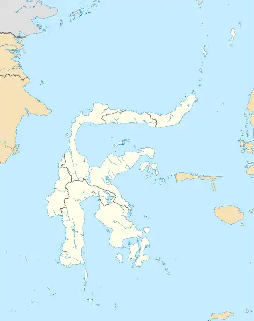
Bombana Regency (Kabupaten Bombana) is a regency of Southeast Sulawesi Province of Indonesia. It consists of part of the southeast peninsula of Sulawesi, together with most of the substantial offshore island of Kabaena to the south. It covers an area of 3,316.16 km2, and had a population on 139,235 at the 2010 Census[2] and 150,706 at the 2020 Census.[3] The administrative centre lies at the town of Rumbia.
Bombana Regency
Kabupaten Bombana | |
|---|---|
 Coat of arms | |
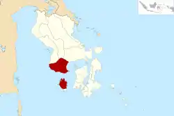 Location within Southeast Sulawesi | |
| Coordinates: 4°48′17″S 121°48′32″E | |
| Country | Indonesia |
| Province | Southeast Sulawesi |
| Capital | Rumbia |
| Government | |
| • Regent | Tafdil |
| • Vice Regent | Masyhura |
| Area | |
| • Total | 3,316.16 km2 (1,280.38 sq mi) |
| Population (2020 Census)[1] | |
| • Total | 150,706 |
| • Density | 45/km2 (120/sq mi) |
| Time zone | UTC+8 (ICST) |
| Area code | (+62) 405 |
| Website | bombanakab |

Administration
The regency is divided into 22 districts (kecamatan), tabulated below with their areas and their populations at the 2010 Census[4] and the 2020 Census.[5] The table also includes the number of administrative villages (rural desa and urban kelurahan) and offshore islands in each district, and its post code.
| Name | English name | Area in km2 | Population Census 2010 | Population Census 2020 | Number of villages | Number of islands | Post code |
|---|---|---|---|---|---|---|---|
| Kabaena Utara | North Kabaena | 132.97 | 3,671 | 4,031 | 6 | 4 | 93785 |
| Kabaena Barat | West Kabaena | 39.43 | 7,492 | 7,829 | 5 | 7 | 93780 |
| Kabaena | Kabaena | 103.57 | 2,849 | 3,120 | 4 | - | 93781 |
| Kabaena Selatan | South Kabaena | 129.20 | 2,606 | 3,325 | 4 | - | 93782 |
| Kabaena Tengah | Central Kabaena | 275.58 | 3,254 | 4,064 | 7 | - | 93783 |
| Kabaena Timur | East Kabaena | 121.25 | 6,663 | 7,566 | 7 | 2 | 93784 |
| (Most of Kabaena Island) | 802.00 | 26,535 | 29,935 | 33 | 13 | ||
| Rumbia | 58.99 | 10,710 | 12,385 | 5 | - | 93771 | |
| Mata Oleo | 108.53 | 6,092 | 7,079 | 11 | 3 | 93770 | |
| Kepulauan Masaloka Raya | Masaloka Raya Islands | 2.66 | 2,978 | 2,332 | 5 | 5 | 93778 |
| Rumbia Tengah | Central Rumbia | 21.11 | 6,356 | 7,267 | 5 | - | 93771 |
| Rarowatu | 166.81 | 6,225 | 6,342 | 9 | - | 93787 | |
| Rarowatu Utara | North Rarowatu | 239.40 | 7,359 | 7,147 | 8 | 1 | 93788 |
| Lantari Jaya | 285.01 | 7,520 | 8,475 | 9 | - | 93774 | |
| Mata Usu | 456.17 | 1,264 | 1,806 | 5 | - | 93786 | |
| Poleang Tenggara | Southeast Poleang | 133.51 | 3,754 | 4,246 | 5 | 1 | 93775 |
| Poleang Timur | East Poleang | 101.55 | 9,109 | 10,152 | 5 | - | 93776 |
| Poleang Selatan | South Poleang | 89.88 | 6,602 | 6,911 | 5 | 1 | 93773 |
| Poleang Utara | North Poleang | 237.27 | 10,454 | 10,968 | 8 | - | 93777 |
| Tontonunu | 131.14 | 5,251 | 5,391 | 5 | - | 93789 | |
| Poleang Tengah | Central Poleang | 41.69 | 3,480 | 3,676 | 4 | - | 93779 |
| Poleang | 115.39 | 14,277 | 14,336 | 10 | 1 | 93772 | |
| Poleang Barat | West Poleang | 325.05 | 11,269 | 12,258 | 11 | - | 93772 |
Climate
Most of Bombana Regency has a tropical rainforest climate (Af) with moderate rainfall from August to November and heavy rainfall from December to July. The following climate data is for the town of Rumbia, the seat of the regency.
| Climate data for Rumbia | |||||||||||||
|---|---|---|---|---|---|---|---|---|---|---|---|---|---|
| Month | Jan | Feb | Mar | Apr | May | Jun | Jul | Aug | Sep | Oct | Nov | Dec | Year |
| Average high °C (°F) | 31.1 (88.0) |
31.0 (87.8) |
31.2 (88.2) |
31.2 (88.2) |
30.8 (87.4) |
30.1 (86.2) |
29.8 (85.6) |
30.5 (86.9) |
31.3 (88.3) |
32.4 (90.3) |
32.4 (90.3) |
31.5 (88.7) |
31.1 (88.0) |
| Daily mean °C (°F) | 27.2 (81.0) |
27.2 (81.0) |
27.3 (81.1) |
27.3 (81.1) |
27.1 (80.8) |
26.5 (79.7) |
25.9 (78.6) |
26.1 (79.0) |
26.7 (80.1) |
27.5 (81.5) |
28.0 (82.4) |
27.5 (81.5) |
27.0 (80.6) |
| Average low °C (°F) | 23.4 (74.1) |
23.4 (74.1) |
23.4 (74.1) |
23.5 (74.3) |
23.5 (74.3) |
22.9 (73.2) |
22.0 (71.6) |
21.8 (71.2) |
22.1 (71.8) |
22.7 (72.9) |
23.6 (74.5) |
23.6 (74.5) |
23.0 (73.4) |
| Average rainfall mm (inches) | 193 (7.6) |
184 (7.2) |
208 (8.2) |
188 (7.4) |
249 (9.8) |
219 (8.6) |
148 (5.8) |
95 (3.7) |
82 (3.2) |
68 (2.7) |
128 (5.0) |
172 (6.8) |
1,934 (76) |
| Source: Climate-Data.org[6] | |||||||||||||
References
- Badan Pusat Statistik, Jakarta, 2021.
- Biro Pusat Statistik, Jakarta, 2011.
- Badan Pusat Statistik, Jakarta, 2021.
- Biro Pusat Statistik, Jakarta, 2011.
- Badan Pusat Statistik, Jakarta, 2021.
- "Climate: Rumbia". Climate-Data.org. Retrieved 22 November 2020.
Regencies and cities of Southeast Sulawesi | ||
|---|---|---|
Capital: Kendari | ||
| Regencies |  | |
| Cities | ||