Highway M04 (Ukraine)
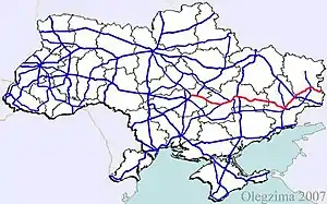
Highway M04 is a Ukraine international highway connecting Znamianka to Krasnodon on the border with Russia, where it continues into Russia as the A260.[1]
 | |
|---|---|
 | |
| Route information | |
Part of  E 40 E 40 E 50 E 50 | |
| Length | 566.9 km (352.3 mi) |
| Major junctions | |
| West end |  M 12 in Znamianka M 12 in Znamianka |
 M 22 in Oleksandriia M 22 in Oleksandriia M 03 in Debaltseve M 03 in Debaltseve | |
| East end | Russian border at Izvaryne |
| Location | |
| Regions | Kropyvnytskyi region, Dnipropetrovsk Oblast, Donetsk Oblast, Luhansk Oblast |
| Highway system | |
| Roads in Ukraine | |
In Soviet times the M04 was part of the M21. Today the highway stretches through four oblasts and ends at the Izvaryne-Donetsk border checkpoint which is part of Krasnodon city (Luhansk Oblast). The section from Znamianka to Debaltseve is part of European route E50, and the section from Debaltseve to the Russian border is part of European route E40.
War in Donbas
In eastern Ukraine, significant armed conflict has occurred along and near the M04 in the Donetsk and Luhansk Oblasts during the War in Donbass.
Route
| Marker | Main settlements | Notes | Highway Interchanges |
|---|---|---|---|
| 0 km | Znamianka | E 50/ E 584 M 12 • E 584 M 12 •  H 01 H 01 | |
| Oleksandriia | E 584 M 22 | ||
| Chapaivka |  H 11 H 11 | ||
| Dnipro |  H 08 H 08 | ||
| Donetsk |  H 20 H 20 | ||
| Debaltseve | E 40/ E 50 M 03 | ||
| Luhansk | 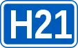 H 21 H 21 | ||
| 566 km | Izvaryne / Border (Russia) | E 40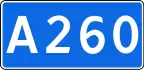 A 260 A 260 |
Gallery
.JPG.webp) M04 crossing Zhovta River near Piatykhatky, Dnipropetrovsk Oblast
M04 crossing Zhovta River near Piatykhatky, Dnipropetrovsk Oblast
References
External links
- National Roads in Ukraine in Russian
| E-roads in Ukraine |   | |
|---|---|---|
| International | ||
| National | ||
| Regional |
| |
| ||
This article is issued from Wikipedia. The text is licensed under Creative Commons - Attribution - Sharealike. Additional terms may apply for the media files.