Krajná Poľana
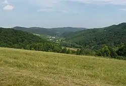
Krajná Poľana (Rusyn: Крайня Поляна, Hungarian: Ladomérmező) is a village and municipality in Svidník District in the Prešov Region of north-eastern Slovakia.
Krajná Poľana | |
|---|---|
Municipality | |
 | |
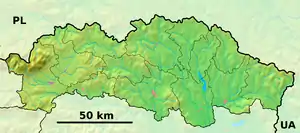  Krajná Poľana Location of Krajná Poľana in the Prešov Region 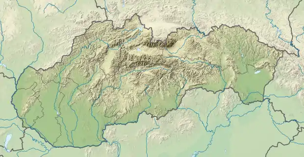 Krajná Poľana Location of Krajná Poľana in Slovakia | |
| Coordinates: 49°21′50″N 21°41′10″E | |
| Country |  Slovakia Slovakia |
| Region | Prešov |
| District | Svidník |
| First mentioned | 1618 |
| Area | |
| • Total | 2.943 km2 (1.136 sq mi) |
| Elevation | 333 m (1,093 ft) |
| Population | |
| • Total | 214 |
| • Density | 73/km2 (190/sq mi) |
| Time zone | UTC+1 (CET) |
| • Summer (DST) | UTC+2 (CEST) |
| Postal code | 090 05 |
| Area code(s) | +421-54 |
| Car plate | SK |
| Website | krajnapolana |
History
The village is first mentioned in historical records in 1618, and it is the oldest village in the region. The village was originally named Hunkovska Polana. From the late 18th Century all the way until the First World War the village was largely inhabited by Polish-speaking settlers from Barwinek, Tylawa and other villages located only a few miles to the north. Intermarriage between Poles and Slovaks was common. This ethnic mixing was made easier by the First Partition of Poland, as a result of which the Polish-Habsburg border on the Carpathian ridge disappeared.
Geography
The municipality lies at an altitude of 333 metres and covers an area of 2.943 km2. It has a population of about 214 people. Next to way is a water dam on Ladomirka river.
Genealogical resources
The records for genealogical research are available at the state archive "Statny Archiv in Presov, Slovakia"
- Greek Catholic church records (births/marriages/deaths): 1823–1922 (parish B)
External links
 Media related to Krajná Poľana at Wikimedia Commons
- Official website

- Statistics
- Surnames of living people in Krajna Polana