List of designated places in Alberta
A designated place is a type of geographic unit used by Statistics Canada to disseminate census data.[1] It is usually "a small community that does not meet the criteria used to define incorporated municipalities or Statistics Canada population centres (areas with a population of at least 1,000 and no fewer than 400 persons per square kilometre)."[2] Provincial and territorial authorities collaborate with Statistics Canada in the creation of designated places so that data can be published for sub-areas within municipalities.[2] Starting in 2016, Statistics Canada allowed the overlapping of designated places with population centres.[2]
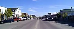
At the 2016 Census of Population, Alberta had 304 designated places,[3] an increase from 264 in 2011.[4] Designated place types in Alberta include 10 dissolved municipalities, 10 Métis settlements, and 284 unincorporated places.[5] In 2016, the 304 designated places had a cumulative population of 56,070 and an average population of 184. Alberta's largest designated place is Lac La Biche with a population of 2,314.[5]
List
| Total designated places | — | — | — | 56,070 | 55,768 | +0.5% | 6,026.01 | 9.3/km2 |
| Province of Alberta | — | — | — | 4,067,175 | 3,645,257 | +11.6% | 640,330.46 | 6.4/km2 |
Retired designated places
T & E Trailer Park, located within the City of Grande Prairie, was last recognized as a designated place in the 2006 Census of Canada.[7][8] Parkland Village, located within Parkland County, was last recognized as a designated place in the 2001 Census of Canada.[8][9]
See also
Notes
- One of two parts of Calling Lake.
- One of two parts of Calling Lake.
- Forms part of the Hamlet of Cochrane Lake.
- Mistakenly spelled Debolt by Statistics Canada.
- Different from the Town of Fairview in northwest Alberta.
- Also known as Ferrier.
- One of two parts of Gift Lake Metis Settlement.
- One of two parts of Gift Lake Metis Settlement.
- Also known as Grouard.
- Also known as Half Moon Lake.
- Also known as Hillcrest.
- Also known as Maskwacis.
- One of two parts of Kikino Metis Settlement.
- One of two parts of Kikino Metis Settlement.
- Also known as Kountry Meadow Estates.
- La Crete's designated place boundary only covers a portion of the Hamlet of La Crete.
- Mistakenly spelled Lac des Arcs by Statistics Canada.
- Mistakenly spelled Lac la Biche by Statistics Canada.
- Langdon's designated place boundary only covers a portion of the Hamlet of Langdon.
- Mistakenly spelled MacKay by Statistics Canada.
- One of two parts of Mulhurst Bay.
- One of two parts of Mulhurst Bay.
- Different from the nearby Hamlet of Namao in Sturgeon County.
- Mistakenly spelled Picardville by Statistics Canada.
- Also known as Dead Man's Flats.
- Different from the Hamlet of Poplar Ridge in Brazeau County.
- Mistakenly spelled Shaftsbury Settlement by Statistics Canada.
References
- "2006 Census Dictionary, Figure 20: Hierarchy of standard geographic units for dissemination, 2006 Census". Statistics Canada. November 20, 2009. Retrieved May 5, 2012.
- "Dictionary, Census of Population, 2016: Designated place (DPL)". Statistics Canada. February 8, 2017. Retrieved September 2, 2021.
- "Table 1.1: Geographic areas by province and territory, 2016 Census". Statistics Canada. February 8, 2017. Retrieved August 28, 2021.
- "Census Dictionary: Table 1 – Geographic units by province and territory, 2011 Census". Statistics Canada. January 31, 2012. Retrieved May 5, 2012.
- "Population and dwelling counts, for Canada, provinces and territories, and designated places, 2016 and 2011 censuses – 100% data (Alberta)". Statistics Canada. February 7, 2018. Retrieved August 28, 2021.
- "Population and dwelling counts, for Canada, provinces and territories, census divisions, census subdivisions (municipalities) and designated places, 2016 and 2011 censuses – 100% data (Alberta)". Statistics Canada. February 7, 2018. Retrieved August 28, 2021.
- "Population and dwelling counts, for Canada, provinces and territories, and designated places, 2011 and 2006 censuses (Alberta)". Statistics Canada. February 8, 2012. Retrieved February 19, 2012.
- "Population and dwelling counts, for Canada, provinces and territories, and designated places, 2006 and 2001 censuses - 100% data (Alberta)". Statistics Canada. January 6, 2010. Retrieved February 19, 2012.
- "Population and Dwellings Counts, for Canada, Provinces and Territories, Census Divisions, Census Subdivisions (Municipalities) and Designated Places, 2001 and 1996 Censuses - 100% Data (Parkland County)". Statistics Canada. Retrieved August 24, 2014.
| Subdivisions | |
|---|---|
| Communities | |
| Cities and urban service areas | |
| Census divisions | |
| |


.svg.png.webp)

| Provinces | |
|---|---|
| Territories |
|
| |