List of designated places in Saskatchewan
A designated place is a type of geographic unit used by Statistics Canada to disseminate census data.[1] It is usually "a small community that does not meet the criteria used to define incorporated municipalities or Statistics Canada population centres (areas with a population of at least 1,000 and no fewer than 400 persons per square kilometre)."[2] Provincial and territorial authorities collaborate with Statistics Canada in the creation of designated places so that data can be published for sub-areas within municipalities.[2] Starting in 2016, Statistics Canada allowed the overlapping of designated places with population centres.[2]
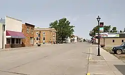
At the 2016 Census of Population, Saskatchewan 193 designated places,[3] a decrease from 194 in 2011.[4] Designated place types in Saskatchewan include 40 dissolved municipalities, 9 northern settlements, 143 organized hamlets, and a single retired population centre.[5] In 2016, the 193 designated places had a cumulative population of 9,615 and an average population of 50. Saskatchewan's largest designated place is Gravelbourg with a population of 1,083.[5]
List
| Total designated places | — | 9,615 | 9,373 | +2.6% | 121.8 | 78.9/km2 |
| Province of Saskatchewan | — | 1,098,352 | 1,033,381 | +6.3% | 588,243.54 | 1.9/km2 |
See also
- List of census agglomerations in Saskatchewan
- List of cities in Saskatchewan
- List of communities in Saskatchewan
- List of ghost towns in Saskatchewan
- List of hamlets in Saskatchewan
- List of Indian reserves in Saskatchewan
- List of municipalities in Saskatchewan
- List of population centres in Saskatchewan
- List of resort villages in Saskatchewan
- List of rural municipalities in Saskatchewan
- List of towns in Saskatchewan
- List of villages in Saskatchewan
Notes
- One of two parts of Crystal Lake.
- One of two parts of Crystal Lake.
References
- "2006 Census Dictionary, Figure 20: Hierarchy of standard geographic units for dissemination, 2006 Census". Statistics Canada. November 20, 2009. Retrieved May 5, 2012.
- "Dictionary, Census of Population, 2016: Designated place (DPL)". Statistics Canada. February 8, 2017. Retrieved September 2, 2021.
- "Table 1.1: Geographic areas by province and territory, 2016 Census". Statistics Canada. February 8, 2017. Retrieved August 28, 2021.
- "Census Dictionary: Table 1 – Geographic units by province and territory, 2011 Census". Statistics Canada. January 30, 2012. Retrieved May 5, 2012.
- "Population and dwelling counts, for Canada, provinces and territories, and designated places, 2016 and 2011 censuses – 100% data (Saskatchewan)". Statistics Canada. February 7, 2018. Retrieved August 30, 2021.
| Provinces | |
|---|---|
| Territories |
|
| |

.svg.png.webp)