Matapouri
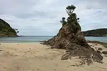
Matapouri (Māori: Matapōuri) is a coastal settlement in the Whangarei District of Northland, New Zealand.[1][2][3] It is 7 km north of Tutukaka and 35 km north-east of Whangarei,[4][5][6] in an area known as the Tutukaka Coast. Matapouri is described by the Whangarei District Council as "an archetypal Kiwi bach settlement".[7] Holiday homes make up 90 percent of the houses and at holiday times the number of residents swells to seven times its permanent population[8] of 372 (as of 2010).[7]
Matapouri | |
|---|---|
| Matapōuri | |
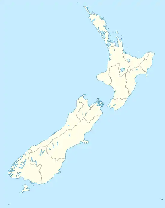  Matapouri Location in New Zealand | |
| Coordinates: 35°33′55″S 174°30′15″E | |
| Country | New Zealand |
| Region | Northland Region |
| District | Whangarei District |
History
The early European settlement of Matapouri was based on the milling and transport of timber. The first school was built in 1899 and the first recorded store in 1912.[9]
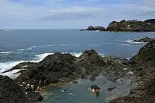
Te Wai o Te Taniwha, the Mermaid Pools, were a major tourist destination at Matapouri, but was closed indefinitely in 2019, due to a decision made by the local Māori authorities, Te Whanau ā Rangiwhakaahu Hapū Trust, to close the Pools due to too many irresponsible tourists.[10]
Demographics
Matapouri
The permanent population of Matapouri was 372 (as of 2010).[7]
Matapouri-Tutukaka
| Year | Pop. | ±% p.a. |
|---|---|---|
| 2006 | 1,203 | — |
| 2013 | 1,347 | +1.63% |
| 2018 | 1,692 | +4.67% |
| Source: Statistics New Zealand[11] | ||
The statistical area of Matapouri-Tutukaka, which includes the settlement of Tutukaka and a large rural area, 78 square kilometres in total,[12] had a population of 1,692 at the 2018 New Zealand census, an increase of 345 people (25.6%) since the 2013 census, and an increase of 489 people (40.6%) since the 2006 census. There were 657 households. There were 846 males and 846 females, giving a sex ratio of 1 male per female. Of the total population, 297 people (17.6%) were aged up to 15 years, 198 (11.7%) were 15 to 29, 834 (49.3%) were 30 to 64, and 363 (21.5%) were 65 or older. Figures may not add up to the total due to rounding.
Ethnicities were 89.4% European/Pākehā, 17.7% Māori, 2.5% Pacific peoples, 1.8% Asian, and 2.1% other ethnicities. People may identify with more than one ethnicity. The percentage of people born overseas was 22.0, compared with 27.1% nationally. Although some people objected to giving their religion, 64.0% had no religion, 26.6% were Christian, and 3.4% had other religions.
Of those at least 15 years old, 384 (27.5%) people had a bachelor or higher degree, and 159 (11.4%) people had no formal qualifications. The median income was $32,300. The employment status of those at least 15 was that 630 (45.2%) people were employed full-time, 249 (17.8%) were part-time, and 36 (2.6%) were unemployed.[11]
Marae
Matapōuri Marae is a meeting ground for Ngāti Rehua, Ngāti Toki-ki-te-Moananui of Ngātiwai, and Te Whānau a Rangiwhaakahu of Te Āki Tai.[13] It includes Te Tokomanawa o te Aroha meeting house.[14]
References
Citations
- "New Zealand's favourite family beaches revealed". NZ Herald. 20 January 2017. ISSN 1170-0777. Retrieved 15 October 2017.
- "Matapouri Bay". www.tutukakacoastnz.com. Retrieved 15 October 2017.
- "Matapouri and Woolleys Bay Whangarei District Council". www.wdc.govt.nz. Retrieved 15 October 2017.
- Dinsdale, Mike (4 October 2017). "Australian tourism campaign for Northland ruled a success". NZ Herald. ISSN 1170-0777. Retrieved 15 October 2017.
- "Matapouri Estuary". New Zealand Geographic. Retrieved 15 October 2017.
- "Matapouri Bay | Northland & Bay of Islands, New Zealand". www.newzealand.com. Retrieved 15 October 2017.
- "Whangarei District Growth Strategy", p. 199.
- "Whangarei District Growth Strategy", p. 76.
- "Whangarei District Growth Strategy", p. 202.
- Moger, Laine (15 February 2019). "Matapouri Mermaid Pools closes indefinitely due to tourists' rubbish". Stuff.
- "Statistical area 1 dataset for 2018 Census". Statistics New Zealand. March 2020. Matapouri-Tutukaka (105600). 2018 Census place summary: Matapouri-Tutukaka
- "Matapouri-Tutukaka". .id consulting pty ltd. Retrieved 3 April 2021.
- "Te Kāhui Māngai directory". tkm.govt.nz. Te Puni Kōkiri.
- "Māori Maps". maorimaps.com. Te Potiki National Trust.
Works cited
- "Whangarei District Growth Strategy" (PDF). Whangarei District Council. 2010. Archived (PDF) from the original on 17 February 2021. Retrieved 3 April 2021.