Norwell, Queensland
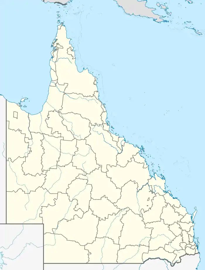
Norwell is a rural locality in the City of Gold Coast, Queensland, Australia.[2] In the 2016 census Norwell had a population of 200 people.[1]
| Norwell Gold Coast, Queensland | |||||||||||||||
|---|---|---|---|---|---|---|---|---|---|---|---|---|---|---|---|
 Canefields, Norwell, circa 1915 | |||||||||||||||
  Norwell | |||||||||||||||
| Coordinates | 27.7769°S 153.3125°E | ||||||||||||||
| Population | 200 (2016 census)[1] | ||||||||||||||
| • Density | 7.7/km2 (20/sq mi) | ||||||||||||||
| Postcode(s) | 4208 | ||||||||||||||
| Area | 26.1 km2 (10.1 sq mi) | ||||||||||||||
| Time zone | AEST (UTC+10:00) | ||||||||||||||
| Location |
| ||||||||||||||
| LGA(s) | City of Gold Coast | ||||||||||||||
| State electorate(s) | Coomera | ||||||||||||||
| Federal division(s) | Fadden | ||||||||||||||
| |||||||||||||||
Geography
Norwell is in the north of the City of Gold Coast. It is bounded to the east by Jacobs Well, to the south by Pimpama, to the west by Ormeau, and to the north by Gilberton and Woongoolba.
History
In the late 1800s, the farming district located between the Pimpama River and the Logan River called Pimpama Island and encompasses the modern localities of Jacobs Well, Norwell, Steiglitz and Woongoolba. It was referred to as an island because there were a number of lagoons and swamps that isolated the area during the wet season; however, this disadvantage made it good land for growing sugar cane.[3]
Norwell was named after the Norwell sugar plantation which was owned by William Pidd in the 1870s.[4]
Norwell State School opened on 17 January 1910 and closed on 30 April 1971.[5][6]
In the 2011 census, Norwell had a population of 282 people.[7]
In the 2016 census Norwell had a population of 200 people.[1]
Education
Jacobs Well Environmental Education Centre is an Outdoor and Environmental Education Centre on the corner of Behms & Pimpama-Jacobs Well Roads (27.7824°S 153.3349°E).[8][9]
There are no conventional schools in Norwell. The nearest primary schools are Woongoolba State School in neighbouring Woongoolba to the north and Ormeau State School in neighbouring Ormeau to the west. The nearest secondary school is Ormeau Woods State High School in Ormeau.[10]
Amenities
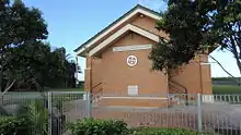
Today, the only public building in the district is the Apostolic church, which was built in 1963.[4]
Attractions

Holden operate a driver training facility at Norwell. In addition to driver safety programs at a number of levels of experience, the centre also offers 4WD training and performance driving courses and "hot laps" in a high-performance car.[11] It is also the base for Paul Morris Motorsport and MARC Cars Australia.[12]
References
 |
Wikimedia Commons has media related to Norwell, Queensland. |
- Australian Bureau of Statistics (27 June 2017). "Norwell (SSC)". 2016 Census QuickStats. Retrieved 20 October 2018.

- "Norwell – locality in City of Gold Coast (entry 46071)". Queensland Place Names. Queensland Government. Retrieved 27 December 2020.
- "Woongoolba History". City of Gold Coast Council. Archived from the original on 7 April 2014. Retrieved 5 April 2014.
- "Norwell History". City of Gold Coast Council. Archived from the original on 7 April 2014. Retrieved 4 April 2014.
- "Opening and closing dates of Queensland Schools". Queensland Government. Retrieved 4 April 2014.
- "Agency ID 6494, Norwell State School". Queensland State Archives. Retrieved 4 April 2014.
- Australian Bureau of Statistics (31 October 2012). "Norwell". 2011 Census QuickStats. Retrieved 4 April 2014.
- "State and non-state school details". Queensland Government. 9 July 2018. Archived from the original on 21 November 2018. Retrieved 21 November 2018.
- "Jacobs Well Environmental Education Centre". Archived from the original on 24 November 2018. Retrieved 21 November 2018.
- "Queensland Globe". State of Queensland. Retrieved 4 March 2021.
- "About the Driving Centre". Holden. Retrieved 14 April 2014.
- "Motor Sport". Morris International. Archived from the original on 25 February 2021. Retrieved 4 March 2021.