Steiglitz, Queensland
Steiglitz is a rural coastal town and locality in the City of Gold Coast, Queensland, Australia.[2][3] In the 2016 census the locality of Steiglitz had a population of 705 people.[1]
| Steiglitz Gold Coast, Queensland | |||||||||||||||
|---|---|---|---|---|---|---|---|---|---|---|---|---|---|---|---|
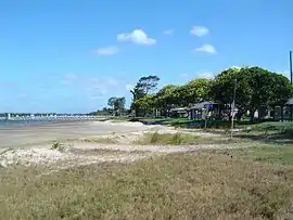 Foreshore and Tipplers Passage at Cabbage Tree Point, 2014 | |||||||||||||||
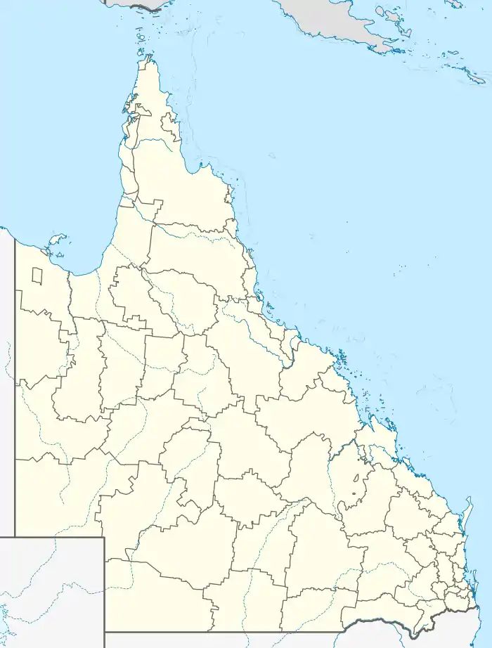  Steiglitz | |||||||||||||||
| Coordinates | 27.7441°S 153.3533°E | ||||||||||||||
| Population | 705 (2016 censusc)[1] | ||||||||||||||
| • Density | 61.84/km2 (160.2/sq mi) | ||||||||||||||
| Postcode(s) | 4207 | ||||||||||||||
| Area | 11.4 km2 (4.4 sq mi) | ||||||||||||||
| Time zone | AEST (UTC+10:00) | ||||||||||||||
| Location |
| ||||||||||||||
| LGA(s) | City of Gold Coast | ||||||||||||||
| State electorate(s) | Coomera | ||||||||||||||
| Federal division(s) | Fadden | ||||||||||||||
| |||||||||||||||
Geography
Steiglitz is bounded to the east by Moreton Bay, to the south by Jacobs Well, to the west and north by Woongoolba.
Cabbage Tree Point is a headland jutting into Moreton Bay (27.7344°S 153.3580°E). [4]
The town in Steiglitz is located at Cabbage Tree Point and is often referred to by that name. The name refers to the cabbage tree palms that grew in the area.[5]
History
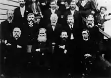
The district is named after Stegelitz, Germany, the home town of the pioneer family Kleingschmidt.[6]
In the late 1800s, the farming district located between the Pimpama River and the Logan River called Pimpama Island and encompasses the modern localities of Jacobs Well, Norwell, Steiglitz and Woongoolba. It was referred to as an island because there were a number of lagoons and swamps that isolated the area during the wet season; however, this disadvantage made it good land for growing sugar cane.[7]
German immigrant families settled in the area in the 1870s. Lutheran services were held in private homes until the first church was erected in 1882, being replaced by the present church in 1908. The church was renovated in 1930.[8]
The Rocky Point Sugar Mill was established by Carl Heinrich Heck in 1878 on Mill Road (and crosses the boundary between Woongoolba and Steiglitz). Despite being one of the oldest sugar mills in Australia, it is still privately owned by the Heck Group, a family company of five generations. There were once other sugar mills in the area, but they have now closed and Rocky Point has expanded to replace their lost capacity.[9] A co-generation plant was added in 2001-2.[10][11]
In the 2011 census, Steiglitz had a population of 441 people.[12]
In the 2016 census the locality of Steiglitz had a population of 705 people.[1]
Economy
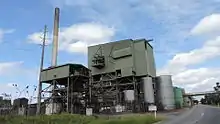
Rocky Point Sugar Mill is a sugar mill at 102-120 Mill Road (27.7338°S 153.3272°E), extending across the road into neighbouring Woongoolba.[13][10] The mill's co-generation plant produces almost 200GWh of electricity per annum from renewable sources, which can be used in the mill and/or exported, making Rocky Point one of the most energy-efficient sugar mills in Australia.[11]
Education
There are no schools in Steiglitz. The nearest primary school is Woongoolba State School in neighbouring Woongoolba to the west. The nearest government secondary school is Ormeau Woods State High School in Ormeau to the south-west.[14]
Amenities
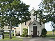
Bethlehem Lutheran Church is at 1281 Stapylton Jacobs Well Road (27.7459°S 153.3258°E).[15] Bethlehem Preschool and Kindergarten is immediately adjacent at 1279 Stapylton Jacobs Well Road (27.7459°S 153.3252°E).[15]
Woongoolba Bowls Club is a sports and community club at 324 Cabbage Tree Point Road (27.7346°S 153.3550°E).[15] The Gold Coast City Council operates a fortnightly mobile library service which visits the Bowls Club on Cabbage Tree Point Road.[16]
Horizon Shores Marina is a 27.3-hectare (67-acre) marina at 80 Cabbage Tree Point Road (27.7539°S 153.3474°E).[17]
Rudy Maas Marina is a 1.1-hectare (2.7-acre) marina at 82 Cabbage Tree Point Road (27.7507°S 153.3503°E).[17]
There is a boat ramp at Charlie Hammel Park at the far end of Cabbage Tree Point Road (27.7349°S 153.3587°E). It is managed by the Gold Coast City Council.[18]
There are a number of parks in the area, including:
- Behm Creek Reserve (27.7576°S 153.3483°E)[19]
- Cabbage Tree Point Conservation Park (27.7259°S 153.3518°E)[19]
- Charlie Hammel Park (27.7352°S 153.3576°E)[19]
- Floodgate Area (27.7266°S 153.3480°E)[19]
- Lake Royal Palms Park (27.7361°S 153.3538°E)[19]
- Rocky Point Reserve (27.7158°S 153.3428°E)[19]
- Short Cut Road Reserve (27.7444°S 153.3340°E)[19]
- Sugar Mill Reserve (27.7352°S 153.3374°E)[19]
References
- Australian Bureau of Statistics (27 June 2017). "Steiglitz (SSC)". 2016 Census QuickStats. Retrieved 20 October 2018.

- "Steiglitz – town in City of Gold Coast (entry 32327)". Queensland Place Names. Queensland Government. Retrieved 27 December 2020.
- "Steiglitz – locality in City of Gold Coast (entry 46101)". Queensland Place Names. Queensland Government. Retrieved 27 December 2020.
- "Cabbage Tree Point – point in City of Gold Coast (entry 5635)". Queensland Place Names. Queensland Government. Retrieved 27 December 2020.
- "Cabbage Tree Point History". City of Gold Coast Council. Archived from the original on 7 April 2014. Retrieved 4 April 2014.
- "Place Names of South-East Queensland, Australia". Piula Publications. Retrieved 18 April 2014.
- "Woongoolba History". City of Gold Coast Council. Archived from the original on 7 April 2014. Retrieved 5 April 2014.
- "History". Alberton Lutheran Parish. Archived from the original on 2 March 2021. Retrieved 14 March 2021.
- "A brief history - Carl Heinrich Heck". Heck Group. Archived from the original on 7 April 2014. Retrieved 4 April 2014.
- "Rocky Point Sugar Mill". Heck Group. Archived from the original on 14 February 2016. Retrieved 14 March 2021.
- "Introduction". Heck Group. Archived from the original on 7 March 2021. Retrieved 14 March 2021.
- Australian Bureau of Statistics (31 October 2012). "Steiglitz (Qld)". 2011 Census QuickStats. Retrieved 4 April 2014.
- "Landmark Areas - Queensland". Queensland Open Data. Queensland Government. 18 November 2020. Archived from the original on 21 November 2020. Retrieved 21 October 2020.
- "Queensland Globe". State of Queensland. Retrieved 15 March 2021.
- "Building points - Queensland". Queensland Open Data. Queensland Government. 17 November 2020. Archived from the original on 25 November 2020. Retrieved 25 November 2020.
- "Mobile Library 2018 timetable" (PDF). Gold Coast City Council. Archived (PDF) from the original on 30 January 2018. Retrieved 30 January 2018.
- "Marinas - Queensland". Queensland Open Data. Queensland Government. 18 November 2020. Archived from the original on 24 November 2020. Retrieved 24 October 2020.
- "Recreational Boating Facilities Queensland". Queensland Open Data. Queensland Government. 12 November 2020. Archived from the original on 22 November 2020. Retrieved 22 November 2020.
- "Land for public recreation - Queensland". Queensland Open Data. Queensland Government. 20 November 2020. Archived from the original on 22 November 2020. Retrieved 22 November 2020.
External links
 |
Wikimedia Commons has media related to Steiglitz, Queensland. |
- "Steiglitz". Queensland Places. Centre for the Government of Queensland, University of Queensland.