Sirajganj
Sirajganj is a city in north-central region in Bangladesh, lying on the west of Jamuna River, about 110 km (68 mi) northwest of Dhaka.
Sirajganj
সিরাজগঞ্জ | |
|---|---|
City | |
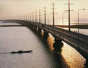 The Jamuna Bridge | |
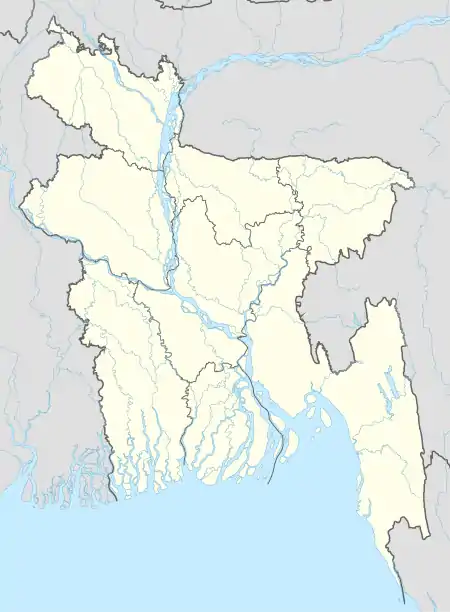  Sirajganj | |
| Coordinates: 24°27′N 89°45′E | |
| Country | Bangladesh |
| Division | Rajshahi Division |
| District | Sirajganj District |
| Establishment | Early 1800s |
| Municipality | 1869 |
| Administrative district | 1984 |
| Government | |
| • Type | Municipality |
| • Mayor | Sayed Abdur Rouf Mukta |
| Area | |
| • Total | 28.49 km2 (11.00 sq mi) |
| Elevation | 16 m (52 ft) |
| Population (2016)[1] | |
| • Total | 297,230 |
| • Density | 10,000/km2 (27,000/sq mi) |
| Time zone | UTC+6 (BST) |
| Website | District website |
Overview
Sirajganj is the main town in Sirajganj District. It consists of 15 wards and 52 mohallas. The city has a population around 297230. It was once considered a principal jute trade centre. It still has an important jute industry named Jatiyo Jute Mill. Its jute mills were among the first in the British Bengal area.
In modern days, it is still an important place for trading as it is located in a very convenient geographical location having a well-developed connectivity via road, rail and river with rest of the country.
History
During British rule, Sirajganj was a town in the Pabna District of Eastern Bengal and Assam. Its location on the right bank of the Jamuna River or main stream of the Brahmaputra was a six-hour journey by steamer from the railway terminal at Goalundo. It was the chief river mart for jute in northern Bengal, with several jute presses. The jute mills were closed after the 1897 Assam earthquake. The population according to the 1901 census of India was 23,114.[2]
Transportation
Jamuna Bridge, the 2nd largest bridge of Bangladesh, is situated here. Through this bridge, it is connected to Dhaka, the capital, and the eastern part of country with both road and railways. Sirajganj is a river port, as well. Besides, it has a well-developed connection with northern and southern Bangladesh. Pipul Baria Bazar is one of the famous place in this road in Sirajganj District.
Cycle rickshaws and auto rickshaws are the main mode of transport within the city area. The service is available almost everywhere in Sirajganj District, which is affordable for all.
Education
There are eight colleges in Sirajganj: Darul Islam Women's College, Islamia Government College, Jewels Oxford College, Moulana Bhasani Degree College, Rajab Ali Memorial Science College, Rashidozzoha Government Women's College, Sirajganj Government College, and Uttaran Women's College. Sirajganj Collectorate School & College, Sirajganj Police Line School and College, Sabuj Kanan School & College.[3]
According to Banglapedia, B.L. Government High School, founded in 1869, Harina Baghbati High School (1866), Saleha Ishaque Government Girls' High School (1937), and Victoria High School (1898), Subgacha Tenglahata Rafatullah High School (1944), Mechra High School (1948), Rupsha High School (1989) are notable secondary schools.[4]
Ghorachara High School is one of the prominent school situated in Ghorachara village, Sadar Upazila, Sirajganj District.
Arts and festivals
- Handloom Fest Sirajganj
- Rabindra Festival Shahzadpur, Sirajganj
References
- "এক নজরে সিরাজগঞ্জ পৌরসভা". সিরাজগঞ্জ জেলা (in Bengali). Retrieved 30 September 2021.
- Chisholm, Hugh, ed. (1911). . Encyclopædia Britannica (11th ed.). Cambridge University Press.
- "List of Colleges". Department of Secondary and Higher Education. Retrieved 6 September 2020.
- Islam, Kamrul (2012). "Sirajganj Sadar Upazila". In Islam, Sirajul; Jamal, Ahmed A. (eds.). Banglapedia: National Encyclopedia of Bangladesh (Second ed.). Asiatic Society of Bangladesh.
External links
 |
Wikivoyage has a travel guide for Sirajganj District. |
- Islam, Kamrul (2012). "Sirajganj District". In Islam, Sirajul; Jamal, Ahmed A. (eds.). Banglapedia: National Encyclopedia of Bangladesh (Second ed.). Asiatic Society of Bangladesh.