Aravan District
Aravan is a district of Osh Region in south-western Kyrgyzstan. The administrative seat lies at Aravan.[2] Its area is 1,340 square kilometres (520 sq mi) (making it the smallest district in Osh Region), and its resident population was 106,134 in 2009.[1]
Aravan | |
|---|---|
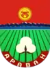 Coat of arms | |
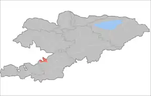 | |
| Country | Kyrgyzstan |
| Region | Osh Region |
| Area | |
| • Total | 1,340 km2 (520 sq mi) |
| Population (2009)[1] | |
| • Total | 106,134 |
| • Density | 79/km2 (210/sq mi) |
| Time zone | UTC+6 |
Geography
The district lies in the south-east part of the Fergana Valley. It borders with the Chil'-Ustun Range in the north-east, and with the Keklik-Too mountains in the east. In the south, the district is occupied by the Jalgyz-Archa and the Ulu-Too mountains. In the west, it borders with Kerkidon reservoir. In the north, the topography of the area is flat, and in the south it rises, changing to hilly terrain. The difference in absolute elevations from north to south is 500-750 meters. [3]
Demographics
As of 2009, Aravan District contained 48 villages.
| Year | Pop. | ±% |
|---|---|---|
| 1970 | 43,894 | — |
| 1979 | 53,220 | +21.2% |
| 1989 | 71,214 | +33.8% |
| 1999 | 91,438 | +28.4% |
| 2009 | 106,134 | +16.1% |
| Note: de jure population; Source:[1] | ||
Ethnic composition
According to the 2009 Census, the ethnic composition of the Aravan District (de jure population) was:[1]
| Ethnic group | Population | Proportion of Aravan District population |
|---|---|---|
| Uzbeks | 62,281 | 58.7% |
| Kyrgyzs | 42,049 | 39.6% |
| Azerbaijanis | 760 | 0.7% |
| Tajiks | 542 | 0.5% |
| Tatars | 135 | 0.1% |
| other groups | 367 | 0.4% |
Rural communities and villages
In total, Aravan District include 48 settlements in 8 rural communities (ayyl aymagy). Each rural community can consist of one or several villages. The rural communities in Aravan District are:[2][4]
- Аllya Anarov (seat: Jangy-Aravan; incl. Aravan, Achchy, Kara-Bulak, Sasyk-Üngkür, Madaniyat and Pakhta-Abad)
- Chek-Abad (seat: Köchübaev; incl. Agronom, Jakshylyk, Jar-Kyshtak, Kukalapash, Maksim-Tobu, Pakhtachy and Tölöykön)
- Kerme-Too (seat: Gulbakhor; incl. Kichik-Alay, Kündölük, Maydan-Tal, Ming-Teke, Sary-Bulak and Chogom)
- Mangyt (seat: Mangyt; incl. Kesek, Kyzyl-Korgon, Tölöykön and Jangy-Aryk)
- Nurabad (seat: Kayragach-Aryk; incl. Kakyr-Piltan and Langar)
- S.Yusupov (seat: Aravan; incl. Karrak, Oktyabr, Erke-Kashka and Sutkor)
- Tepe-Korgon (seat: Tepe-Korgon; incl. Arap, Internatsional, Kesov, Uygur-Abad, Chertik, Yangi-Abad and Yangi-Yul)
- Töö-Moyun (seat: Khauz; incl. Ak-Shor, Jeke-Miste, Kerkidan, Nayman, Sary-Tash and Syrt)
References
- "2009 population census of the Kyrgyz Republic: Osh Region" (PDF). Archived from the original (PDF) on 10 August 2011. Retrieved 2011-03-22.
- "Classification system of territorial units of the Kyrgyz Republic" (in Kyrgyz). National Statistics Committee of the Kyrgyz Republic. May 2021. pp. 48–50.
- Мониторинг, прогнозирование опасных процессов и явлений на территории Кыргызской Республики [Monitoring and Forecasting of Natural Hazards in Kyrgyz Republic] (PDF) (in Russian) (18th ed.). Ministry of Emergency Situations of Kyrgyz Republic. 2021. p. 331. Retrieved December 9, 2021.
- List of Rural Communities of Kyrgyzstan Archived 2010-02-09 at the Wayback Machine
| North Kyrgyzstan |
|  Raions of Kyrgyzstan | ||||||||||
|---|---|---|---|---|---|---|---|---|---|---|---|---|
| South Kyrgyzstan |
| |||||||||||
Places adjacent to Aravan District | |
|---|---|


