Roads in Georgia (country)
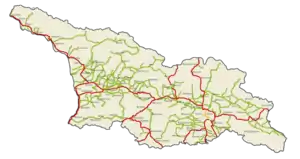
A network of trunk highways connects the Georgian capital Tbilisi, where more than a third of the national population lives, with neighboring countries. This is the backbone for a network of domestic (or state) roads that connect vital regions, such as Kakheti and Imereti wine regions, Racha-Lechkhumi and Kvemo Svaneti mountain regions or Samtskhe-Javakheti highlands with each other and the capital.
| Georgia road network | |
|---|---|
.svg.png.webp)   | |
 | |
| System information | |
| Maintained by the Roads Department of Ministry of Regional Development and Infrastructure of Georgia (GeoRoad) | |
| Length | 20,964 km[1][2] (13,026 mi) |
| Formed | 1996[3] |
| Highway names | |
| International roads | ს x - ს xx (S) |
| State roads | შ x - შ xxx (Sh) |
| Local roads | ა x - ა xxx (A, per municipality) |
| System links | |
| |
The current classification of roads has its root in the mid-1990s and recognizes three categories of (numbered) roads: international (S), domestic (Sh) and local (A). Total length of these roads is approximately 21,000 kilometres (13,000 mi) by 2020,[2] divided over ~1,600 km (990 mi) international routes, ~5,400 km (3,400 mi) domestic state routes and ~14,000 km (8,700 mi) local roads. Local classified roads are administered at the municipal level. This page provides an overview of the first two groups, which are commonly used on maps and road signs alike. Direction signs are generally in both Georgian and Latin script.
Classification
.jpg.webp)
The foundation of the current Georgian route network was laid as late as the 1980s. Only in 1982 the Soviet Union reorganized its public road numbering system to a three-tier classification system. Prior to that, very few highways had a public number, three of which were in the Georgian SSR.
Since 1996 the Georgian road network has roads of "international", "domestic", and "local" importance based on an ordinance of that year that replaced the numbering system inherited from the Soviet Union.[3] The ordinance was officially adopted in law in 1997 and replaced in the old law the words "trunk" ("მაგისტრალური", "magist’raluri", M) with "international" and "republican" ("რესპუბლიკური", "resp’ublik’uri", R) with "domestic".[4]
The 1996 ordinance replaced the old designations M, A and R and redefined the routes and their numbers with a new list added to the ordinance. The road numbers are prefixed with
- ს (S) which stands for "საერთაშორისო მნიშვნელობის გზა" (Saertashoriso mnishvnelobis gza, road of international importance);
- შ (Sh) which stands for "შიდა მნიშვნელობის გზა" (Shida mnishvnelobis gza, road of domestic importance);
- ა (A) which stands for "ადგილობრივი მნიშვნელობის გზა" (Adgilobrivi mnishvnelobis gza, road of local importance).
In short, most of the old A routes (and the only M route) became S-highways and R routes became Sh-roads. While the list of international and domestic roads is "usually reviewed every 5 years" and approved by the government of Georgia according to the law on motor roads,[5] local roads are designated by individual municipalities since a 2007 decentralization reform. Each municipality administers up to hundreds ა (A) roads. In the Autonomous Republics of Adjara and Abkhazia local ა (A) roads are reviewed every 3 years by the autonomous executive branch. For Abkhazia this would be its government-in-exile. The law on roads defines
- roads of international importance as roads connecting administrative, important industrial and cultural centers of Georgia and other countries;
- roads of domestic importance as roads connecting Tbilisi with cultural or economic centers, capitals of the Autonomous Republics and administrative centers of the regions, as well as access to highways of international and domestic importance and connecting important centers of the Autonomous Republics;
- roads of local importance as roads connecting administrative centers of municipalities with their settlements, roads connecting settlements with international and domestic roads and between settlements as well as roads connecting tourist, recreation, sport, historical, cultural or scientific destinations with municipal centers.
Network
.jpg.webp)
The numbered route network in Georgia has been gradually expanding. Since the introduction of the current classification one S-road has been added (S13 in 2011), while the Sh route network saw a major expansion in 2006. Adjustment in highway lengths occur due to realignments. With the ongoing realignment of major highways, further changes in length can be expected. The list of Sh-roads has grown from 73 in 1996 to 205 in 2017. The table below does not specify A-roads of local importance as data is generally not very consistent or complete to create a reliable picture. S and Sh roads fall under the responsibility of the Roads Department of the Ministry of Regional Development and Infrastructure of Georgia while local A roads are the responsibility of municipalities.
| 1996[3] | 2005[6] | 2006[7] | 2008[8] | 2011[9] | 2014[10] | 2017[1] | |||||||||||||||||||||||
|---|---|---|---|---|---|---|---|---|---|---|---|---|---|---|---|---|---|---|---|---|---|---|---|---|---|---|---|---|---|
| ს-roads (S) | Amount | 12 | 12 | 12 | 12 | 13 | 13 | 13 | |||||||||||||||||||||
| Length | 1581 km 982 mi |
1581 km 982 mi |
1565 km 972 mi |
1563 km 971 mi |
1603 km 996 mi |
1603 km 996 mi |
1595 km 991 mi | ||||||||||||||||||||||
| შ-roads (Sh) | Amount | 73 | 74 | 194 | 199 | 200 | 202 | 205 | |||||||||||||||||||||
| Length | 3392 km 2108 mi |
3417 km 2123 mi |
5446 km 3384 mi |
5446 km 3384 mi |
5308 km 3298 mi |
5298 km 3292 mi |
5373 km 3339 mi | ||||||||||||||||||||||
| Total length | 4973 km 3090 mi |
4998 km 3106 mi |
7011 km 4356 mi |
7009 km 4355 mi |
6911 km 4294 mi |
6901 km 4288 mi |
6968 km 4330 mi | ||||||||||||||||||||||
| The table is based on successive decreed lists for "Determination of International, Domestic and Local Roads of Georgia" of 1996,[3] 2005,[6] 2006,[7] 2008,[8] 2011,[9] 2014[10] and 2017[1] | |||||||||||||||||||||||||||||
List of roads of international importance
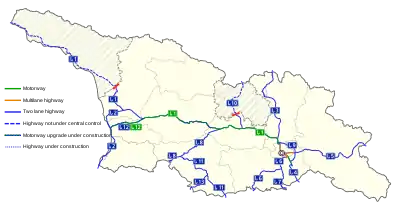
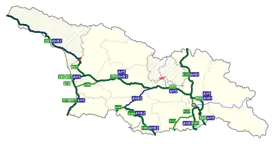
The S-roads "of international importance" (ს1 to ს13) connect Georgia with neighboring Azerbaijan (to 2 border crossings), Armenia (3), Turkey (3) and Russia (3, two are outside of Georgian control). Eleven S-roads terminate at a border (crossing), while two act as connectors within the S-network (S9 and S12). Two S-routes run partially through breakaway Abkhazia (S1) and South Ossetia (S10). The sections within these areas are beyond control of Georgian authorities and through travel is not possible from/to Tbilisi controlled territory, except for foot passage into Abkhazia. However, these roads have active border crossings into Russia and serve traffic between Russia and both regions.
Most of the ~1,600 kilometres (990 mi) of S-roads are in a good or acceptable condition with an asphalt or concrete surface. Typically they have been built as two-lane highway. Limited sections have been upgraded since 2006 to motorway, expressway or limited-access two lane highway with hard shoulders in the spirit of a super-two and this is gradually expanding. These upgrades are mostly related to the E60/E70 East-West Highway project, an internationally sponsored project to create an (east-west) transport corridor through Georgia, connecting Azerbaijan and Armenia with Turkey. Most S-routes are part of European E-roads which are often displayed together with the Georgian road numbers. Three Asian Highway Network routes traverse Georgia, but these are not signposted. One explanation for that is that Georgia identifies itselves explicitly as European.[11]
| Number | E Route | AH Route | Name | Length (km) | Notes |
|---|---|---|---|---|---|
 ს 1 ს 1 |
   |
   |
Tbilisi - Senaki - Leselidze | 537 | Tbilisi - Surami and Argveta - Kutaisi - Samtredia have been (re)built as motorway (170km). 58 km of new motorway construction Surami - Argveta via Rikoti Pass is ongoing with expected opening in 2023.[12][13] |
 ს 2 ს 2 |
 |
|
Senaki - Poti - Sarpi | 119 | S2 upgrade is ongoing: the 32 km Kobuleti Bypass has been rebuilt as super-two with 90 km/h speed limit, as will be the 14 km Batumi Bypass. Kobuleti to Grigoleti (S12) is under construction as motorway (14 km).[14][15] |
 ს 3 ს 3 |
|
|
Mtskheta - Stepantsminda - Larsi | 139 | Also called Georgian Military Road. In 2021 construction started of the 23 km Khveseti - Kobi section to bypass Gudauri and the Jvari Pass with a 2+1 road and a 9 km two-lane tunnel, the longest in the Caucasus.[16][17][18][19] |
 ს 4 ს 4 |
|
|
Tbilisi - Red Bridge | 57 | Rustavi - Red Bridge will be rerouted as 32 km motorway, including a new motorway section linking the S4 with the S7 to Armenia. The EU will provide financial support.[20] |
| ს 5 |
Tbilisi – Bakurtsikhe – Lagodekhi | 160 | Tbilisi (S9) - Sagarejo (35km) will be constructed as motorway.[21] | ||
 ს 6 ს 6 |
|
|
Ponichala – Marneuli – Guguti | 98 | |
 ს 7 ს 7 |
 |
|
Marneuli – Sadakhlo | 34 | Rebuilding 16 km of the S7 to motorway plus 14 km new motorway to connect with S4 to Rustavi is in preparation.[20] |
 ს 8 ს 8 |
 |
|
Khashuri – Akhaltsikhe – Vale | 97 | |
 ს 9 ს 9 |
|
|
Tbilisi Bypass | 49 | |
 ს 10 ს 10 |
Gori – Tskhinvali – Gupta – Java – Roki | 92 | |||
 ს 11 ს 11 |
|
|
Akhaltsikhe – Ninotsminda | 112 | |
.svg.png.webp)  ს 12 ს 12 |
 |
Samtredia - Lanchkhuti - Grigoleti | 57 | The entire S12 is under construction as new motorway. In July 2020 Japana-Lanchkhuti (14 km) opened.[22] Three other sections experience delays (see S12 page). | |
 ს 13 ს 13 |
Akhalkalaki - Kartsakhi | 36 |
This table is based on the last published list of roads by the Government of Georgia which is from 2017.[1] Some details in the table have been updated with actual developments, such as road length after opening of new sections.
List of roads of domestic importance
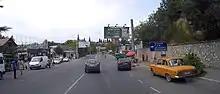
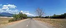
The vast network of nearly 5,400 km (3,400 mi) domestic შ Sh-roads connects vital regions with each other and the capital. By far most of these routes are relatively short, but some routes are quite long, up to nearly 200 km. The longer Sh-roads are interregional in nature while others are designed as part of a subregional network, provide access to the main S-highways or remote mountain valleys. The list of Sh-routes is slowly expanding. Recent additions შ203, შ204 and შ 205 are former parts of the S1 and S2 highways, renumbered to Sh-road after realignment of S1 and S2 sections. More of such additions can be expected with the ongoing and scheduled realignment of parts of key S-highways. At the same time, new regional routes are being built in mountain regions and elsewhere.
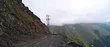
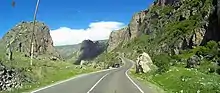
The condition of Sh-roads varies from excellent to horrid. From newly sealed (asphalt) to unsealed or lacking decades of reconstruction. This mixed picture also applies to long distance Sh-routes. That said, with the limited resources the state has, some key projects have been launched since 2006, and increasingly so since 2014. The Sh7 road to Mestia in the Svaneti mountain valley and the long distance Sh31 through the southern Samtskhe-Javakheti region were key regional road projects during the tenure of 3rd President Saakashvili. In more recent years other long and medium distance roads in the regions in partially or wholly terrible shape have been reconstructed, such as the Sh16 through Racha, the Sh26 to Shatili, the Sh38 across the Gombori mountains and others. Also, realignment of regional roads as bypass, such as the Sh42 Gurjaani-Bakurtsikhe Bypass,[23] is a point of attention. Overall, the quality of the regional road network is improving with the years, but large sections remain in bad (unsealed) condition under sometimes harsh climatic conditions, especially in the mountainous regions.
1-50
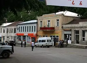
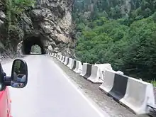
.jpg.webp)
.jpg.webp)
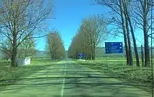


.png.webp)


51-100
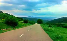

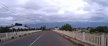
| Number | Name (route) | Length (km) |
|---|---|---|
 შ 51 შ 51 | Vartsikhe - Rokhi | 7,2 |
 შ 52 შ 52 | Tsqaltubo - Khoni | 15,2 |
 შ 53 შ 53 | Khoni - Matkhoji - Martvili | 15 |
 შ 54 შ 54 | Zestaponi - Baghdati | 18,8 |
 შ 55 შ 55 | Dzirula - Kharagauli - Moliti - Phona - Chumateleti | 51 |
 შ 56 შ 56 | Rikoti Tunnel Bypass | 4 |
 შ 57 შ 57 | Abastumani - Kanobili | 5 |
 შ 58 შ 58 | Khertvisi - Vardzia | 22,6 |
 შ 59 შ 59 | (km 101) - Kareli | 4,3 |
 შ 60 შ 60 | (km 81) - Gori - (km 87) | 5 |
 შ 61 შ 61 | Kaspi - Kavtiskhevi | 10,8 |
 შ 62 შ 62 | Igoeti - Akhmaji | 12 |
 შ 63 შ 63 | Igoeti - Kaspi - Akhalkalaki | 20,5 |
 შ 64 შ 64 | Narekvavi - Mtskheta - Railway Station | 6,4 |
 შ 65 შ 65 | Bagischala - Dusheti - Aragvispiri | 19,3 |
 შ 66 შ 66 | Rustavi - Gardabani - Vakhtangisi (Azerbaijan Border,  Highway R24) Highway R24) | 24,5 |
 შ 67 შ 67 | Gamarjveba - Rustavi | 7,4 |
 შ 68 შ 68 | Didi Dmanisi - Dmanisi - Gomareti - Bediani | 70,2 |
 შ 69 შ 69 | Kvareli - Mukuzani | 17 |
 შ 70 შ 70 | Telavi - Shakriani | 11,4 |
 შ 71 შ 71 | Bakuriani Circular Path | 3 |
 შ 72 შ 72 | Tirdznisi - Ditsi - Eredvi - Kheiti | 18,8 |
 შ 73 შ 73 | (km 30) - Poti Sea Port (Via Khobi st.) | 4,5 |
 შ 74 შ 74 | Motsameta Monastery Road | 1,5 |
 შ 75 შ 75 | Bakuriani Didveli Ski complex Road | 2,6 |
| Number | Name (route) | Length (km) |
 შ 76 შ 76 | Goderdzi Pass - Beshumi | 10 |
 შ 77 შ 77 | Salkhino - Dadiani Palace Road | 6,7 |
 შ 78 შ 78 | Hatsvali Ski complex Road | 6 |
 შ 79 შ 79 | Prometheus Cave Road | 2,2 |
 შ 80 შ 80 | Natanebi - Choloki Bridge | 8,1 |
 შ 81 შ 81 | Chokhatauri - Bakhmaro | 53 |
 შ 82 შ 82 | Ozurgeti - Ninoshvili - Lesa | 24,8 |
 შ 83 შ 83 | Chokhatauri - Zomleti | 15 |
 შ 84 შ 84 | Zugdidi - Jikhashkari - Chkhorotsqu | 26 |
 შ 85 შ 85 | Martvili - Taleri - Chkhorotsqu | 43 |
 შ 86 შ 86 | Nokalakevi - Ledzadzame - Didi Chkoni | 24,2 |
 შ 87 შ 87 | Khobi - Sajijao - Lesichine | 29,2 |
 შ 88 შ 88 | Zugdidi - Narazeni - Dzveli Khibula - Akhali khibula - Zubi | 23,8 |
 შ 89 შ 89 | Tsalenjikha - Obuji - Jikhashkari | 14,2 |
 შ 90 შ 90 | Darcheli - Ganmukhuri | 14 |
 შ 91 შ 91 | Taleri - Lebarde | 34 |
 შ 92 შ 92 | Martvili - Martvili Monastery | 1,3 |
 შ 93 შ 93 | Nosiri - Gejeti - Nokalakevi | 16,5 |
 შ 94 შ 94 | Tsalenjikha - Jvari - Jvarzeni | 12 |
 შ 95 შ 95 | Tsalenjikha - Lia - Pakhulani | 10,5 |
 შ 96 შ 96 | Tsalenjikha - Tsalenjikha Cathedral | 1,5 |
 შ 97 შ 97 | Shua Khorga - Kulevi | 16 |
 შ 98 შ 98 | Khobi - Akhalsopeli - Railway Platform | 10,5 |
 შ 99 შ 99 | Becho - Shikhra | 8,2 |
 შ 100 შ 100 | Khaishi - Sakeni - Omarishara | 58 |
101-150
| Number | Name (route) | Length (km) |
|---|---|---|
 შ 101 შ 101 | Zestaponi - Kitskhi - Kharagauli | 21 |
 შ 102 შ 102 |  (km 8) - Terjola - Zeda Alisubani - Tuzi - Kvatsikhe - Katskhi (km 8) - Terjola - Zeda Alisubani - Tuzi - Kvatsikhe - Katskhi | 28.4 |
 შ 103 შ 103 | Ianeti - Didi Jikhaishi - Khoni | 17.1 |
 შ 104 შ 104 | Kutaisi - Geguti - Sakulia - Bashi - Ianeti | 34 |
 შ 105 შ 105 | Vani - Sulori | 11.5 |
 შ 106 შ 106 | Shuamta - Chkvishi | 4.6 |
 შ 107 შ 107 | Vani - Gaghma Vani | 2 |
 შ 108 შ 108 | Kutaisi - Sapishkhia - Chognari | 4.7 |
 შ 109 შ 109 | Tkibuli - Sochkheti - Orpiri | 24 |
 შ 110 შ 110 | Gelati Monastery complex road | 2.6 |
 შ 111 შ 111 | Banoja - Sataplia | 6.1 |
 შ 112 შ 112 | Tskaltubo - Partskhanakanevi | 11.3 |
 შ 113 შ 113 | Giorgi Tsereteli Museum road | 1.1 |
 შ 114 შ 114 | Chiatura - Perevisa - Sveri - Tvalueti - Gezruli | 32 |
 შ 115 შ 115 | Shukruti - Usakhelo - Korbouli | 19.2 |
 შ 116 შ 116 | Matkhoji – Khidi - Gordi - Kinchkha | 19 |
 შ 117 შ 117 | (km 2) - Dzedzileti - Gelaveri | 20 |
 შ 118 შ 118 | Gordi - Nogha - Dzedzileti | 5.6 |
 შ 119 შ 119 | Chrebalo - Nikortsminda | 25.1 |
 შ 120 შ 120 | Tsesi - Uravi | 14.2 |
 შ 121 შ 121 | Saglolo – Chiora – Ghebi | 12 km |
 შ 122 შ 122 | Lentekhi – Bavari | 22 km |
 შ 123 შ 123 | TSana – Sesho | 78 km |
 შ 124 შ 124 | Adigeni – Ude – Arali | 16 km |
 შ 125 შ 125 | Akhaltsikhe – Ghreli – Sapara Monastery | 9 km |
| Number | Name (route) | Length (km) |
 შ 126 შ 126 | (km 33, Akhalkalaki)- Kirovakani - Kumurdo | 10 km |
 შ 127 შ 127 | Borjomi - Tsemi | 13 km |
 შ 128 შ 128 | Tsaghveri - Kimotesubani | 4 km |
 შ 129 შ 129 | Akhalkalaki – Khakhubeti – Rkoni | 22 km |
 შ 130 შ 130 | Chakvi – Entrance of Makhinjauri Tunnel | 7 km |
 შ 131 შ 131 |  (km 25) - Tsinarekhi - Kvatakhevi (km 25) - Tsinarekhi - Kvatakhevi | 10 km |
 შ 132 შ 132 | Metekhi - Kvemo Gomi - Church of St John the Baptist | 9 km |
 შ 133 შ 133 | (km 57) - Samtavisi - Samtavisi Cathedral | 4 km |
 შ 134 შ 134 | Kareli – Kintsvisi | 9 km |
 შ 135 შ 135 | – Ruisi | 1 km |
 შ 136 შ 136 | – Urbnisi | 1 km |
 შ 137 შ 137 | Khidistavi – Ateni - Zemo Boshuri | 28 km |
 შ 138 შ 138 | Gori – Mejvrishevi | 17 km |
 შ 139 შ 139 | - Uplistsikhe | 7 km |
 შ 140 შ 140 | Tskhinvali – Vanati - Zonkari - Atsrishevi | 28 km |
 შ 141 შ 141 | Vanati - Geri | 12 km |
 შ 142 შ 142 | Sasadilo - Orkhevi - Khevsurtsopeli | 27 km |
 შ 143 შ 143 | Dusheti - Mchadijvari - Odzisi | 18 km |
 შ 144 შ 144 |  - Zarzma monastery - Zarzma monastery | 1 km |
 შ 145 შ 145 | - Chargali | 3 km |
 შ 146 შ 146 | Stepantsminda – Gergeti Trinity Church | 6,5 km |
 შ 147 შ 147 | Achkhoti - Sno – Akhaltsikhe - Juta | 20 km |
 შ 148 შ 148 | Orkhevi – Sioni | 4 km |
 შ 149 შ 149 | Tsitsamuri – Saguramo - Tskhvarichamia | 21 km |
 შ 150 შ 150 | Mtskheta – Shiomghvime | 11 km |
151-200
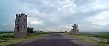
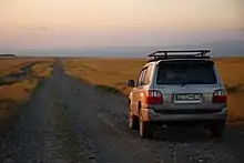
| Number | Name (route) | Length (km) |
|---|---|---|
 შ 151 შ 151 | Natakhtari - Tsilkani - Mukhrani | 16 km |
 შ 152 შ 152 | Zahesi – Jvari Monastery | 7 km |
 შ 153 შ 153 | Nichbisi - Digdori - Didi Toneti | 28 km |
 შ 154 შ 154 | Bolnisi – TSughrughasheni | 12 km |
 შ 155 შ 155 | Kveshi - Dzedzvnariani - Tandzia | 8 km |
 შ 156 შ 156 | (km 35) - Tsurtavi Castle | 1 km |
 შ 157 შ 157 | Rustavi - Jandari | 13 km |
 შ 158 შ 158 | (km 10) - David Gareja | 14 km |
 შ 159 შ 159 |  - Betania - Betania | 5 km |
 შ 160 შ 160 | Vaziani - Martqopi - Norio - Martqopi Monastery of the Deity | 27.5 km |
 შ 161 შ 161 | Shulaveri – Red Bridge | 23 km |
 შ 162 შ 162 | Shulaveri - Sioni - Tserakvi | 24 km |
 შ 163 შ 163 | Marneuli – Algeti (Məscidli Görarxı) - Azizkendi | 19 km |
 შ 164 შ 164 | Tsereteli - Norgiughi - Mughanlo - Kaselo | 25 km |
 შ 165 შ 165 |  (km 25) - Amlevi - Orbeti - (km 25) - Amlevi - Orbeti - | 11 km |
 შ 166 შ 166 | Tetritsqaro - Ksovreti – Gudarekhi | 14.5 km |
 შ 167 შ 167 |  - Samshvildi - Samshvildi Fortress - Samshvildi - Samshvildi Fortress | 2 km |
 შ 168 შ 168 | Samshvildi - Pirghebuli monastery | 7 km |
 შ 169 შ 169 | Imera - Bareti - Tejisi - Chivtkili - Khachkoi - Gumbati - Avranlo | 32 km |
 შ 170 შ 170 | Gurjaani – Apeni - Chabukiani - Kabali | 30 km |
 შ 171 შ 171 | Sakobo - Khirsa - Samtatskaro - Tsiteli Sabatlo | 67 km |
 შ 172 შ 172 | Sagarejo – Udabno - David Gareja | 13 km |
 შ 173 შ 173 | Archiloskalo - Samtatskaro | 6 km |
 შ 174 შ 174 | Khornabuji - Erisimedi | 21 km |
 შ 175 შ 175 | Signagi - Tsnori | 8 km |
| Number | Name (route) | Length (km) |
 შ 176 შ 176 | Signagi - St. Nino Monastery | 1 km |
 შ 177 შ 177 | - St. Nino's spring | 3 km |
 შ 178 შ 178 |  (Near Telavi) - Dzveli Shuamta's Monastery (Near Telavi) - Dzveli Shuamta's Monastery | 2 km |
 შ 179 შ 179 |  - Ikalto Academy - Ikalto Academy | 2 km |
 შ 180 შ 180 | Akura - Mama Davity Historical Monument | 3 km |
 შ 181 შ 181 | Zinobiani – Chikaani - Gavazi | 13 km |
 შ 182 შ 182 | Kvareli - Kvareli Lake | 8.5 km |
 შ 183 შ 183 | Akhmeta – Jokolo - Batsara Reserve | 22 km |
 შ 184 შ 184 | Zemo Khodashen – Alaverdi Monastery – Kvemo Alvan | 12 km |
 შ 185 შ 185 | Chuburkhindji - Nabakevi - Otobaia - Gagida | 26 km |
 შ 186 შ 186 | - Mokvi - Chlow - Otap | 21 km |
 შ 187 შ 187 | Sokhumi – Besleti | 3.5 km |
 შ 188 შ 188 | Sokhumi - Gumista | 3.5 km |
 შ 189 შ 189 | - Sukhumi Babushara Airport | 4.5 km |
 შ 190 შ 190 | - Abgharkhuki - Durifshi - Lykhny - (Gudauta) | 36 km |
 შ 191 შ 191 | - New Athos Cave | 1 km |
 შ 192 შ 192 | Gagra – Kolkhida | 8 km |
 შ 193 შ 193 | Leselidze - Gantiadi | 9 km |
 შ 194 შ 194 | Leselidze – Mikelrypsh | 17 km |
 შ 195 შ 195 | (km 43) – Natlismtsemeli | 5 km |
 შ 196 შ 196 | Nikozi - Avnevi | 9 km |
 შ 197 შ 197 |  – Nekresi monastery – Nekresi monastery | 4 km |
 შ 198 შ 198 | (km 4) - Variani - Sakasheti - Breti - (km 101) | 25 km |
 შ 199 შ 199 | Kubriantkari - Akhaltsikhe - Kenchaklde - Kheoba | 15 km |
 შ 200 შ 200 | - Khaberia Winery (Kvareli) | 1.5 km |
201-205


| Number | Name (route) | Length (km) |
|---|---|---|
 შ 201 შ 201 |  (km 10) – Orpir - Tsutskhvati - Tsutskhvati Cave (km 10) – Orpir - Tsutskhvati - Tsutskhvati Cave | 11 km |
 შ 202 შ 202 | – Gori - (Gori Tunnel Bypass) | 6 km |
 შ 203 შ 203 | (km 102, Kareli Exit) - Gomi - Agara - (km 121) | 19 km |
 შ 204 შ 204 | (km 214, Nakhshirghele Exit) - Kutaisi - Samtredia | 48 km |
 შ 205 შ 205 | Kobuleti - Chakvi - .svg.png.webp) | 15 km |
The tables above are based the last published list of roads by the Government of Georgia which is from 2017.[1]
Border checkpoints
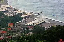
Georgia has 14 border checkpoints for vehicular traffic with its four neighbours. Eleven of these are the terminus of an S-road, the other three connect to a domestic Sh-road.
_to_Russia.jpg.webp)
Road network in the Georgian SSR
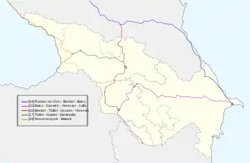
For decades the Soviet Union lacked a systematic public numbering system for its (trunk) road network. In 1960 a list of 37 numbered "highways of national importance" across the 15 Soviet Socialist Republics was adopted.[24] Three of these routes passed through the Georgian Soviet Socialist Republic: the 16, 17 and 19.
| Route | Length* | Currently part of | |
|---|---|---|---|
| 16 | Beslan - Ordzhonikidze - Tbilisi - Leninakan - Yerevan | 270 km (170 mi) | S3 (Georgian Military Highway) and S6 via Marneuli with transit through Tbilisi city. |
| 17 | Tbilisi - Kutaisi - Samtredia | 245 km (152 mi) | S1 between Natakhtari and Samtredia but through the cities of Gori, Khashuri and Kutaisi |
| 19 | Novorossiysk - Batumi | 404 km (251 mi) | S1 (Sokhumi - Zugdidi, Samtredia), part of S12, Sh2 via Ozurgeti and S2 |
| *) Shown is the length of the route within the Georgian SSR. | |||
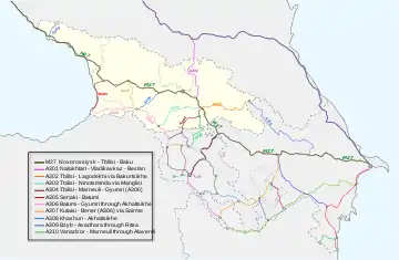
In 1982 a three-tier classification system was adopted in the Soviet Union with M, A and R (Russian: Р) routes. The M ("magistral", main arterial) and A (national) routes were assigned at the federal Soviet level, while the R ("republican") routes were assigned at the Soviet republican level. Cross border R-routes therefore had different numbers on either side of the internal borders. The A-routes had 3 digits and were assigned based on their region: the 300 series was assigned to the Caucasus and Central Asia.[25] The R-routes had 1-3 digits, based on their importance in the road network. One M-route (M-27) and ten A-routes (A-301 to A-310) led through the Georgian SSR.[26] These designations were maintained in independent Georgia until the late 1990s when Georgia switched to their own (and current) system.
| Route | Length* | Currently part of | |
|---|---|---|---|
| M-27 | Novorossiysk - Tbilisi - Baku | 604 km (375 mi) | Entire S1, through Tbilisi city, and entire S4. |
| A-301 | Tbilisi (Natakhtari) - Beslan | 137 km (85 mi) | S3 (Georgian Military Highway) |
| A-302 | Tbilisi - Lagodekhi via Bakurtsikhe | 152 km (94 mi) | S5 (Kakheti Highway). A-302 continued as A-315 after Lagodekhi |
| A-303 | Tbilisi - Bogdanovka (Ninotsminda) via Manglisi | 164 km (102 mi) | Via Tbilisi's Sololaki District, Kojori, Manglisi and then Sh31 to Ninotsminda. |
| A-304 | Tbilisi - Leninakan (Gyumri) until A-306 | 98 km (61 mi) | Entire S6 |
| A-305 | Mikha Tskhakaya (Airbase Senaki, M-27) - Batumi | 97 km (60 mi) | S2 highway from Senaki via Poti to Batumi |
| A-306 | Batumi - Leninakan (Gyumri) through Akhaltsikhe | 166 km (103 mi) | Sh2 Batumi - Akhaltsikhe and S11 via Ninotsminda to Armenia |
| A-307 | Kutaisi - Benara (A-306) via Sairme | 104 km (65 mi) | Sh14 Kutaisi - Benara (Sh2 connection) via Baghdati and Sairme |
| A-308 | Khashuri - Akhaltsikhe | 77 km (48 mi) | S8 highway Khashuri - Akhaltsikhe via Borjomi |
| A-309 | Bzyb - Avadhara through Ritsu | 59 km (37 mi) | Entire Sh11 route (located in Abkhazia). |
| A-310 | Kirovakan (Vanadzor) - Marneuli through Alaverdi | 349 km (217 mi) | Entire S7 highway Marneuli - Sadakhlo |
| *) Shown is the length of the route within the Georgian SSR. | |||
See also
- (pdf) Complete official list of Georgian Highways - 2017 update as attached to resolution 491, 2 November 2017.[1]
- Roads Department of the Ministry of Regional Development and Infrastructure of Georgia
References
- "2017 List of highways of international and domestic importance" (in Georgian). The Legislative Herald of Georgia. 2 November 2017. Retrieved 21 July 2021.
- "Statistical Yearbook Georgia 2020" (PDF). GeoStat. 2020. p. 200. Retrieved 23 July 2021.
- "On Approval of Indicators and List for Determination of International, Domestic and Local Roads of Georgia" (in Georgian). The Legislative Herald of Georgia. 16 December 1996. Retrieved 19 July 2021.
- "On Changes and Amendments to the Law of the Republic of Georgia on Roads" (in Georgian). The Legislative Herald of Georgia. 16 October 1997. Retrieved 19 July 2021.
- "Law "About motor roads", consolidated version of 15 July 2020" (in Georgian). The Legislative Herald of Georgia. 15 July 2020. Retrieved 19 July 2021.
- "2005 List of Roads of International, Domestic and Local Importance" (in Georgian). The Legislative Herald of Georgia. 5 August 2005. Retrieved 19 July 2021.
- "2006 List for Determination of International, Domestic and Local Roads of Georgia" (in Georgian). The Legislative Herald of Georgia. 15 September 2006. Retrieved 21 July 2021.
- "2008 List for Determination of International, Domestic and Local Roads of Georgia" (in Georgian). The Legislative Herald of Georgia. 3 November 2008. Retrieved 21 July 2021.
- "2011 List of highways of international and domestic importance" (in Georgian). The Legislative Herald of Georgia. 27 May 2011. Retrieved 21 July 2021.
- "2014 List of highways of international and domestic importance" (in Georgian). The Legislative Herald of Georgia. 18 June 2014. Retrieved 21 July 2021.
- "Georgia's Unfinished Search for Its Place in Europe". carenegie Europe. 6 April 2021. Retrieved 20 July 2021.
- "Works are concurrently ongoing on 62 bridges and 39 tunnels at Rikoti Pass section". Roads Department of the Ministry of Regional Development and Infrastructure of Georgia. 2 April 2021. Retrieved 21 July 2021.
- "Contract Awarded for Construction of Zemo Osiauri-Chumateleti Second Section (Khashuri Bypass)". Roads Department of the Ministry of Regional Development and Infrastructure of Georgia. 16 December 2020. Retrieved 21 July 2021.
- "Construction of Grigoleti-Kobuleti bypass road is in active phase". Roads Department of the Ministry of Regional Development and Infrastructure of Georgia. 8 July 2020. Retrieved 21 July 2021.
- "Construction of Batumi Bypass Road in Active Phase". Roads Department of the Ministry of Regional Development and Infrastructure of Georgia. 19 June 2020. Retrieved 21 July 2021.
- "Construction of a new Kvesheti-Kobi road and 9 km long tunnel has been launched". Roads Department of the Ministry of Regional Development and Infrastructure of Georgia. 11 June 2021. Retrieved 21 July 2021.
- "First look at the new Kvesheti-Kobi road/". Kvesheti-Kobi Project. 24 August 2020. Retrieved 21 July 2021.
- "Georgia: North–South Corridor (Kvesheti–Kobi) Road Project". Asian Development Bank. Retrieved 21 July 2021.
- "North-South Corridor (Kvesheti-Kobi) Road Project". European Bank for Reconstruction and Development. Retrieved 21 July 2021.
- "Team Europe: EIB provides €106.7 million to Georgia for major upgrades of its East-West highway". European External Action Service. 1 July 2021. Retrieved 21 July 2021.
- "Bidding has been announced for construction of Tbilisi- Sagarejo Highway". Roads Department of the Ministry of Regional Development and Infrastructure of Georgia. 26 June 2021. Retrieved 21 July 2021.
- "New 14km Japana-Lanchkhuti Section of Highway Open". Roads Department of the Ministry of Regional Development and Infrastructure of Georgia. 18 July 2020. Retrieved 21 July 2021.
- "Photo Gallery: Construction of Bakurtsikhe-Gurjaani bypass road is being completed" (in Georgian). Ministry of Regional Development and Infrastructure of Georgia. 8 June 2021. Retrieved 23 July 2021.
- "Resolution of the USSR Council of Ministers of 12/22/1960 N 1303 "On approval of the List of highways of national importance"" (in Russian). USSR Law. 22 December 1960. Archived from the original on 4 April 2019. Retrieved 2 September 2021.
- "Road numbering systems - Russia". Retrieved 19 August 2021.
- "Decision of the Council of Ministries of the USSR of 08.27.1982 N 800 on Approval of the List of Roads of the USSR of National Significance" (in Russian). USSR Law. 27 August 1982. Retrieved 5 September 2021.


Motorways in Asia | |
|---|---|
| Sovereign states | |
| States with limited recognition | |
| Dependencies and other territories | |
| |